Toggle navigation
LMEC Home
Exhibitions
Georeferencing
Tools for Teachers
Collections
My Favorites
Sign Up / Log In
Search
Search the map portal
Map Collection
Map Collection
Map Sets
Search
Search
Search for
Search In
All Fields
Creator
Title
Subject
Place
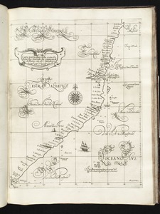
Search All Digital Collections
Advanced Search
8168 Results
My Search
Start Over
More Like
commonwealth:cj82m353b
Remove constraint More Like: commonwealth:cj82m353b
Filter your Search
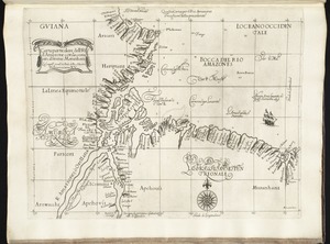
Place
North and Central America
4,913
United States
3,744
Suffolk (county)
1,026
Boston
999
Europe
963
Canada
428
France
269
Massachusetts
258
more
Place
»
Topic
Boston (Mass.)--Maps
574
United States--Maps
270
Real property--Massachusetts--Boston--Maps
174
Massachusetts--Maps
160
Landowners--Massachusetts--Boston--Maps
132
North America--Maps--Early works to 1800
103
New England--Maps
99
Europe--Maps
78
more
Topic
»
Date
Date range begin
–
Date range end
Current results range from
1482
to
2023
View distribution
Creator
United States. Hydrographic Office
357
O.H. Bailey & Co
148
Des Barres, Joseph F. W. (Joseph Frederick Wallet), 1722-1824
123
United States. Post Office Dept
120
Ptolemy, 2nd cent
100
Walling, Henry Francis, 1825-1888
94
Jefferys, Thomas, -1771
85
Geological Survey (U.S.)
82
more
Creator
»
Format
Maps/Atlases
8,109
Manuscripts
215
Prints
51
Books
36
Objects/Artifacts
10
Drawings/Illustrations
8
Posters
4
Georeferenced
Yes
869
No
7,299
Collection
Norman B. Leventhal Map Center Collection
8,162
Boston and New England Maps
2,184
Urban Maps
1,925
Maritime Charts and Atlases
750
American Revolutionary War-Era Maps
620
Boston Redevelopment Authority Collection
86
Library and Archives Canada Collection
2
Richard H. Brown Revolutionary War Map Collection at Mount Vernon
2
more
Collection
»
Available to use
No known restrictions
8,021
Creative Commons license
48
Search Constraints
Sort by relevance
relevance
title
date (asc)
date (desc)
Number of results to display per page
100 per page
10
per page
20
per page
50
per page
100
per page
View results as:
grid view
map view
Search Results
1.
Carta particolare della terra nuoua con la Gran Baia et il Fiume Grande della Canida
2.
De Noordelyckste Zee Kusten van America van Groenland door de Straet Davis ende Straet Hudson tot Terra Neuf =...
3.
Paskaert van de Noordelijckste kuste van America van Groenland door de Straet Davis en de Straet Hudson tot Terra Neuf
4.
Chart of the Streights of Belle Isle
5.
A chart of the banks and part of the coast of Newfoundland including the islands of Sable and Cape Breton
6.
A chart of the banks and part of the coast of Newfoundland including the islands of Sable and Cape Breton
7.
A chart of the Banks of Newfoundland, drawn from a great number of hydrographical surveys, chiefly from those of Chabert, Cook...
8.
A chart of the Streights of Bell Isle
9.
Chart of the streights of Belle Isle
10.
Chart of the streights of Belle Isle
11.
Canada orientale nell' America Settentrionale
12.
A Chart of the north part of America, describing the sea coast of Groenland, Dawies Streights, Baffins Bay, Hudsons Streights,...
13.
A general chart of the island of Newfoundland with the rocks & soundings
14.
New Found Land, St. Laurence Bay, the fishing banks, Acadia, and part of New Scotland
15.
A new map of the only useful and frequented part of New Found Land
16.
Plans des isles, rades, et ports de plusieurs lieux de l'Amérique : tirés de la Carte angloise de Mr. Popple publiée en 1733...
17.
Carte particuliere de l'Amerique septentrionale ou sont compris le Destroit de Davids, le Destroit de Hudson, &c
18.
Chart comprizing Greenland with the countries and islands about Baffin's and Hudson's Bays
19.
Alla serma. sigra. principsa. d'Vrbino Grandvchessa di Toscana sva sigra. d: Roberto Dvdleo Dvca di Northumbria
20.
Barbariae et Guineae maritimi à freto Gibraltar ad fluvium Gambiae cum Insulis Salfis Flandrisis et Canaricis
21.
Carta particolare che comincia con il capo S. Andrea è finiscie con il capo Matas d'America
22.
Carta particolare del' mare del' Zur che comincia con il' capo S. Francesco nel' Peru è finisce con il' capo S. Lazaro nella...
23.
Carta particolare del' mare Occeani dal' isole d'Asores di Flores, e coruo sin alla tierra nuoua in America
24.
Carta particolare del' Peru che comincia con il capo di Guanapo è finisce con il' C. S. Francesco
25.
Carta particolare del' Peru che comincia con il rio Pigua è finisce con il capo di Guanapo
26.
Carta particolare del'India Occidentale che comincia con il Capo S. Romano nel' mare del' nort è finisce con il' Rio Coquele
27.
Carta particolare del'India Occidentale che contiene il Golfo de Veragua, la Baia di Honduras nel' mare del'Noort è parte del'...
28.
Carta particolare del'Isola di Cuba è di Iamaica con il capo della Florida è l'Isola Intorno
29.
Carta particolare dell' Isola di Bermuda sin all' India Occidentale et al' capo S. Romano della Florida
30.
Carta particolare dell' mare del' Zur che comincia con il capo Lucar è finisce con Cagidos della nuoua Spagnia, è la Baia di...
31.
Carta particolare dell' rio d'Amazone con la costa sin al fiume Maranhan
32.
Carta particolare dell' Rio della Plata che comincia con la costa in gra di 31 di latine: australe, é finisce con il capo S....
33.
Carta particolare della America è parte maestrale dal C. di Cedros
34.
Carta particolare della Baia di Messico con la costa
35.
Carta particolare della Brasilia australe che comincia dal' Poro. del' Spirto. Santo è finisce con il capo Bianco
36.
Carta particolare della Brasilia, che comincia con il capo S. Antonio et finisce con il porto del' Spirito Sancto
37.
Carta particolare della Brasilia settentrionale
38.
Carta particolare della costa del' Peru parte australe con parte di Cili
39.
Carta particolare della costa di America Australe che comincia al C. di Matas sin al C. di Galegos
40.
Carta particolare della costa di Chilue è di Chica è parte australe di Cili
41.
Carta particolare della costa di Cili
42.
Carta particolare della costa di Florida è di Virginia
43.
Carta particolare della nuoua Belgia è parte della nuoua Anglia
44.
Carta particolare della parte ocidentale della nuova Spagnia, è del la California
45.
Carta particolare dell'India Ocidentale, con la terra ferma dal' capo di Paria sin al' capo S. Romano
46.
Carta particolare dell'Isola Ispaniola è S. Gioni. nel'India ocidentle. con l'Isola Intorno
47.
Carta particolare dello istreto e mare iscoperto de Hen. Hudson Ingilese nel. 1611
48.
Carta particolare dello Stretto di Magellano è di Maire
49.
A chart of the coast of Barbaria with the western, Canaria, & Cape de Verd, isles
50.
De cust van Barbaria, Gualata, Arguyn en Geneheo van Capo S Vincente tot Capo Verde
51.
Insulae Promontorii Viridis, Hispanis, Issas Cabo Verde, Belgis, De Soute Eylanden
52.
Pascaarte vande zee custen van Guinea, en Brasilia : van Cabo de Verde, tot C. de bona Esperanc̨a : van R. de Amazones tot Rio...
53.
Paskaart van de cust van Portugal, Barbaria en Genehoa : beginnende van d'Barlenges tot aan C. Verde met al zyn Diepte en...
54.
Portolan atlas
55.
Al sermo. Ferdinando. II. Grandvca di Toscana svo signore Don Roberto Dudleo, Duca di Northumbria
56.
Chart of the Banks of Newfoundland, drawn from a great number of hydrographical surveys, these charts are followed, according...
57.
A chart of the sea-coast of Newfoundland between St. Laurence and Point May survey'd by order of Hugh Palliser esqr. commodore...
58.
A sketch of the River Exploits and the east end of Lieutenants Lake in Newfoundland
59.
Chart comprizing Greenland with the countries and islands about Baffin's and Hudson's Bays
60.
Scandinavia
61.
Carta marina nova tabula
62.
The 100th anniversary map of Abraham Lincoln's visit to Massachusetts, September 11-23, 1848
63.
1630 shoreline
64.
1879. Progress map of the U.S. Geographical Surveys west of the 100th Meridian : prepared under the direction of 1st Lieut....
65.
1903 Map of Salem and surrounding places
66.
19th annual convention of the National Association of Real Estate Boards : at Tulsa, June 7 to June 11 in 1926
67.
2005 significant U.S. hurricane strikes
68.
The 2100 project : an atlas for the Green New Deal
69.
227 Harzgerode
70.
305 Glatz
71.
38,000,000 escaped -- 10,000,000 died
72.
4 Kinten
73.
660 Wakulah St., Roxbury
74.
[A chart of Boston Bay and vicinity]
75.
[A chart of New York Island & North River : East River, passage through Hell Gate, Flushing Bay, Hampstead Bay, Oyster,...
76.
The A.A.A. key road map of continental Europe
77.
Aaron Bohrod's America, its history
78.
ABC pathfinder railway guide map : eastern division
79.
Abolition of Slavery, 1863
80.
Aboriginal map of North America, denoting the boundaries and the locations of various Indian tribes
81.
Acapulco, México
82.
Accurata delineatio Castrorum Suecicorum, ut et Haffniae, Regni Daniae Metropolis
83.
Accurata delineatio oppugnatae a faederatis, Caesareis, Polonicis, Danicis, et Brandeburgicis copijs sub-ductu Seren: Electoris...
84.
Accurata delineatio regionis circa Nieburgum Fioniæ cum prælio ibi commisso inter Danorum et fæderatorum exercitum ab una et...
85.
Accurata Scaniae, Blekingiae et Hallandiae descriptio
86.
An accurate map of Cuba, and the adjacent islands
87.
An accurate map of Dorset Shire divided into hundreds
88.
An accurate map of Dorset Shire, divided into its hundreds
89.
An accurate map of England and Wales with the principal roads from the best authorities
90.
An accurate map of England and Wales with the principal roads from the best authorities
91.
An accurate map of Europe from the best authorities
92.
An accurate map of Hindostan or India, from the best authorities
93.
An accurate map of His Majesty's province of New-Hampshire in New England : taken from actual surveys of all the inhabited...
94.
An Accurate map of New Hampshire in New England, from a late survey
95.
An Accurate map of New York in North America, from a late survey
96.
An accurate map of North America : describing and distinguishing the British and Spanish dominions on this great continent :...
97.
An accurate map of North America : describing and distinguishing the British and Spanish dominions of this great continent;...
98.
An accurate map of North America : describing and distinguishing the British, Spanish and French dominions on this great...
99.
An accurate map of North and South Carolina with their Indian frontiers, shewing in a distinct manner all the mountains,...
100.
An accurate map of Rhode Island, part of Connecticut and Massachusets, shewing Admiral Arbuthnot's station in blocking up...
‹ Prev
Next ›
1
2
3
4
5
…
81
82


![[A chart of Boston Bay and vicinity]](https://bpldcassets.blob.core.windows.net/derivatives/images/commonwealth:cj82m2976/image_thumbnail_300.jpg)


