Toggle navigation
LMEC Home
Exhibitions
Georeferencing
Tools for Teachers
Collections
My Favorites
Sign Up / Log In
Search
Search the map portal
Map Collection
Map Collection
Map Sets
Search
Search
Search for
Search In
All Fields
Creator
Title
Subject
Place
Search All Digital Collections
Advanced Search
8275 Results
My Search
Start Over
More Like
commonwealth:6h446t70w
Remove constraint More Like: commonwealth:6h446t70w
Filter your Search
Place
North and Central America
5,024
United States
3,714
Suffolk (county)
1,138
Boston
1,111
Europe
963
Canada
427
France
269
Massachusetts
256
more
Place
»
Topic
Boston (Mass.)--Maps
595
United States--Maps
270
Real property--Massachusetts--Boston--Maps
252
Landowners--Massachusetts--Boston--Maps
169
Massachusetts--Maps
160
City planning--Massachusetts--Boston--Maps
135
North America--Maps--Early works to 1800
103
New England--Maps
99
more
Topic
»
Date
Date range begin
–
Date range end
Current results range from
1482
to
2023
View distribution
Creator
United States. Hydrographic Office
357
O.H. Bailey & Co
148
Boston Redevelopment Authority
138
Des Barres, Joseph F. W. (Joseph Frederick Wallet), 1722-1824
123
United States. Post Office Dept
120
Ptolemy, 2nd cent
100
Walling, Henry Francis, 1825-1888
94
Bromley, George Washington
85
more
Creator
»
Format
Maps/Atlases
8,216
Manuscripts
215
Prints
51
Books
36
Objects/Artifacts
10
Drawings/Illustrations
8
Posters
4
Georeferenced
Yes
870
No
7,405
Collection
Norman B. Leventhal Map Center Collection
8,164
Boston and New England Maps
2,261
Urban Maps
2,002
Maritime Charts and Atlases
750
American Revolutionary War-Era Maps
616
Boston Redevelopment Authority Collection
162
Massachusetts Real Estate Atlases
35
Mapping Boston Collection
1
Available to use
No known restrictions
8,098
Creative Commons license
47
Search Constraints
Sort by date (desc)
relevance
title
date (asc)
date (desc)
Number of results to display per page
50 per page
10
per page
20
per page
50
per page
100
per page
View results as:
grid view
map view
Search Results
101.
Boston shoreline 1630
102.
Boston shoreline 1795
103.
Boston shoreline 1852
104.
Boston shoreline 1880
105.
Boston shoreline 1916
106.
Boston shoreline 1934
107.
Boston shoreline 1950
108.
Boston shoreline 1995
109.
Boston shoreline composite
110.
Tactical pilotage chart, TPC
111.
Mediterranean Sea, plans on the coasts of Italy and Sicilia
112.
Haiti
113.
Major thoroughfare system, city of Boston, July, 1994
114.
North Atlantic Ocean, southeast coast of North America, including the Bahamas and Greater Antilles
115.
East Asia
116.
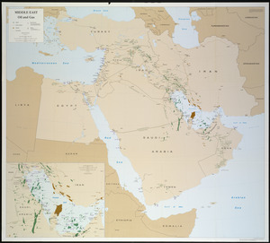
Middle East, oil and gas : Middle East
117.
North Atlantic Ocean, West Indies
118.
Circulation plan of parking lot at the corner of VFW Parkway and Spring Street, West Roxbury
119.
Asia
120.
Infrastructure around Tobin Bridge/US route 1 in Charlestown
121.
Berkeley Street community garden
122.
Waterfront skyline
123.
Flirtation walk schematic planting plan Charlestown Navy Yard
124.
Planting beds on Dartmouth Street and Boylston Street in Copley Square
125.
Brighton and Allston urban design strategy
126.
Charlestown Navy Yard master plan
127.
Columbia Point updated base maps
128.
Flirtation walk existing conditions plan Charlestown Navy Yard
129.
Gate 5 - Chelsea Street modified landscape scheme, Charlestown, MA
130.
Little Mystic Channel landscape scheme, Charlestown, MA
131.
Outline map of Boston
132.
Profile of Huntington Avenue/St. James Avenue from Harcourt Street to Berkeley Street
133.
Ropewalk bldg. Charlestown Navy Yard
134.
Shadow analysis
135.
Street trees Comm. Ave.
136.
Topographic map of Brighton and Allston
137.
View of the South End
138.
Washington Street boulevard study : generalized land use - proposed
139.
Washington Street boulevard study : proposed fabric
140.
Washington Street boulevard study : corridor wide urban design strategy
141.
Sears Park conceptual site plan with historic waterway
142.
Ruggles Center : existing condition plan
143.
Ruggles Center : site area diagram
144.
660 Wakulah St., Roxbury
145.
James Hayes Park
146.
John Hancock office and parking garage complex, Boston, Massachusetts
147.
We must have order
148.
Zoning districts, city of Boston
149.
New Congress Street improvements
150.
Charlestown Navy Yard area
‹ Prev
Next ›
1
2
3
4
5
6
7
…
165
166