Ruggles Center : existing condition plan

Item Information
- Title:
- Ruggles Center : existing condition plan
- Description:
-
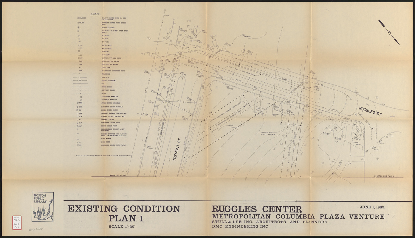
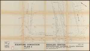
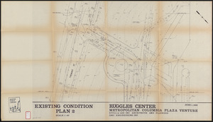
These maps of the Ruggles Center development project area in Boston's Roxbury's neighborhood show the location of trees and infrastructure items such as traffic lights, storm drains, catch basins, sign posts, fire alarms, sewers, hydrants, utilities, handicapped ramps, concrete trash cans, etc.
- Publisher:
- Metropolitan/Columbia Plaza Venture
- Cartographer:
- DMC Engineering, Inc.
- Cartographer:
- Stull and Lee
- Date:
-
June 1, 1989
- Format:
-
Maps/Atlases
- Location:
-
Boston Public Library
Central Library in Copley Square - Collection (local):
-
Boston Public Library Collection
- Subjects:
-
Roxbury (Boston, Mass.)--Maps
City planning--Massachusetts--Boston--Maps
- Places:
-
Suffolk (county)BostonRoxbury
- Extent:
- 3 maps ; sheets 61 x 108 cm
- Terms of Use:
-
No known copyright restrictions.
No known restrictions on use.
- Publisher:
-
[Boston] :
Metropolitan Columbia Plaza Venture
- Scale:
-
Scale 1:240
- Language:
-
English
- Table of Contents:
-
Plan 1
Plan 2
Plan 3
- Catalog Record:
-
http://bpl.bibliocommons.com/item/show/1012648075
- Notes:
-
Also issued as appendix to Application for planned development area for Ruggles Center (BRA/2439)
- Identifier:
-
06_01_017205A
06_01_017205B
06_01_017205C
- Call #:
-
BRA/4159
- Barcode:
-
mq6309393


