Search Constraints
Search Results


805. Ayer, Mass

807. Azores


812. Azores, San Miguel


![B. & F. Realty Corp., Bldg.; Laurel Plastics, Inc., Ten., Madison, Maine [insurance map]](https://bpldcassets.blob.core.windows.net/derivatives/images/commonwealth:4j03df33z/image_thumbnail_300.jpg)

![Bachmann Uxbridge Worsted Corporation, New Bedford, Mass. [insurance map]](https://bpldcassets.blob.core.windows.net/derivatives/images/commonwealth:ww72bz32g/image_thumbnail_300.jpg)


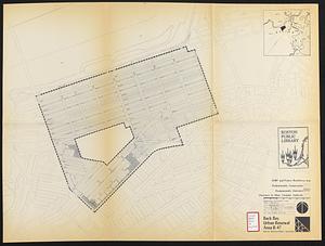
820. Back Bay park

821. Back Bay park


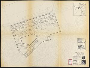
824. Back Bay study


865. Baldwinville, Mass

866. Balkan Peninsula

867. Balkan peninsula


869. The Balkans

870. The Balkans


875. Baltic Basin

876. Baltic provinces


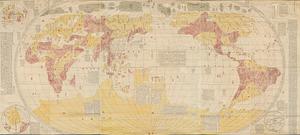
885. Bankoku yochi zu
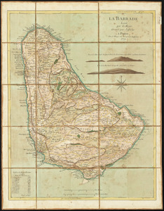
886. La Barbade

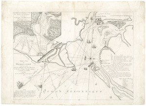
887. Barbadoes

888. Barbadoes

889. Barbados

890. Barbaria


![The Barre Wool Combing Company, Limited, South Barre, Mass. [insurance map]](https://bpldcassets.blob.core.windows.net/derivatives/images/commonwealth:2r36vc66d/image_thumbnail_300.jpg)


897. Barrington Bay
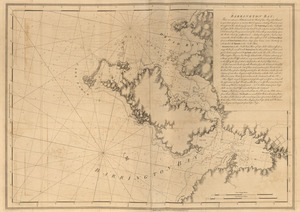
898. Barrington Bay

