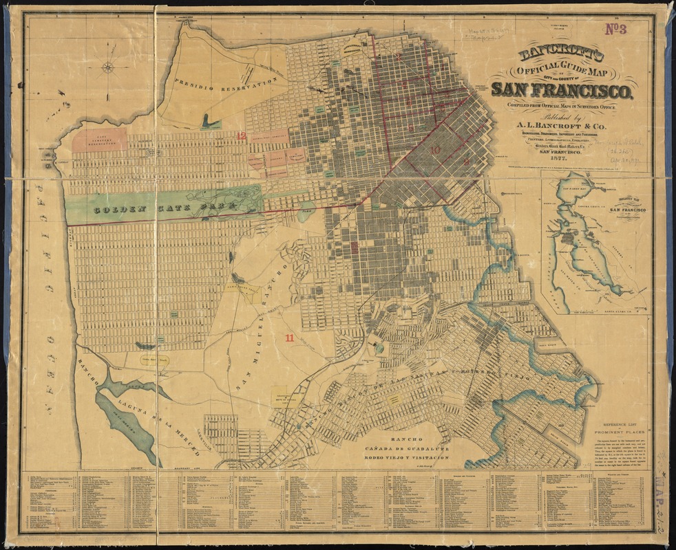
Bancroft's official guide map of city and county of San Francisco
Item Information
- Title:
- Bancroft's official guide map of city and county of San Francisco
- Title (alt.):
-
Official guide map of city and county of San Francisco
Bancroft's official guide map of the city and county of San Francisco
Official guide map of the city and county of San Francisco
- Creator:
- A.L. Bancroft & Company
- Name on Item:
-
compiled from official maps in surveyor's office.
- Date:
-
1877
- Format:
-
Maps/Atlases
- Location:
-
Boston Public Library
Norman B. Leventhal Map & Education Center - Collection (local):
-
Norman B. Leventhal Map & Education Center Collection
- Subjects:
-
San Francisco (Calif.)--Maps
San Francisco Bay Area (Calif.)--Maps
- Places:
-
CaliforniaSan Francisco (county)
- Extent:
- 1 map : col. ; 52 x 73 cm., folded in cover 16 x 11 cm.
- Terms of Use:
-
No known copyright restrictions.
No known restrictions on use.
- Publisher:
-
San Francisco :
A.L. Bancroft & Co.
- Scale:
-
Scale [ca. 1:22,000]
- Language:
-
English
- Notes:
-
Shows drainage, wards, railroads, ranchos, flumes, etc.
Includes index to points of interest and inset of "Skeleton map showing the relative position of San Francisco to the surrounding country" (scale [1:506,880]. 8 miles to 1 in.).
- Identifier:
-
06_01_011419
- Call #:
-
G4364.S5 1877 .A42
- Barcode:
-
39999065685883