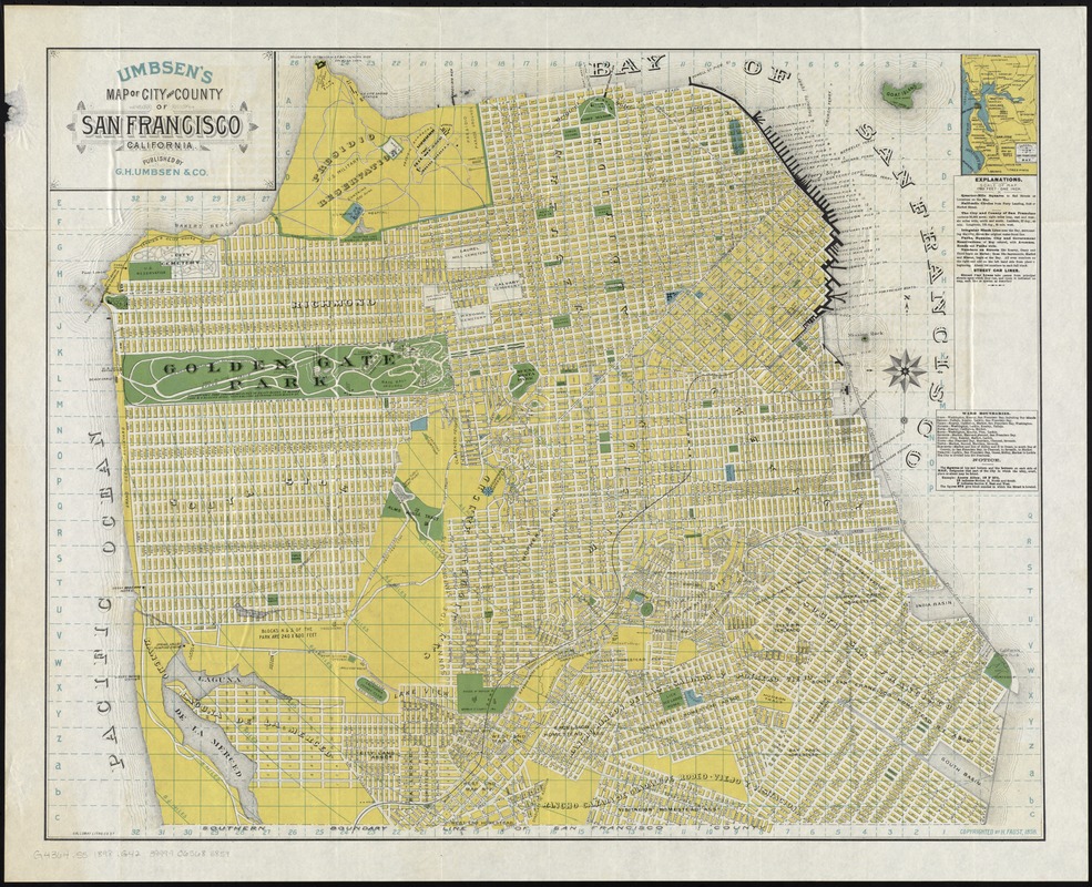
Umbsen's map of the City and County of San Francisco, California
Item Information
- Title:
- Umbsen's map of the City and County of San Francisco, California
- Title (alt.):
-
Map of the City and County of San Francisco, Calif
- Creator:
- G.H. Umbsen & Co
- Date:
-
[ca. 1898]
- Format:
-
Maps/Atlases
- Location:
-
Boston Public Library
Norman B. Leventhal Map & Education Center - Collection (local):
-
Norman B. Leventhal Map & Education Center Collection
- Subjects:
-
San Francisco (Calif.)--Maps
San Francisco Bay Area (Calif.)--Maps
- Places:
-
CaliforniaSan Francisco (county)
- Extent:
- 1 map : col. ; 59 x 73 cm.
- Terms of Use:
-
No known copyright restrictions.
No known restrictions on use.
- Publisher:
-
[San Francisco?] :
G.H. Umbsen & Co.
- Scale:
-
Scale [1:21,120]. 1,760 ft. - 1 in.
- Language:
-
English
- Notes:
-
Relief shown by hachures.
Shows drainage, block numbers, wharves, public buildings, tract names, radial distances from Ferry building, railroads, street car lines, acreage, etc.
Marked for indexing.
Inset: General view of San Francisco Bay.
- Identifier:
-
06_01_011416
- Call #:
-
G4364.S5 1898 .G42
- Barcode:
-
39999065685859