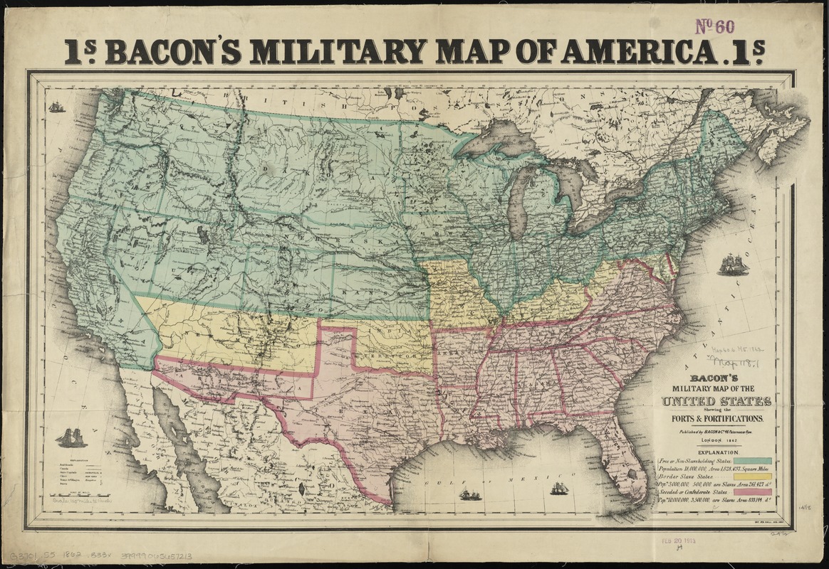
Bacon's military map of the United States shewing the forts & fortifications
Item Information
- Title:
- Bacon's military map of the United States shewing the forts & fortifications
- At head of map :
- Bacon's military map of America
- Creator:
- Bacon & Co
- Date:
-
1862
- Format:
-
Maps/Atlases
- Location:
-
Boston Public Library
Norman B. Leventhal Map & Education Center - Collection (local):
-
Norman B. Leventhal Map & Education Center Collection
- Subjects:
-
Fortification--United States--Maps
United States--History--Civil War, 1861-1865--Maps
- Places:
-
United States
- Extent:
- 1 map : hand col. ; 38 x 65 cm.
- Terms of Use:
-
No known copyright restrictions.
No known restrictions on use.
- Publisher:
-
London :
Bacon & Co.
- Scale:
-
Scale [ca. 1:7,150,000]
- Language:
-
English
- Notes:
-
Relief shown by hachures.
Prime meridians: Washington and Greenwich.
Shows free or non-slavehold states, border slave states, and seeded or confederate states.
Includes population and land area figures.
"Ent. Sta. Hall. Aug. 1862."
- Identifier:
-
06_01_008881
- Call #:
-
G3701.S5 1862 .B33x
- Barcode:
-
39999065657213


