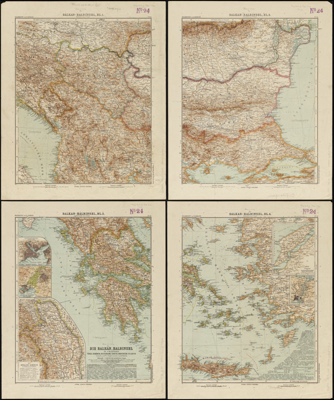
Die Balkan-Halbinsel in 4 blättern : Türkei, Rumänien, Griechenland, Serbien, Montenegro, Bulgarien
Item Information
- Title:
- Die Balkan-Halbinsel in 4 blättern : Türkei, Rumänien, Griechenland, Serbien, Montenegro, Bulgarien
- Cartographer:
- Vogel, C. (Carl), 1828-1897
- Contributor:
- Domann, B. (Bruno)
- Publisher:
- Justus Perthes (Firm : Gotha, Germany)
- Name on Item:
-
entworfen von Dr. C. Vogel, bearbeitet von B. Domann ; gestochen von E. Kühn u. Weiler
- Date:
-
1913
- Format:
-
Maps/Atlases
- Location:
-
Boston Public Library
Norman B. Leventhal Map & Education Center - Collection (local):
-
Norman B. Leventhal Map & Education Center Collection
- Subjects:
-
Balkan Peninsula--Maps
- Places:
-
Balkan Peninsula (area)
- Extent:
- 1 map on 4 sheets : color ; 81 x 68 cm, on sheets 50 x 41 cm
- Terms of Use:
-
No known copyright restrictions.
No known restrictions on use.
- Publisher:
-
Gotha :
Justus Perthes
- Scale:
-
Scale 1:1,500,000
- Language:
-
German
- Notes:
-
Relief shown by hachures and spot heights. Depths shown by isolines.
Insets: Constantinopel -- Athen und Piraeus -- Das Nördliche Rumänien -- Strasse der Dardanellen -- Der Bosporus.
From Stieler's Hand Atlas, plates 51- 54.
- Identifier:
-
06_01_012612
- Call #:
-
G6800 1913 .V64
- Barcode:
-
39999065697722


