Azores, Terceira and Graciosa
Item Information
- Title:
- Azores, Terceira and Graciosa
- Cartographer:
- Great Britain. Hydrographic Office
- Surveyor:
- Vidal, A. T. E. (Alexander Thomas Emeric), 1792-1863
- Engraver:
- J. & C. Walker (Firm)
- Name on Item:
-
surveyed by Captn. A.T.E. Vidal, R.N., 1844 ; engraved by J. & C. Walker
- Date:
-
1849
- Format:
-
Maps/Atlases
- Genre:
-
Nautical charts
- Location:
-
Boston Public Library
Norman B. Leventhal Map & Education Center - Collection (local):
-
Norman B. Leventhal Map & Education Center Collection
- Subjects:
-
Graciosa Island (Azores)--Maps
Terceira Island (Azores)--Maps
Nautical charts--Azores--Graciosa Island
Nautical charts--Azores--Terceira Island
- Places:
-
PortugalAzores (region)Graciosa, Ilha (island)
PortugalAzores (region)Terceira, Ilha (island)
- Extent:
- 2 maps on 1 sheet ; 47 x 44 cm and 17 x 19 cm, on sheet 50 x 65 cm
- Terms of Use:
-
No known copyright restrictions.
No known restrictions on use.
- Publisher:
-
London :
Hydrographic Office of the Admiralty; Sold by R.B. Bate, agent for the sale of the Admiralty charts, 21 Poultry
- Scale:
-
Scale approximately 1:147,000
Scale approximately 1:150,000
- Language:
-
English
- Notes:
-
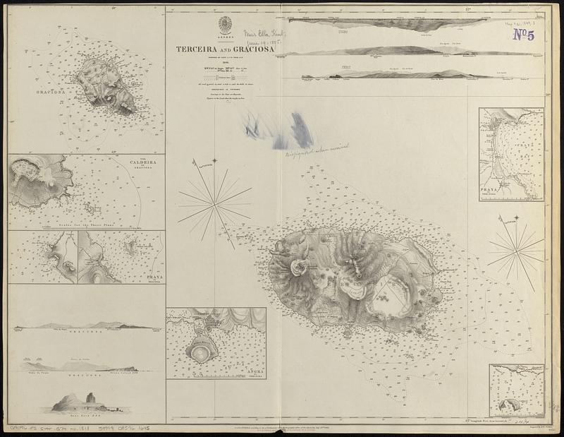
Relief shown by hachures and spot heights. Depths shown by soundings and isolines.
Includes 6 coastal views and 6 insets.
Insets: Caldeira of Graciosa -- [Gomez Bay] -- Praya de Graciosa -- Angra de Terceira -- Praya de Terceira -- [Cabras Islands].
"[Chart] 1818."--Lower right corner.
"Published according to Act of Parliament at the Hydrographic Office of the Admiralty, July 23rd, 1849."
- Identifier:
-
06_01_017601
- Call #:
-
G9096.P5 svar .G74 no. 1818
- Barcode:
-
39999085961645


