Search Constraints
Search Results


1318. Boston urban wilds


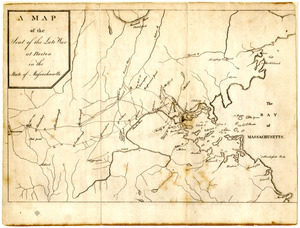
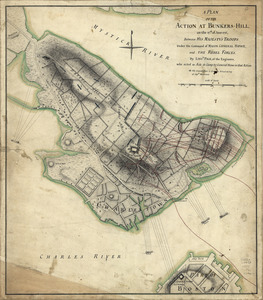
![[Battle of Bunker Hill]](https://bpldcassets.blob.core.windows.net/derivatives/images/commonwealth:z603vj11x/image_thumbnail_300.jpg)
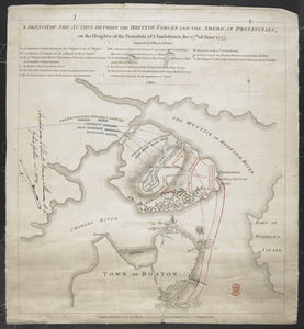
1324. [Battle of Bunker Hill]


1330. East Boston flood risk


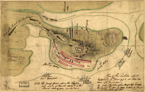
![[Bunker Hill--rough sketch]](https://bpldcassets.blob.core.windows.net/derivatives/images/commonwealth:z603vj151/image_thumbnail_300.jpg)
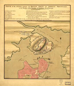
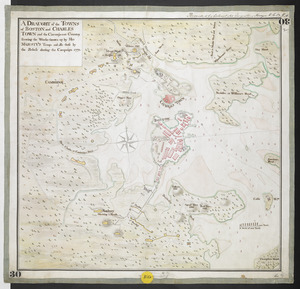
![[Rough draft of Charlestown, in water colour]](https://bpldcassets.blob.core.windows.net/derivatives/images/commonwealth:z603vj49v/image_thumbnail_300.jpg)


1370. The Harbor Park system


1377. Boston Harbor

1378. Boston Harbor, 1778


1380. A city of unequal risks


1386. 1630 shoreline