Boston Harbor, Massachusetts
Item Information
- Title:
- Boston Harbor, Massachusetts
- Title (alt.):
-
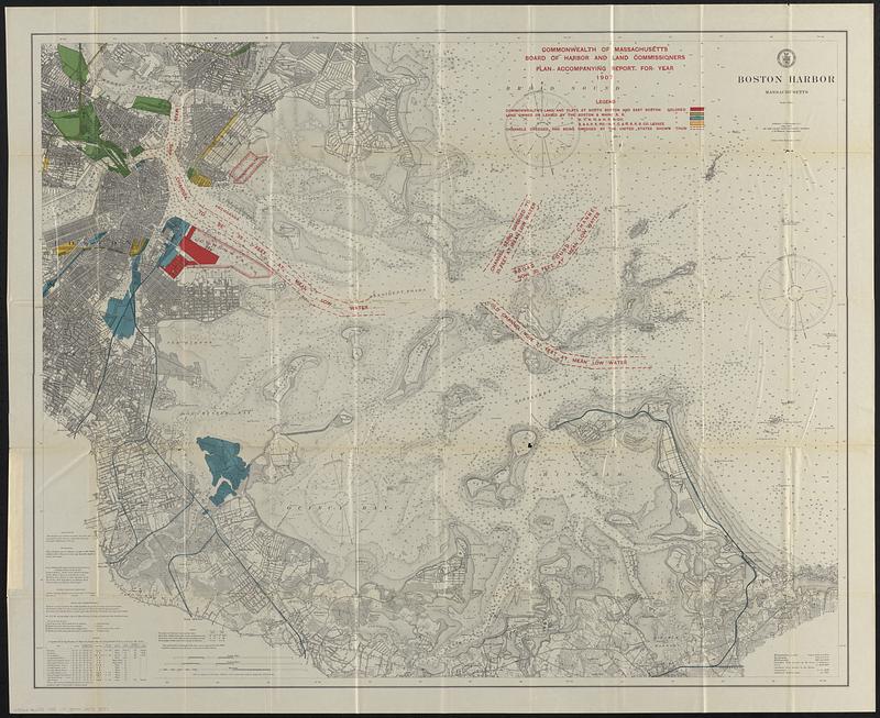
Plan accompanying report for year 1907
- Cartographer:
- U.S. Coast and Geodetic Survey
- Contributor:
- Board of Harbor and Land Commissioners of Massachusetts
- Date:
-
[1908]
- Format:
-
Maps/Atlases
- Genre:
-
Nautical charts
- Location:
-
Boston Public Library
Norman B. Leventhal Map & Education Center - Collection (local):
-
Norman B. Leventhal Map & Education Center Collection
- Subjects:
-
Boston Harbor (Mass.)--Maps
Nautical charts--Massachusetts--Boston Harbor
Harbors--Massachusetts--Boston--Maps
- Places:
-
MassachusettsBoston Harbor
- Extent:
- 1 map : color ; 89 x 110 cm
- Terms of Use:
-
No known copyright restrictions.
No known restrictions on use.
- Publisher:
-
[Boston, Mass.] :
[Commonwealth of Massachusetts, Board of Harbor and Land Commissioners]
- Scale:
-
Scale 1:20,000
- Language:
-
English
- Notes:
-
Shows Commonwealth's lands or flats, lands owned or leased by railroads, and channels dredged or being dredged.
Depths shown by soundings and isolines.
"Commonwealth of Massachusetts, Board of Harbor and Land Commissioners. Plan accompanying report for year 1907."
From: Public document No. 11, 29th Annual report of the Board of Harbor and Land Commissioners, for the year 1907.
"Date of the 1st publication 1896."
- Notes (date):
-
This date is inferred.
- Identifier:
-
06_01_018473
- Call #:
-
G3762.B65P5 1908 .U7
- Barcode:
-
39999085948097


