Boston Harbour : from the survey of A.S. Wadsworth Esq. U.S.N. and the chart of Des Barres
Item Information
- Title:
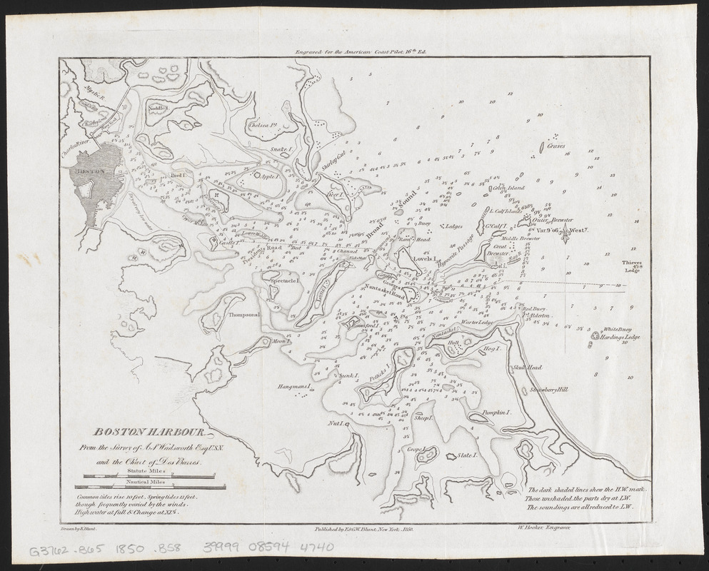
- Boston Harbour : from the survey of A.S. Wadsworth Esq. U.S.N. and the chart of Des Barres
- Cartographer:
- Blunt, Edmund M. (Edmund March), 1770-1862
- Contributor:
- Des Barres, Joseph F. W. (Joseph Frederick Wallet), 1729-1824
- Contributor:
- Wadsworth, A. S.
- Engraver:
- Hooker, William, 1782-1856
- Publisher:
- E. & G.W. Blunt (Firm)
- Name on Item:
-
drawn by E. Blunt ; W. Hooker, engraver
- Date:
-
1850
- Format:
-
Maps/Atlases
- Location:
-
Boston Public Library
Norman B. Leventhal Map & Education Center - Collection (local):
-
Norman B. Leventhal Map & Education Center Collection
- Subjects:
-
Nautical charts--Massachusetts--Boston Harbor
Boston Harbor (Mass.)--Maps
- Places:
-
MassachusettsBoston Harbor
- Extent:
- 1 map ; 21 x 26 cm
- Terms of Use:
-
No known copyright restrictions.
No known restrictions on use.
- Publisher:
-
New York :
E. & G.W. Blunt
- Scale:
-
Scale approximately 1:84,000
- Language:
-
English
- Notes:
-
Relief shown by hachures. Depths shown by soundings.
"Engraved for the American Coast Pilot, 16th ed."
- Identifier:
-
06_01_016175
- Call #:
-
G3762.B65 1850 .B58
- Barcode:
-
39999085944740


