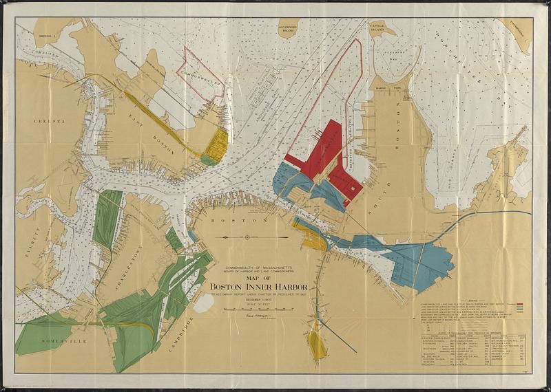
Map of Boston inner harbor to accompany report under chapter 93, resolves of 1907, December 1, 1907
Item Information
- Title:
- Map of Boston inner harbor to accompany report under chapter 93, resolves of 1907, December 1, 1907
- Cartographer:
- Board of Harbor and Land Commissioners of Massachusetts
- Name on Item:
-
Commonwealth of Massachusetts, Board of Harbor and Land Commissioners
- Date:
-
[1907]
- Format:
-
Maps/Atlases
- Genre:
-
Nautical charts
- Location:
-
Boston Public Library
Norman B. Leventhal Map & Education Center - Collection (local):
-
Norman B. Leventhal Map & Education Center Collection
- Subjects:
-
Boston Harbor (Mass.)--Maps
Land use--Massachusetts--Boston--Maps
Railroads--Massachusetts--Boston--Maps
Nautical charts--Massachusetts--Boston Harbor
Harbors--Massachusetts--Boston--Maps
- Places:
-
MassachusettsBoston Harbor
- Extent:
- 1 map : color ; 99 x 143 cm
- Terms of Use:
-
No known copyright restrictions.
No known restrictions on use.
- Publisher:
-
[Boston, Mass.] :
[Commonwealth of Massachusetts, Board of Harbor and Land Commissioners]
- Scale:
-
Scale approximately 1:6,600
- Language:
-
English
- Notes:
-
Shows Commonwealth's lands and flats, lands owned or leased by railroads, and mean low water.
Depths shown by soundings and isolines.
Includes table of "Width of passageway for vessels in bridges."
From: Public document No. 11, 29th Annual report of the Board of Harbor and Land Commissioners, for the year 1907.
- Notes (date):
-
This date is inferred.
- Identifier:
-
06_01_018484
- Call #:
-
G3762.B65P5 1907 .B63
- Barcode:
-
39999085948105


