Waterfront land inventory South Boston : CRP port study
Item Information
- Title:
- Waterfront land inventory South Boston : CRP port study
- Description:
-
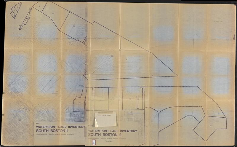
Part of a report on waterfront property in Boston.
- Cartographer:
- Boston Redevelopment Authority
- Date:
-
1969
- Format:
-
Maps/Atlases
- Location:
-
Boston Public Library
Central Library in Copley Square - Collection (local):
-
Boston Public Library Collection
- Subjects:
-
Boston (Mass.)--Maps
City planning--Massachusetts--Boston--Maps
Urban renewal--Massachusetts--Boston--Maps
Central business districts--Massachusetts--Boston--Maps
Waterfronts--Massachusetts--Boston--Maps
Buildings--Massachusetts--Boston--Maps
Real property--Massachusetts--Boston--Maps
- Places:
-
Suffolk (county)Boston
- Extent:
- 1 map ; 167 x 101 cm
- Terms of Use:
-
No known copyright restrictions.
No known restrictions on use.
- Publisher:
-
Boston :
Boston Redevelopment Authority
- Scale:
-
Scale approximately 1:2,400
- Language:
-
English
- Catalog Record:
-
Accompanying text
- Notes:
-
Shows land parcels keyed to an inventory listing number on the map, address, owner, parcel number, area, assessed land value, assessed building value, and land use.
- Identifier:
-
06_01_017787
- Call #:
-
BRA/FOLIO/136 map
- Barcode:
-
mq6311366


