A city of unequal risks
Item Information
- Title:
- A city of unequal risks
- Cartographer:
- Boston Public Library. Norman B. Leventhal Map and Education Center
- Cartographer:
- Bowe, Emily, 1992-
- Name on Item:
-
Norman B. Leventhal Map & Education Center ; map design: Emily Bowe
- Date:
-
2022
- Format:
-
Maps/Atlases
- Location:
-
Boston Public Library
Norman B. Leventhal Map & Education Center - Collection (local):
-
Norman B. Leventhal Map & Education Center Collection
- Subjects:
-
Boston (Mass.)--Maps
Climatic changes--Social aspects--Massachusetts--Boston--Maps
Disasters--Social aspects--Massachusetts--Boston--Maps
Floods--Massachusetts--Boston--Maps
Urban heat island--Massachusetts--Boston--Maps
Open spaces--Massachusetts--Boston--Maps
- Places:
-
MassachusettsSuffolk (county)Boston
- Extent:
- 1 map : color
- Terms of Use:
-
No known copyright restrictions.
No known restrictions on use.
- Publisher:
-
Boston :
Norman B. Leventhal Map & Education Center
- Language:
-
English
- Notes:
-
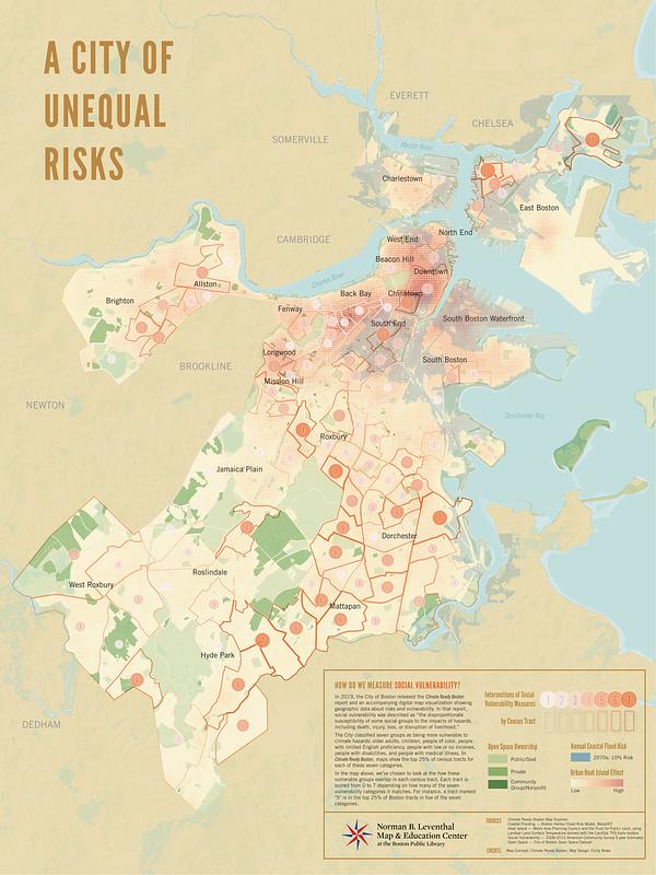
Shows social vulnerability, open space ownership, areas at 10% risk of annual coastal flooding in 2070, and urban heat island effect.
- Notes (exhibitions):
-
Exhibited: "More or less in common: environment and justice in the human landscape," organized by Leventhal Map & Education Center at the Boston Public Library, 2022.
- Identifier:
-
BostonClimate


