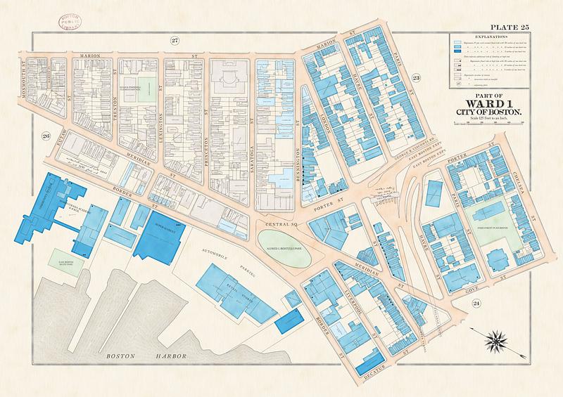
East Boston flood risk
Item Information
- Title:
- East Boston flood risk
- Title (alt.):
-
Part of Ward 1, city of Boston
Plate 25
- Cartographer:
- Woodruff, Andy
- Publisher:
- Boston Public Library. Norman B. Leventhal Map and Education Center
- Date:
-
2023
- Format:
-
Maps/Atlases
- Location:
-
Boston Public Library
Norman B. Leventhal Map & Education Center - Collection (local):
-
Norman B. Leventhal Map & Education Center Collection
- Subjects:
-
East Boston (Boston, Mass.)--Maps
Floods--Risk assessment--Massachusetts--Boston--Maps
Climatic changes--Risk assessment--Massachusetts--Boston--Maps
Real property--Massachusetts--Boston--Maps
Landowners--Massachusetts--Boston--Maps
- Places:
-
MassachusettsSuffolk (county)BostonEast Boston
- Extent:
- 1 map : color
- Terms of Use:
-
Under copyright.
This work is licensed for use under a Creative Commons Attribution License (CC BY).

- Publisher:
-
Boston :
Norman B. Leventhal Map and Education Center
- Notes:
-
Indicates flood risk under several scenarios of climate change-induced sea level rise, drawn in the style of fire insurance and real estate atlases.
Also shows lots, building footprints, and property owners.
- Identifier:
-
east_boston_flood


