Toggle navigation
LMEC Home
Exhibitions
Georeferencing
Tools for Teachers
Collections
My Favorites
Sign Up / Log In
Search
Search the map portal
Map Collection
Map Collection
Map Sets
Search
Search
Search for
Search In
All Fields
Creator
Title
Subject
Place
Search All Digital Collections
Advanced Search
337 Results
My Search
Start Over
More Like
commonwealth:z603vv407
Remove constraint More Like: commonwealth:z603vv407
Filter your Search
Place
North and Central America
270
United States
208
Suffolk (county)
72
Boston
70
Massachusetts
38
New York
32
Canada
28
North America
27
more
Place
»
Topic
Boston (Mass.)--Maps--Early works to 1800
46
Boston Harbor (Mass.)--Maps--Early works to 1800
21
Boston (Mass.)--History--Revolution, 1775-1783--Maps--Early works to 1800
19
North America--Maps--Early works to 1800
18
New England--Maps--Early works to 1800
11
United States--History--Revolution, 1775-1783--Maps--Early works to 1800
11
Vues d'optique
10
Fortification--Massachusetts--Boston--Maps--Early works to 1800
9
more
Topic
»
Date
Date range begin
–
Date range end
Current results range from
1694
to
1879
View distribution
Creator
Faden, William, 1749-1836
33
Jefferys, Thomas, -1771
30
Le Rouge, Georges-Louis
24
Des Barres, Joseph F. W. (Joseph Frederick Wallet), 1722-1824
22
Sayer, Robert, 1725-1794
19
Korn, Christoph Heinrich, 1726-1783
11
Raspe, Gabriel Nicolaus, 1712-1785
11
Simcoe, John Graves, 1752-1806
10
more
Creator
»
Format
Maps/Atlases
294
Prints
32
Manuscripts
25
Drawings/Illustrations
9
Books
2
Georeferenced
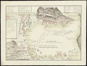
Yes
18
No
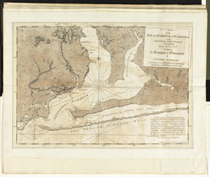
319
Collection
American Revolutionary War-Era Maps
327
Richard H. Brown Revolutionary War Map Collection at Mount Vernon
293
Boston and New England Maps
41
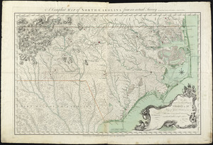
Norman B. Leventhal Map & Education Center Collection
38
Urban Maps
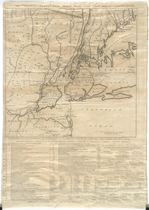
25
Mapping Boston Collection
8
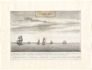
Maritime Charts and Atlases
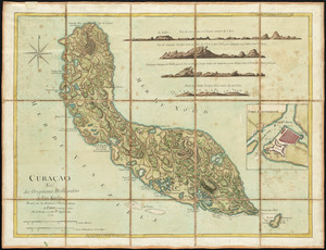
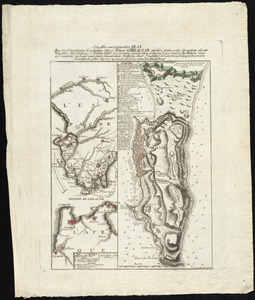
6
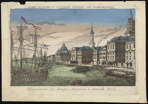
Library of Congress Collection
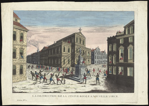
3
more
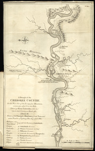
Collection
»
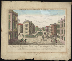
Available to use
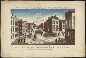
Creative Commons license
305
No known restrictions
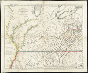
32
Search Constraints
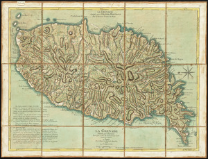
Sort by relevance
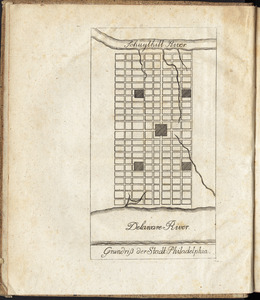
relevance
title
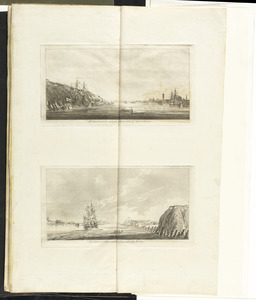
date (asc)
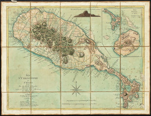
date (desc)
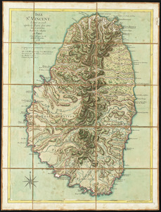
Number of results to display per page
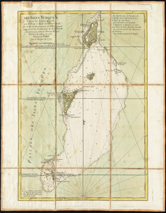
100 per page
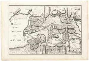
10
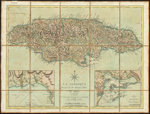
per page
20
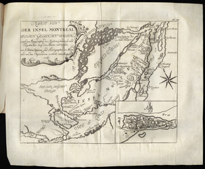
per page
50
per page
100
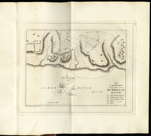
per page
View results as:
grid view
map view
Search Results
101.
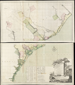
Chart comprizing Greenland with the countries and islands about Baffin's and Hudson's Bays
102.
Chart containing the coasts of California, New Albion, and Russian discoveries to the north : with the peninsula of Kamchatka,...
103.
Chart containing the greater part of the South Sea to the south of the line, with islands dispersed thro' the same
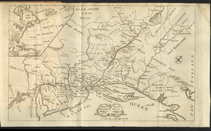
104.
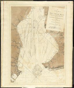
A chart of Delawar Bay, with soundings and nautical observations
105.
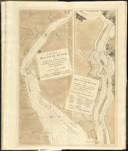
A chart of Delawar River from Bombay Hook to Ridley Creek, with soundings &c taken by Lt. Knight of the Navy
106.
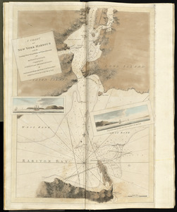
A chart of New York Harbour with the soundings views of land marks and nautical directions : for the use of pilotage
107.
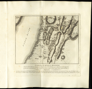
A chart of North and South America, including the Atlantic and Pacific Oceans, with the nearest coasts of Europe, Africa and Asia
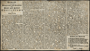
108.
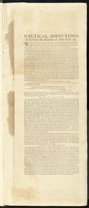
Chart of South America, comprehending the West Indies, with the adjacent islands, in the Southern Ocean, and South Sea
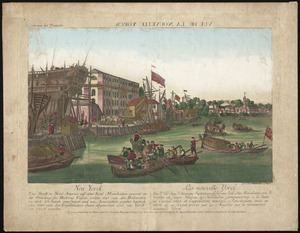
109.
Chart of the Atlantic Ocean, with the British, French, & Spanish settlements in North America, and the West Indies : as also on...
110.
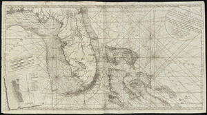
Chart of the Banks of Newfoundland, drawn from a great number of hydrographical surveys, these charts are followed, according...
111.
A chart of the bay and harbour of Pensacola in the Province of West Florida
112.
[Chart of the coast of Georgia]
113.
[Chart of the coast of Georgia]
114.
[Chart of the Gulf Stream]
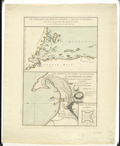
115.
A chart of the Harbour of Boston, with the soundings, sailing-marks, and other directions
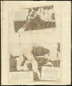
116.
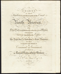
Charts of several harbours, and divers parts of the coast of North America, from New York south westwards to the Gulph of Mexico
117.
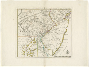
A chorographical map, of the country, round Philadelphia = : carte particuliere, des environs de Philadelphie
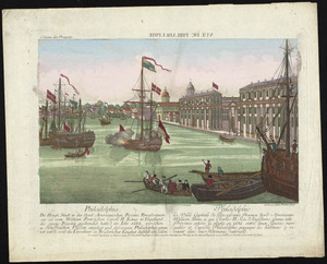
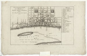
118.
A chorographical map of the northern department of North-America
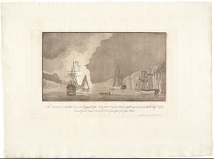
119.
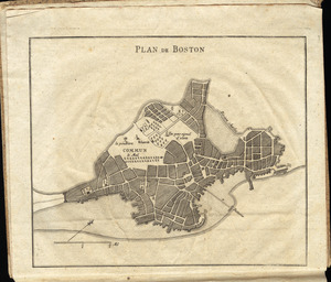
A chorographical map of the Province of New-York in North America, divided into counties, manors, patents and townships :...
120.
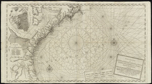
The coast of a part of New England, New York, New Jersey, Pensilvania, Maryland, Virginia, and part of North Carolina &c. with...
121.
The coast of a part of North Carolina, South Carolina, Georgia and part of East Florida, with the bays, soundings, banks, roks,...
122.
The coast of New Schotland, New England, the gulph and river of St. Laurence : the islands of New Foundland, Cape Breton, St....
123.
A compleat map of North-Carolina from an actual survey
124.
Connecticut and parts adjacent
125.
Connecticut and parts adjacent
126.
The country twenty five miles round New York
127.
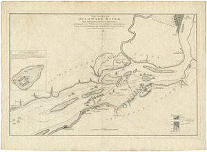
The course of Delaware River from Philadelphia to Chester, exhibiting the several works erected by the rebels to defend its...
128.
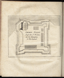
Crown Point : sonst Fort St. Frederic, am See Champlain in Neu England
129.
Le Cte. d'Estaing laisse deux vaisseaux et trois frégates de son escadre à la poursuite de la frégate Anglaise la Mairmaide,...
130.
Curaçao : tiré des originaux Hollandois de Van Keulen ; dressé sur les dernieres observations
131.
Débarquement des troupes Angloises à Nouvelle Yorck
132.
La destruction de la statue royale a Nouvelle Yorck
133.
[Dorchester Neck]
134.
A draught of the Cherokee Country : on the west side of the Twenty Four Mountains, commonly called Over the Hills
135.
[Ein grund-riss von der Festung Duquessne wie sie ausgesehen hat, ehe sie die Frankosen zerstoren aben, und zum theil noch...
136.
Der einzug der königlichen völcker in Neu Yorck
137.
Der einzug der königlichen völcker in Neu Yorck = : L'entré triumphale de troupes royales á Nouvelle Yorck
138.
Exact plan of General Gage's lines on Boston Neck in America
139.
A front view of the lines taken from the advanced post near Browns house : A view of the harbour of Boston taken from Fort Hill...
140.
A general map of North America : in which is express'd the several new roads, forts, engagements, &c, taken from actual surveys...
141.
A general map of the middle British colonies, in America : viz Virginia, Màriland, Dèlaware, Pensilvania, New-Jersey,...
142.
La Grenade : divisée par paroisses
143.
Grundriss der stadt Philadelphia
144.
Grundriss des nördlichen theils der Neujorks Insel : nebst den am 16. Novbr. 1776. eroberten Fort Washington nun das Fort...
145.
The harbour and part of the town of Havannah : The entrance of Havannah, from within the harbour
146.
Isle St. Christophe ou St. Kitts
147.
Isle St. Vincent
148.
Les Isles Turques d'après les levées de 1753 par le sloop l'Aigle et l'Emeraude par ordre du Gouverneur de St. Domingue...
149.
L'isthme de l'Acadie, Baye du Beaubassin, en Anglois Shegnekto, environs du Fort Beausejour
150.
La Jamaique
151.
Karte von dem Ostlichen-Stucke von Neu Franckreich oder Canada in America : besonders aber Acadia und Neu Schottland
152.
Karte von der Insel Montreal und den gegenden umher, nach den manuscripten der karten, grundrisse und tagebücher beÿ der...
153.
Karte von Neu England, Neu Yorck und Pensilvanien
154.
Krigs theatreni i America, 1777 = : seat of war in America, 1777
155.
LʼAmérique Septentrionale et Méridionale divisée suivant ses différens pays
156.
The landing at Burrell's, April 17th. 1781
157.
A large and particular plan of Shegnekto Bay, and the circumjacent country, with the forts and settlements of the French 'till...
158.
Lauff des flusses St. Laurentzi von Quebec bis an den See Ontario : 2. bladt
159.
[Map of Boston]
160.
[Map of Florida, Carolina, and the Gulf Coast]
161.
Map of Nova Scotia, or Acadia : with the islands of Cape Breton and St. John's, from actual surveys
162.
A map of South Carolina and a part of Georgia : containing the whole sea-coast; all the islands, inlets, rivers, creeks,...
163.
[Map of the Allegheny and Ohio Rivers] ; Franzosische see kusten von Provence zwischen Marseille und Toulon = : Cotes maritimes...
164.
A map of the British and French dominions in North America with the roads, distances, limits, and extent of the settlements,...
165.
A map of the country between Will's Creek & Monongahela River shewing the rout and encampments of the English army in 1755
166.
A map of the inhabited part of Canada from the French surveys : with the frontiers of New York and New England from the large...
167.
A map of the most inhabited part of New England : containing the provinces of Massachusets Bay and New Hampshire, with the...
168.
A map of the most inhabited part of Virginia containing the whole province of Maryland with part of Pensilvania, New Jersey and...
169.
A map of the north west parts of the United States of America
170.
A map of the Province of New-York : reduc'd from the large drawing of that province, compiled from actual surveys by order of...
171.
[Map of the Siege of Mud Island Fort]
172.
A map of the United States of N. America
173.
Map of the western parts of the colony of Virginia, as far as the Mississipi
174.
March of the Queens Rangers : Emmericks Corps, the Cavalry of the Legion under Lt. Col. Tarleton, and a detachment of the...
175.
Nachricht von der belagerung und einnahme der stadt und hafens Charlestown in America
176.
Nautical directions to sail into the harbour of New-York, &c.
177.
Neu Yorck = : La Nouvelle Yorck
178.
Neuester und acurater plan der weltberuhmten Englischen berg festung Gibraltar auf der Spitze von Spanien : derer wercher...
179.
A new and accurate map of the English empire in North America : representing their rightful claim as confirmed by charters, and...
180.
A new and correct chart of the coast of East Florida, and part of West Florida and Gulf of Mexico, Gulf of Florida or Cannel of...
181.
A new and correct map of North America, with the West India Islands : divided according to the last Treaty of Peace, concluded...
182.
A new chart of the coast of New England, Nova Scotia, and the islands of St. John, Cape Breton, Sable, the banks of St. Peters,...
183.
A new map of North America wherein the British Dominions in the continent of North America : and on the islands of the West...
184.
A new map of Nova Scotia, and Cape Britain : with the adjacent parts of New England and Canada, composed from a great number of...
185.
A new map of the British colonies in North America, shewing the seat of the present war, taken from the best surveys, compared...
186.
A new map of the western parts of Virginia, Pennsylvania, Maryland and North Carolina : comprehending the river Ohio, and all...
187.
[Noddle Island and the Mill Pond]
188.
North America from the French of Mr. D'Anville, improved with the back settlements of Virginia and course of Ohio, illustrated...
189.
The operations of His Majesty's squadron in the Bay of Honduras, under the command of the Hon. John Luttrell from the 15th of...
190.
Order of battle of the army under the command of Lt. General Gage at Boston, July 17th, 1775
191.
Oyster Bay and Huntington : Huntington Bay
192.
[Panoramic view of Newport, Rhode Island and the harbor showing the position of the French fleet and troop encampments]
193.
Partie occidentale de la Virginie, Pensylvanie, Maryland, et Caroline septle. la Rivière d'Ohio, et toutes celles qui s'y...
194.
Partie septentrionale des possessions angloise en Amérique : pour servire d'intelligence à la guerre présente entre les...
195.
Philadelphia = : Philadelphie
196.
Philadelphie, par Easburn, arpenteur general de Pensilvanie
197.
The Phoenix and the Rose engaged by the enemy's fire ships and galleys on the 16 Augst. 1776
198.
Plan de Boston
199.
[Plan de Gibraltar]
200.
Plan de Gibraltar
‹ Prev
Next ›
1
2
3
4


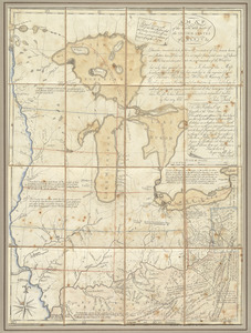
![[Chart of the coast of Georgia]](https://bpldcassets.blob.core.windows.net/derivatives/images/commonwealth:z603vv33t/image_thumbnail_300.jpg)
![[Chart of the coast of Georgia]](https://bpldcassets.blob.core.windows.net/derivatives/images/commonwealth:z603vv35c/image_thumbnail_300.jpg)
![[Chart of the Gulf Stream]](https://bpldcassets.blob.core.windows.net/derivatives/images/commonwealth:z603vr47j/image_thumbnail_300.jpg)


![[Dorchester Neck]](https://bpldcassets.blob.core.windows.net/derivatives/images/commonwealth:dz010v59b/image_thumbnail_300.jpg)
![[Ein grund-riss von der Festung Duquessne wie sie ausgesehen hat, ehe sie die Frankosen zerstoren aben, und zum theil noch aussiehet]](https://bpldcassets.blob.core.windows.net/derivatives/images/commonwealth:z603vv49q/image_thumbnail_300.jpg)


![[Map of Boston]](https://bpldcassets.blob.core.windows.net/derivatives/images/commonwealth:z603vw17n/image_thumbnail_300.jpg)
![[Map of Florida, Carolina, and the Gulf Coast]](https://bpldcassets.blob.core.windows.net/derivatives/images/commonwealth:z603vr379/image_thumbnail_300.jpg)

![[Map of the Allegheny and Ohio Rivers] ; Franzosische see kusten von Provence zwischen Marseille und Toulon =](https://bpldcassets.blob.core.windows.net/derivatives/images/commonwealth:z603vr31n/image_thumbnail_300.jpg)


![[Map of the Siege of Mud Island Fort]](https://bpldcassets.blob.core.windows.net/derivatives/images/commonwealth:z603vr43f/image_thumbnail_300.jpg)


![[Noddle Island and the Mill Pond]](https://bpldcassets.blob.core.windows.net/derivatives/images/commonwealth:dz010v671/image_thumbnail_300.jpg)


![[Panoramic view of Newport, Rhode Island and the harbor showing the position of the French fleet and troop encampments]](https://bpldcassets.blob.core.windows.net/derivatives/images/commonwealth:dz010v493/image_thumbnail_300.jpg)


![[Plan de Gibraltar]](https://bpldcassets.blob.core.windows.net/derivatives/images/commonwealth:z603vt83t/image_thumbnail_300.jpg)