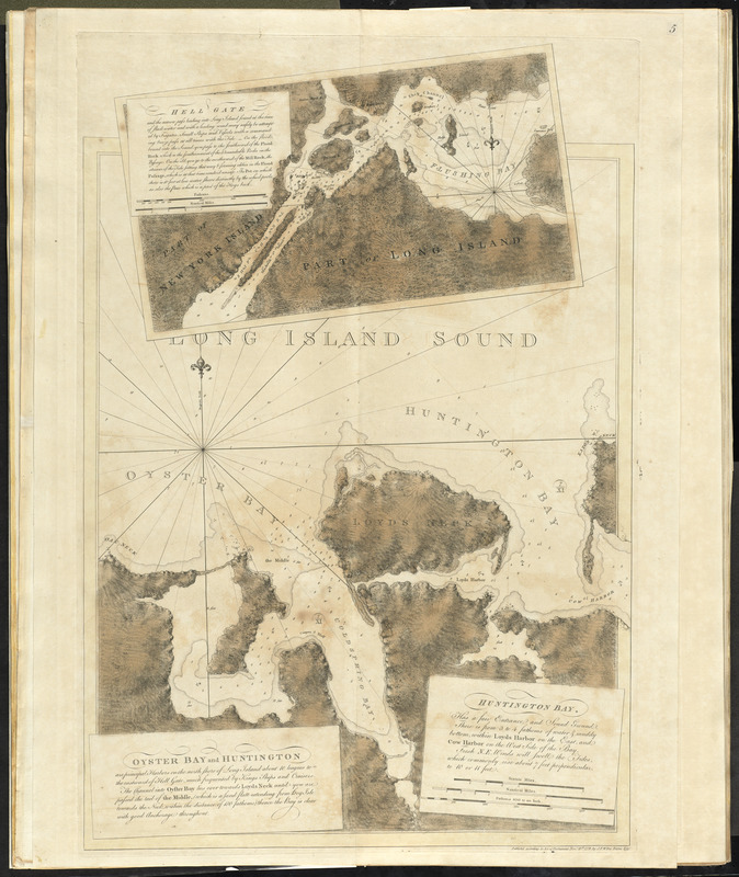
Oyster Bay and Huntington : Huntington Bay
This map is also available in American Revolutionary Geographies Online (ARGO), a collections portal especially built for material relating to the American Revolutionary War Era. Visit ARGO to learn more about this item and explore the historical geography of North America in the late eighteenth century.
Item Information
- Title:
- Oyster Bay and Huntington : Huntington Bay
- Title (alt.):
-
Huntington Bay
- Creator:
- Des Barres, Joseph F. W. (Joseph Frederick Wallet), 1722-1824
- Date:
-
1778
- Format:
-
Maps/Atlases
- Location:
- George Washington's Mount Vernon
- Collection (local):
-
Richard H. Brown Revolutionary War Map Collection at Mount Vernon
- Subjects:
-
Oyster Bay (N.Y. : Bay)--Maps--Early works to 1800
Huntington Bay (N.Y. : Bay)--Maps--Early works to 1800
Hell Gate (New York, N.Y.)--Maps--Early works to 1800
- Places:
-
New York (county)Hell Gate (channel)
Suffolk (county)Huntington Bay
Nassau (county)Oyster Bay
- Extent:
- 1 map : col. ; 66 x 52 cm, on sheet 74 x 64 cm.
- Terms of Use:
-
No known copyright restrictions.
This work is licensed for use under a Creative Commons Attribution Non-Commercial Share Alike License (CC BY-NC-SA).

- Publisher:
-
[London] :
J.F.W. Des Barres
- Scale:
-
Scale ca. 1:25,250
- Language:
-
English
- Catalog Record:
-
MVLA record
- Notes:
-
Relief shown by hachures and shading. Depths shown by soundings.
Includes text and inset "Hell Gate" ca. 1:25,250.
Variant state of entry 1231 in LC Maps of North America, 1750-1789.
- Identifier:
-
06_01_010148
- LCCN:
-
77692981

![[A map of part of Pennsylvania & Maryland intended to shew, at one view, the several places proposed for opening a communication between the waters of the Delaware & Chesopeak Bays]](https://bpldcassets.blob.core.windows.net/derivatives/images/commonwealth:z603vt12v/image_thumbnail_300.jpg)


