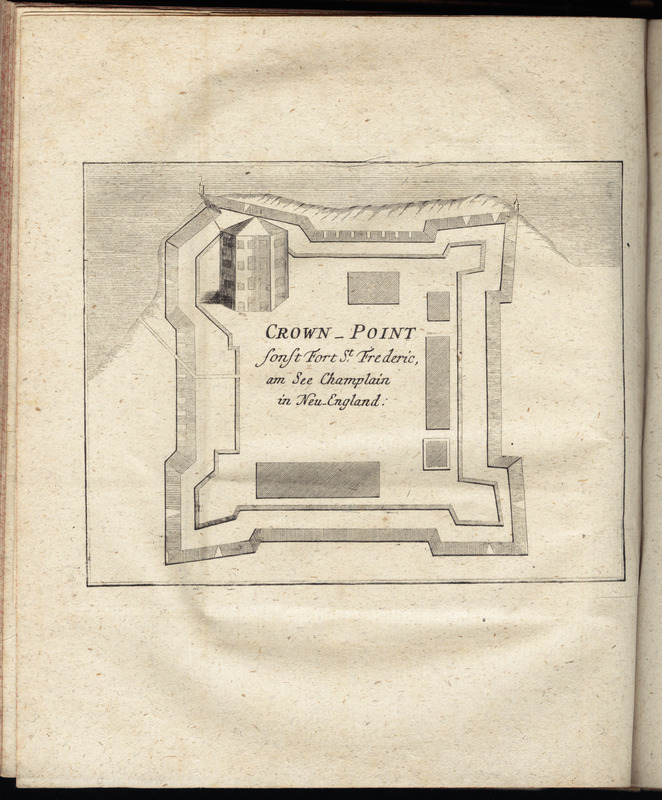
Crown Point : sonst Fort St. Frederic, am See Champlain in Neu England
This map is also available in American Revolutionary Geographies Online (ARGO), a collections portal especially built for material relating to the American Revolutionary War Era. Visit ARGO to learn more about this item and explore the historical geography of North America in the late eighteenth century.
Item Information
- Title:
- Crown Point : sonst Fort St. Frederic, am See Champlain in Neu England
- Creator:
- Korn, Christoph Heinrich, 1726-1783
- Publisher:
- Raspe, Gabriel Nicolaus, 1712-1785
- Date:
-
[1777]
- Format:
-
Maps/Atlases
- Location:
- George Washington's Mount Vernon
- Collection (local):
-
Richard H. Brown Revolutionary War Map Collection at Mount Vernon
- Subjects:
-
Crown Point (N.Y.)--History--Revolution, 1775-1783--Maps--Early works to 1800
Fort Saint Frederic (Crown Point, N.Y.)--Maps--Early works to 1800
- Places:
-
Essex (county)Crown Point (cape)
- Extent:
- 1 map ; 11 x 15 cm.
- Terms of Use:
-
No known copyright restrictions.
This work is licensed for use under a Creative Commons Attribution Non-Commercial Share Alike License (CC BY-NC-SA).

- Publisher:
-
Nuremberg :
Gabriel Nicolaus Raspe
- Scale:
-
Scale [ca. 1:900]
- Language:
-
German
- Catalog Record:
-
MVLA record
- Notes:
-
Oriented with north to the upper left.
In the author's Geschichte der kriege in und ausser Europa, vierter theil (Nurnberg : Gabriel Nicolaus Raspe, 1777).
- Notes (date):
-
This date is inferred.
- Identifier:
-
06_01_010210


![[A map of part of Pennsylvania & Maryland intended to shew, at one view, the several places proposed for opening a communication between the waters of the Delaware & Chesopeak Bays]](https://bpldcassets.blob.core.windows.net/derivatives/images/commonwealth:z603vt12v/image_thumbnail_300.jpg)


