Toggle navigation
LMEC Home
Exhibitions
Georeferencing
Tools for Teachers
Collections
My Favorites
Sign Up / Log In
Search
Search the map portal
Map Collection
Map Collection
Map Sets
Search
Search
Search for
Search In
All Fields
Creator
Title
Subject
Place
Search All Digital Collections
Advanced Search
112 Results
My Search
Start Over
More Like
commonwealth:j3860821t
Remove constraint More Like: commonwealth:j3860821t
Filter your Search
Place
North and Central America
69
United States
52
New England
21
New York
19
Massachusetts
16
New Jersey
9
Rhode Island
8
Connecticut
6
more
Place
»
Topic
New England--Maps--Early works to 1800
15
New Jersey--History--Revolution, 1775-1783--Maps--Early works to 1800
14
World maps--Early works to 1800
13
Fortification--New York (State)--New York--Maps--Early works to 1800
12
America--Maps--Early works to 1800
9
New York (N.Y.)--Buildings, structures, etc--Maps, Manuscript--Early works to 1800
9
New York (State)--History--Revolution, 1775-1783--Maps--Early works to 1800
9
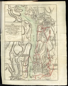
Massachusetts--Maps
8
more
Topic
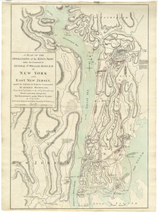
»
Date
Date range begin
–
Date range end
Current results range from
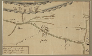
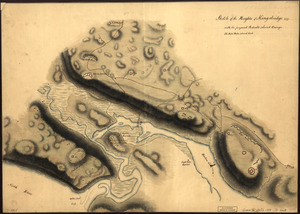
1482
to
1990
View distribution
Creator
Faden, William, 1749-1836
6
Ortelius, Abraham, 1527-1598
5
Bordon, Benedetto, 1450-1530
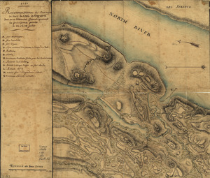
3
Gastaldi, Giacomo, approximately 1500-approximately 1565
3
Hondius, Jodocus, 1594 or 1595-1629
3
Mercator, Gerhard, 1512-1594
3
Münster, Sebastian, 1489-1552
3
Ptolemy, active 2nd century
3
more
Creator
»
Format
Maps/Atlases
112
Manuscripts
12
Books
1
Georeferenced
Yes
9
No
103
Collection
Sidney R. Knafel Map Collection at Phillips Academy
87
American Revolutionary War-Era Maps
49
Library of Congress Collection
11
Norman B. Leventhal Map Center Collection
8
Richard H. Brown Revolutionary War Map Collection at Mount Vernon
4
Boston and New England Maps
1
Harvard Map Collection
1
New-York Historical Society Collection
1
Available to use
Creative Commons license
16
No known restrictions
9
Search Constraints
Sort by date (asc)
relevance
title
date (asc)
date (desc)
Number of results to display per page
100 per page
10
per page
20
per page
50
per page
100
per page
View results as:
grid view
map view
Search Results
1.
The world
2.
Garden of Eden
3.
Secunda etas mundi = Secunda etas mũdi
4.
Map of the Caribbean Area
5.
World map
6.
Generale Ptholemei
7.
Orbis typus uniuersalis iuxta hydrographorum traditionem
8.
Tipus orbis uniuersalis iuxta Ptolomei cosmographi traditionem et Americi Vespucii alior[um]que
9.
Praeclara Ferna[n]di Cortesii de Noua maris Oceani Hyspania Narratio . . .
10.
Oceani occidetalis seu terre nove tabula
11.
Oval map of the world
12.
Scandinavia
13.
Terra de Lavoratore
14.
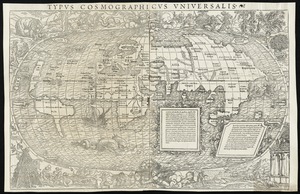
Typus cosmographicus uniuersalis
15.
Nova, et integra universi orbis descriptio
16.
Novae insulae XVII, nova tabula
17.
Carta marina nova tabula
18.
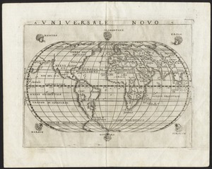
Universale novo
19.
Universalis de terrao orarium ex vera recen [...] traditione
20.
Atlantic Ocean
21.
Universale della parte del mondo nuovamente ritrovata
22.
Herbipolis occidens Wurtzpurg
23.
Americae siue noui orbis, noua descriptio
24.
Quarte partie du monde
25.
La heroike enterprinse faict par le Signeur Draeck d'avoir cirquit toute la terre
26.
Pars Prima. Speculum Nauticum super navigatione maris Occidentalis confectum, continens omnes oras maritimas Gallia, Hispaniae...
27.
Americae siue noui orbis, noua descriptio
28.
Americae pars Borealis, Florida, Baccalaos, Canada, Corterealis
29.
America sive India Nova : ad magnae Gerardi Mercatoris aui universalis imitationem in compendium redacta
30.
America sive novvs orbis respectv Evropaeorvm inferior globi terrestris pars
31.
Orbis terrae compendiosa descriptio : quam ex magna universali Gerardi Mercatoris Domino Richardo Gartho, geographie ac...
32.
Typus orbis terrarum
33.
Maris Pacifici (quod vulgo Mar del Zur) cum regionibus circumiacentibus, insulisque in eodem passim sparsis, novissima descriptio
34.
Theatro del mondo di Abrahamo Ortelio : da lui poco inanzi la sua morte riueduto, & di tauole nuoue, et commenti adorno, &...
35.
Virginia et Nova Francia
36.
The north part of America : conteyning Newfoundland, new England, Virginia, Florida, new Spaine, and Noua Francia wth ye rich...
37.
America
38.
Septentrionalium terrarum descriptio
39.
New Englands prospect : A true, lively, and experimentall description of that part of America, commonly called New England:...
40.
L'Atlas de mer ou monde aquatique, remontrant toutes les côtes de la mer, a scavoir de la partie connuë de I'Univers, avec une...
41.
Costes et rivieres de Virginie, de Mariland, et de Nouvelle Angletere
42.
Pascaert van Nieu Nederland van Hendrick Christiaens Eijland tot staten hoeck of Cabo Cod
43.
A map of New-England, being the first that ever was here cut, and done by the best pattern that could be had, which being in...
44.
New England and New York
45.
Nouvelle Angleterre et Nouvel York
46.
Pas-caert van Nieu Nederland, Virginia, Nieu Engeland als mede Penn-silvania, met de stad Philadelfia van Baston tot Carrik = a...
47.
New England and New York
48.
A map of New England, New York, New Jersey and Pensilvania
49.
Recens edita totius Novi Belgii in America Septentrionali siti
50.
A new map of the most considerable plantations of the English in America
51.
An accurate map of the English colonies in North America, bordering on the river Ohio
52.
The English pilot. The fourth book. Describing the West-India navigation, from Hudson's-Bay to the River Amazones. Particulary...
53.
A map of the British and French dominions in North America with the roads, distances, limits, and extent of the settlements,...
54.
Porti della Nuova York e Perthamboy
55.
Baye et port d'Yorc, capitale de la Nouvelle Yorc
56.
Carte de la Nouvelle Angleterre, New York, Pensilvanie et Nouveau Jersay suivant les cartes angloises
57.
A chart of the gulf stream
58.
Part of east New Jarsey, New York, and Connecticut
59.
Partie de la carte du Capitaine Cluny, auteur d'un ouvrage anglois intitulé American Traveller publié à Londres en 1769
60.
A new and accurate map of the present seat of war in North America : from a late survey
61.
Bowles's new pocket map of the most inhabited part of New England : comprehending the provinces of Massachusets Bay and New...
62.
New York Island : Military; unfinished
63.
A plan of New York Island, with part of Long Island, Staten Island & east New Jersey, with a particular description of the...
64.
A plan of the Narrows of Hells-gate in the East River : near which batteries of cannon and mortars were erected on Long Island...
65.
Plan of The Narrows, shewing the channel, shoal, depth of water, and the several battery's proposed on each side to prevent an...
66.
Map of defenses of New York Island from Fort Washington to Fort Independence, with redoubts, etc. planned between
67.
A New and accurate map of the present seat of war in North America, comprehending New Jersey, Philadelphia, Pensylvania,...
68.
Plan of the operations of General Washington, against the Kings troops in New Jersey : from the 26th. of December 1776, to the...
69.
Plan of the operations of General Washington, against the Kings troops in New Jersey : from the 26th. of December 1776, to the...
70.
A plan of the operations of the King's army : under the command of General Sr. William Howe, K.B. in New York and east New...
71.
A plan of the operations of the King's army under the command of General Sr. William Howe, K.B. in New York and east New...
72.
A plan of the operations of the King's army under the command of General Sr. William Howe, K.B. in New York and east New Jersey...
73.
Plan of the situation of the American & British armies, June 15st 1777
74.
Plan von den operationen der Koeniglichen Armee unter dem General Sir William Howe : in Neuyorck und Ost-Neujerseÿ gegen die...
75.
Plan von den operationen der Koeniglichen Armee unter dem General Sir William Howe : in Neuyorck und Ost-Neujerseÿ gegen die...
76.
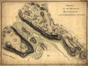
Sketch of the Heights of Kingsbridge 1777, with the proposed redoubts coloured orange : Old rebel works coloured black
77.
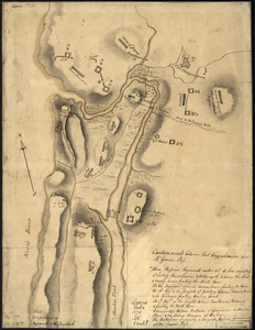
Sketch of the Heights of Kingsbridge, with the proposed redouts couloured yellow
78.
The American Atlas or, A Geographical Description of the whole continent of America : wherein are delineated at large, its...
79.
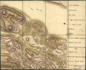
Disposition of British troops, with fortifications north of Fort Knipehausen, i.e. Fort Washington to Fort Independence
80.
An accurate map of Rhode Island, part of Connecticut and Massachusets, shewing Admiral Arbuthnot's station in blocking up...
81.
A new and accurate map of the colony of Massachusets Bay, in North America, from a late survey
82.
A new and accurate map of the province of New York and part of the Jerseys, New England and Canada, shewing the scenes of our...
83.
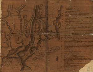
Chart and plan of the harbour of New York & the couny. adjacent, from Sandy Hook to Kingsbridge, comprehending the whole of New...
84.
Nord de l'Ile de New-York
85.
Plan de New-York et les environs
86.
Reconnoissance de King's bridge : I
87.
Reconnoissance des ouvrages du nord de l'Isle de Newyork dont on a déterminé géometriquement les principaux points le 22 et...
88.
A map of the province of Massachusets Bay and colony of Rhode Island, with part of Connecticut, New Hampshire, and Vermont
89.
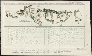
Plan de la bataille de Montmouth où le Gl. Washington commandait l'Armée Américaine et le Gl. Clinton l'Armée Anglaise, le...
90.
Carte de la Nouvelle Angleterre, Nouvelle York, Nouvelle Jersey et Pensilvanie
91.
Chart for the journal of Mr. le Mquis. de Chastellux
92.
A plan of the operations of the King's army under the command of General Sr. William Howe, K.B. in New York and east New Jersey...
93.
Map of the northern, or, New England states of America, comprehending Vermont, New Hampshire, District of Main, Massachusetts,...
94.
A map of Massachusetts, from the best authorities
95.
The state of Massachusetts from the best information
96.
Massachusetts
97.
The American pilot : containing the navigation of the sea coat of North America . . .
98.
Map of Massachusetts, from the best authorities
99.
The state of Massachusetts
100.
Map of the northern part of New England : compiled for Pres't. Dwight's travels
‹ Prev
Next ›
1
2


![Tipus orbis uniuersalis iuxta Ptolomei cosmographi traditionem et Americi Vespucii alior[um]que](https://bpldcassets.blob.core.windows.net/derivatives/images/commonwealth:j3860806q/image_thumbnail_300.jpg)
![Praeclara Ferna[n]di Cortesii de Noua maris Oceani Hyspania Narratio . . .](https://bpldcassets.blob.core.windows.net/derivatives/images/commonwealth:zk51wc44m/image_thumbnail_300.jpg)


![Universalis de terrao orarium ex vera recen [...] traditione](https://bpldcassets.blob.core.windows.net/derivatives/images/commonwealth:hq37vv39x/image_thumbnail_300.jpg)