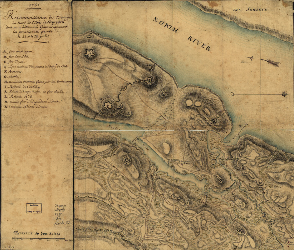
Reconnoissance des ouvrages du nord de l'Isle de Newyork dont on a déterminé géometriquement les principaux points le 22 et le 23 juillet
This map is also available in American Revolutionary Geographies Online (ARGO), a collections portal especially built for material relating to the American Revolutionary War Era. Visit ARGO to learn more about this item and explore the historical geography of North America in the late eighteenth century.
Item Information
- Title:
- Reconnoissance des ouvrages du nord de l'Isle de Newyork dont on a déterminé géometriquement les principaux points le 22 et le 23 juillet
- Date:
-
1781
- Format:
-
Maps/Atlases
Manuscripts
- Location:
- Library of Congress Geography and Map Division
- Collection (local):
-
Library of Congress Collection
- Subjects:
-
Fortification--New York (State)--New York--Maps--Early works to 1800
New York (N.Y.)--Buildings, structures, etc--Maps, Manuscript--Early works to 1800
- Places:
-
New York
- Extent:
- 1 manuscript map : hand color, 46 x 40 cm. on sheet 46 x 54 cm.
- Terms of Use:
-
No known copyright restrictions.
This work is licensed for use under a Creative Commons Attribution Non-Commercial Share Alike License (CC BY-NC-SA).

- Scale:
-
Scale ca. 1:10,300
- Language:
-
French
- Catalog Record:
-
https://lccn.loc.gov/gm71000997
- Notes:
-
Manuscript, pen-and-ink and watercolor.
Has watermark.
Relief shown by hachures.
Shows forts and redoubts.
Indexed.
- Notes (citation):
-
LC Maps of North America, 1750-1789, 1215
- Identifier:
-
ar121500