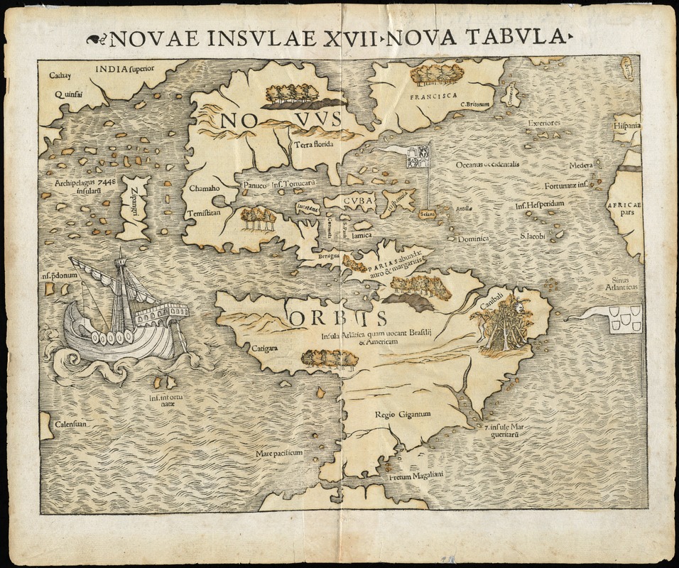
Novae insulae XVII, nova tabula
Item Information
- Title:
- Novae insulae XVII, nova tabula
- Title (alt.):
-
Novae insvlae XVII, nova tabvla
- Contributor:
- Petri, Heinrich, 1508-1579
- Creator:
- Münster, Sebastian, 1489-1552
- Date:
-
[1542]
- Format:
-
Maps/Atlases
- Location:
- Phillips Academy
- Collection (local):
-
Sidney R. Knafel Map Collection at Phillips Academy, Andover MA
- Subjects:
-
Western Hemisphere--Maps--Early works to 1800
America--Maps--Early works to 1800
- Extent:
- 1 map ; 26 x 34 cm.
- Terms of Use:
-
Rights status not evaluated.
Contact host institution for more information.
- Publisher:
-
[Basel] :
[Heinrich Petri]
- Scale:
-
Scale not given
- Language:
-
Latin
- Notes:
-
Relief shown pictorially.
Covers North and South America, with northeast coast of Asia and west coast of Africa.
Includes ill.
First state, Latin edition of 1542
Appears in Munster's Geographia universalis.
- Notes (date):
-
This date is inferred.
- Notes (citation):
-
Burden, P.D. Mapping of North America, 12, state 1
Kershaw, K.A. Early printed maps of Canada, 1b
Suarez, T. Shedding the veil, 23
- Identifier:
-
1427
- Call #:
-
G3290 1540 .M86


