Toggle navigation
LMEC Home
Exhibitions
Georeferencing
Tools for Teachers
Collections
My Favorites
Sign Up / Log In
Search
Search the map portal
Map Collection
Map Collection
Map Sets
Search
Search
Search for
Search In
All Fields
Creator
Title
Subject
Place
Search All Digital Collections
Advanced Search
127 Results
My Search
Start Over
More Like
commonwealth:hq37vv983
Remove constraint More Like: commonwealth:hq37vv983
Filter your Search
Place
North and Central America
84
United States
47
New Jersey
30
New England
23
Massachusetts
20
Connecticut
16
New York
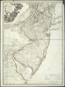
14
Rhode Island
14
more
Place
»
Topic
New Jersey--Maps--Early works to 1800
30
New England--Maps--Early works to 1800
18
Connecticut--Maps--Early works to 1800
15
World maps--Early works to 1800
13
Middle Atlantic States--Maps--Early works to 1800
10
New York (State)--Maps--Early works to 1800
10
Rhode Island--Maps--Early works to 1800
10
America--Maps--Early works to 1800
9
more
Topic
»
Date
Date range begin
–
Date range end
Current results range from
1482
to
1990
View distribution
Creator
Faden, William, 1749-1836
6
Kitchin, Thomas, 1718-1784
5
Ortelius, Abraham, 1527-1598
5
Bancker, Gerard, 1740-1799
4
Lodge, John, -1796
4
Bew, John, -1793
3
Bordon, Benedetto, 1450-1530
3
Gastaldi, Giacomo, approximately 1500-approximately 1565
3
more
Creator
»
Format
Maps/Atlases
127
Books
1
Manuscripts
1
Georeferenced
Yes
15
No
112
Collection
Sidney R. Knafel Map Collection at Phillips Academy
87
American Revolutionary War-Era Maps
59
Norman B. Leventhal Map Center Collection
18
New York Public Library Collection
14
Boston and New England Maps
8
Richard H. Brown Revolutionary War Map Collection at Mount Vernon
7
Library of Congress Collection
1
Maritime Charts and Atlases
1
Available to use
Creative Commons license
22
No known restrictions
18
Search Constraints
Sort by relevance
relevance
title
date (asc)
date (desc)
Number of results to display per page
100 per page
10
per page
20
per page
50
per page
100
per page
View results as:
grid view
map view
Search Results
1.
An accurate map of Rhode Island, part of Connecticut and Massachusets, shewing Admiral Arbuthnot's station in blocking up...
2.
A map of the province of Massachusets Bay and colony of Rhode Island, with part of Connecticut, New Hampshire, and Vermont
3.
A new and accurate map of the colony of Massachusets Bay, in North America, from a late survey
4.
A new and accurate map of the present seat of war in North America : from a late survey
5.
Porti della Nuova York e Perthamboy
6.
An accurate map of Rhode Island, part of Connecticut and Massachusets, shewing Admiral Arbuthnot's station in blocking up...
7.
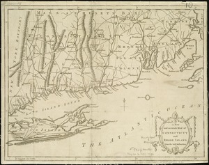
Connecticut
8.
Connecticut and parts adjacent
9.
Connecticut and parts adjacent
10.
A correct map of Connecticut from actual survey
11.
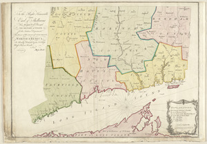
A map of the colonies of Connecticut and Rhode Island, divided into counties & townships, from the best authorities
12.
A map of the colony of Rhode Island : with the adjacent parts of Connecticut, Massachusetts Bay, &c
13.
A map of the province of Massachusets Bay and colony of Rhode Island, with part of Connecticut, New Hampshire, and Vermont
14.
A new and accurate map of Connecticut and Rhode Island, from the best authorities
15.
A new and accurate map of the colony of Massachusets Bay, in North America, from a late survey
16.
To the right honourable, the Earl of Shelbourne, His Majesty's principal Secretary of State for the Southern Department : this...
17.
An accurate map of Staten Island : with that part of New York, Long Island and the Jerseys, which is the rendesvous of the two...
18.
Carte de la Pensylvanie et du Nouveau Jersey
19.
An exact map of New Jersey, Pensylvania [sic], New York, Maryland & Virginia, from the latest surveys
20.
Map no. I
21.
A map of the eastern part of the province of New York with part of New Jersey, & c
22.
A map of the eastern part of the province of New York with part of New Jersey, & c
23.
A map of the provinces of New-York and New Jersey, with a part of Pennsylvania and the Province of Quebec
24.
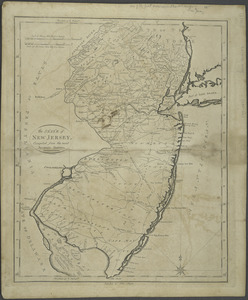
A mapp of New Jersey in America
25.
Mappa geographica Provinciæ Nova Eboraci ab Anglis New-York : dictæ ex ampliori delineatione ad exactas dimensiones concinnata...
26.
A New and accurate map of New Jersey : from the best authorities
27.
A New and accurate map of the present seat of war in North America : comprehending New Jersey, Philadelphia, Pensylvania,...
28.
A New and accurate map of the present seat of war in North America : comprehending New Jersey, Philadelphia, Pensylvania,...
29.
New Engelland, New York, New Yersey und Pensilvania
30.
A new map of Virginia, Mary-land and the improved parts of Penn-sylvania & New Jersey
31.
Paskaerte van de Zuÿdt en Noordt Revier in Nieu Nederlant streckende van Cabo Hinloopen tot Rechkewach
32.
La Pensilvania, la Nuova York, il Jersey Settentrio[na]le : con la parte occidentale del Connecticut, Massachusset-s-bay e...
33.
Pensylvania Nova Jersey et Nova York cum Regionibus ad Fluvium Delaware in America sitis
34.
Position der Koenigl;Grosbrittanischen und derer vereinigten provinzial armée in New York und dem Jerseys in Nord America im...
35.
Position du camp de l'armée combinée a Philipsburg du 6 juillet au 19 aoust
36.
Province de New-Jersey divisée en est et ouest nomée vulgairement les Jerseys
37.
The Province of New Jersey : divided into East and West, commonly called the Jerseys
38.
The Province of New Jersey : divided into East and West, commonly called the Jerseys
39.
The province of New Jersey, divided into east and west, commonly called the Jerseys
40.
The province of New Jersey, divided into east and west, commonly called the Jerseys
41.
The province of New Jersey, divided into east and west, commonly called the Jerseys
42.
The provinces of New York, and New Jersey; with part of Pensilvania, and the governments of Trois Rivières, and Montreal
43.
Seat of war in the environs of Philadeliphia
44.
Seat of war in the environs of Philadeliphia
45.
The State of New Jersey : compiled from the most accurate surveys
46.
An accurate map of the English colonies in North America, bordering on the river Ohio
47.
America
48.
America sive India Nova : ad magnae Gerardi Mercatoris aui universalis imitationem in compendium redacta
49.
America sive novvs orbis respectv Evropaeorvm inferior globi terrestris pars
50.
Americae pars Borealis, Florida, Baccalaos, Canada, Corterealis
51.
Americae siue noui orbis, noua descriptio
52.
Americae siue noui orbis, noua descriptio
53.
The American Atlas or, A Geographical Description of the whole continent of America : wherein are delineated at large, its...
54.
The American pilot : containing the navigation of the sea coat of North America . . .
55.
Atlantic Ocean
56.
L'Atlas de mer ou monde aquatique, remontrant toutes les côtes de la mer, a scavoir de la partie connuë de I'Univers, avec une...
57.
Barnstable County, Dukes County and Nantucket Island, Massachusetts
58.
Baye et port d'Yorc, capitale de la Nouvelle Yorc
59.
Bowles's new pocket map of the most inhabited part of New England : comprehending the provinces of Massachusets Bay and New...
60.
Carta marina nova tabula
61.
Carte de la Nouvelle Angleterre, New York, Pensilvanie et Nouveau Jersay suivant les cartes angloises
62.
Carte de la Nouvelle Angleterre, Nouvelle York, Nouvelle Jersey et Pensilvanie
63.
Chart and plan of the harbour of New York & the couny. adjacent, from Sandy Hook to Kingsbridge, comprehending the whole of New...
64.
Chart for the journal of Mr. le Mquis. de Chastellux
65.
A chart of the gulf stream
66.
Costes et rivieres de Virginie, de Mariland, et de Nouvelle Angletere
67.
The English pilot. The fourth book. Describing the West-India navigation, from Hudson's-Bay to the River Amazones. Particulary...
68.
Garden of Eden
69.
Generale Ptholemei
70.
Geological map of Massachusetts
71.
The harbor of Holmes' Hole
72.
Herbipolis occidens Wurtzpurg
73.
La heroike enterprinse faict par le Signeur Draeck d'avoir cirquit toute la terre
74.
A map of Massachusetts, from the best authorities
75.
Map of Massachusetts, from the best authorities
76.
A map of New England, New York, New Jersey and Pensilvania
77.
A map of New-England, being the first that ever was here cut, and done by the best pattern that could be had, which being in...
78.
A map of the British and French dominions in North America with the roads, distances, limits, and extent of the settlements,...
79.
Map of the Caribbean Area
80.
Map of the northern, or, New England states of America, comprehending Vermont, New Hampshire, District of Main, Massachusetts,...
81.
Map of the northern part of New England : compiled for Pres't. Dwight's travels
82.
Map of the southern part of New England : compiled for Pres't. Dwights travels
83.
Maris Pacifici (quod vulgo Mar del Zur) cum regionibus circumiacentibus, insulisque in eodem passim sparsis, novissima descriptio
84.
Massachusetts
85.
Massachusetts
86.
Massachusetts
87.
Massachusetts and Rhode Island
88.
New England and New York
89.
New England and New York
90.
New Englands prospect : A true, lively, and experimentall description of that part of America, commonly called New England:...
91.
A new map of the most considerable plantations of the English in America
92.
The north part of America : conteyning Newfoundland, new England, Virginia, Florida, new Spaine, and Noua Francia wth ye rich...
93.
Nouvelle Angleterre et Nouvel York
94.
Nova, et integra universi orbis descriptio
95.
Novae insulae XVII, nova tabula
96.
Oceani occidetalis seu terre nove tabula
97.
Old Colony & Newport railway and its connections
98.
Old Colony Railroad and connections
99.
Orbis terrae compendiosa descriptio : quam ex magna universali Gerardi Mercatoris Domino Richardo Gartho, geographie ac...
100.
Orbis typus uniuersalis iuxta hydrographorum traditionem
‹ Prev
Next ›
1
2


![An exact map of New Jersey, Pensylvania [sic], New York, Maryland & Virginia, from the latest surveys](https://bpldcassets.blob.core.windows.net/derivatives/images/commonwealth:z603vp67m/image_thumbnail_300.jpg)


![La Pensilvania, la Nuova York, il Jersey Settentrio[na]le](https://bpldcassets.blob.core.windows.net/derivatives/images/commonwealth:z603vq53g/image_thumbnail_300.jpg)