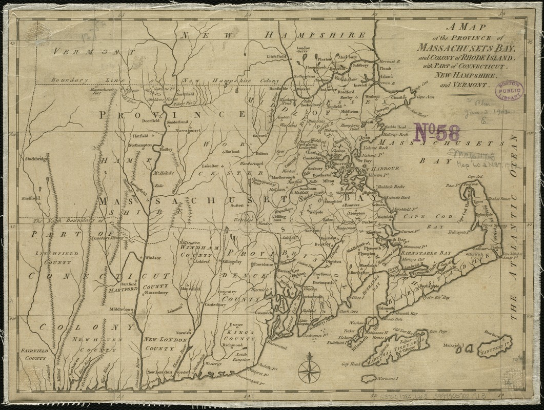
A map of the province of Massachusets Bay and colony of Rhode Island, with part of Connecticut, New Hampshire, and Vermont
This map is also available in American Revolutionary Geographies Online (ARGO), a collections portal especially built for material relating to the American Revolutionary War Era. Visit ARGO to learn more about this item and explore the historical geography of North America in the late eighteenth century.
Item Information
- Title:
- A map of the province of Massachusets Bay and colony of Rhode Island, with part of Connecticut, New Hampshire, and Vermont
- Title (alt.):
-
Map of the province of Massachusetts Bay
- Creator:
- Lodge, John, d. 1796
- Date:
-
[1782]
- Format:
-
Maps/Atlases
- Location:
-
Boston Public Library
Norman B. Leventhal Map & Education Center - Collection (local):
-
Norman B. Leventhal Map & Education Center Collection
- Subjects:
-
Massachusetts--Maps--Early works to 1800
Rhode Island--Maps--Early works to 1800
Connecticut--Maps--Early works to 1800
- Places:
-
Massachusetts
Rhode Island
Connecticut
- Extent:
- 1 map ; 27 x 36 cm.
- Terms of Use:
-
No known copyright restrictions.
No known restrictions on use.
- Publisher:
-
London :
J. Bew
- Scale:
-
Scale [ca. 1:850,000]
- Language:
-
English
- Notes:
-
Prime meridian:Ferro.
Relief shown pictorially.
"Published as the act directs, 15th of April, 1782."
- Notes (date):
-
This date is inferred.
- Identifier:
-
06_01_006266
- Call #:
-
G3720 1782 .L63
- Barcode:
-
39999059021913


