Toggle navigation
LMEC Home
Exhibitions
Georeferencing
Tools for Teachers
Collections
My Favorites
Sign Up / Log In
Search
Search the map portal
Map Collection
Map Collection
Map Sets
Search
Search
Search for
Search In
All Fields
Creator
Title
Subject
Place
Search All Digital Collections
Advanced Search
8171 Results
My Search
Start Over
More Like
commonwealth:6t053p405
Remove constraint More Like: commonwealth:6t053p405
Filter your Search
Place
North and Central America
4,920
United States
3,603
Suffolk (county)
1,026
Boston
999
Europe
963
Canada
427
France
269
Massachusetts
249
more
Place
»
Topic
Boston (Mass.)--Maps
574
United States--Maps
270
Real property--Massachusetts--Boston--Maps
174
Massachusetts--Maps
160
Landowners--Massachusetts--Boston--Maps
132
North America--Maps--Early works to 1800
103
New England--Maps
99
Europe--Maps
78
more
Topic
»
Date
Date range begin
–
Date range end
Current results range from
1482
to
2023
View distribution
Creator
United States. Hydrographic Office
357
O.H. Bailey & Co
148
Des Barres, Joseph F. W. (Joseph Frederick Wallet), 1722-1824
126
United States. Post Office Dept
120
Ptolemy, 2nd cent
100
Walling, Henry Francis, 1825-1888
94
Jefferys, Thomas, -1771
84
Geological Survey (U.S.)
82
more
Creator
»
Format
Maps/Atlases
8,112
Manuscripts
215
Prints
51
Books
36
Objects/Artifacts
10
Drawings/Illustrations
8
Posters
4
Georeferenced
Yes
869
No
7,302
Collection
Norman B. Leventhal Map Center Collection
8,162
Boston and New England Maps
2,184
Urban Maps
1,925
Maritime Charts and Atlases
750
American Revolutionary War-Era Maps
624
Boston Redevelopment Authority Collection
86
Richard H. Brown Revolutionary War Map Collection at Mount Vernon
5
Harvard Map Collection
2
more
Collection
»
Available to use
No known restrictions
8,021
Creative Commons license
55
Search Constraints
Sort by relevance
relevance
title
date (asc)
date (desc)
Number of results to display per page
50 per page
10
per page
20
per page
50
per page
100
per page
View results as:
grid view
map view
Search Results
1.
Virginiae partis australis et Floridae partis orientalis, interjacentium[que] regionum nova descriptio
2.
Virginiae partis australis, et Floridae partis orientalis, interjacentiumq[ue] regionum nova descriptio
3.
Georgia, from the latest authorities
4.
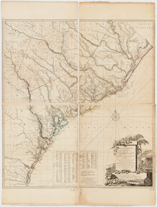
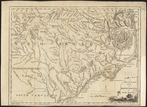
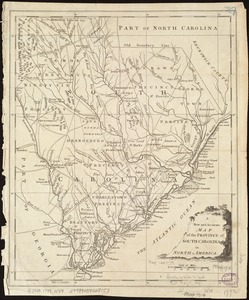
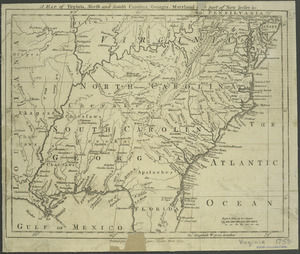
An accurate map of North and South Carolina with their Indian frontiers, shewing in a distinct manner all the mountains,...
5.
Carolina
6.
Chart of the coast of America from Cape Hateras to Cape Roman
7.
Chart of the coast of America from Cape Hateras to Cape Roman
8.
Chart of the coast of America from Cape Hateras to Cape Roman
9.
Chart of the coast of America from Cape Hateras to Cape Roman
10.
A New description of Carolina
11.
A new map of Carolina
12.
A new mapp of Carolina
13.
A chart of South Carolina and Georgia
14.
A chart of South Carolina and Georgia
15.
A chart of South Carolina and Georgia
16.
A chart of South Carolina and Georgia
17.
A map of South Carolina and a part of Georgia : containing the whole sea-coast; all the islands, inlets, rivers, creeks,...
18.
A map of the seat of war in the southern part of Virginia, North Carolina, and the northern part of South Carolina
19.
Caroline méridionale et partie de la Georgie
20.
A map of South Carolina and a part of Georgia : Containing the whole sea-coast; all the islands, inlets, rivers, creeks,...
21.
Carte de la Virginie, du Maryland et de l'etat de Delaware
22.
Les costes aux environs de la Riviere de Misisipi : decouvertes par Mr. de la Salle en 1683 et reconnues par Mr. le Chevallier...
23.
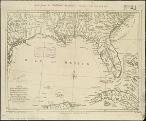
Florida called by ye French Louisiana &c
24.
Florida from the latest authorities
25.
La Floride, suivant les nouvelles observations de Messrs. de l'Academie des Sciences, etc : augmentées de Nouveau
26.
A general map of the southern British colonies in America comprehending North and South Carolina, Georgia, East and West...
27.
A map of East and West Florida, Georgia, and Louisiana, with the islands of Cuba, Bahama, and the countries surrounding the...
28.
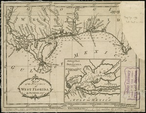
Map of the province of West Florida
29.
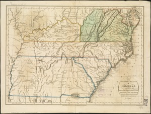
Map of the southern states of America, comprehending Maryland, Virginia, Kentucky, Territory s'th of the Ohio, North Carolina,...
30.
A new and general map of the Southern dominions belonging to the United States of America, viz North Carolina, South Carolina,...
31.
Americæ pars, nunc Virginia dicta, primum ab Anglis inuenta, sumtibus Dn. Walteri Raleigh, equestris ordinis Viri, Anno Dn̄i....
32.
A new and accurate map of North Carolina in North America
33.
Virginia Marylandia et Carolina in America septentrionali Brittannorum industria excultæ
34.
Virginiae item et Floridae Americae provincarum, nova descriptio
35.
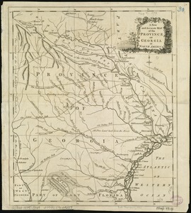
A New and accurate map of the province of Georgia in North America
36.
A New and accurate map of the province of South Carolina in North America
37.
[Map of Florida, Carolina, and the Gulf Coast]
38.
A map of Virginia, North and South Carolina, Georgia, Maryland : with part of New Jersey &c
39.
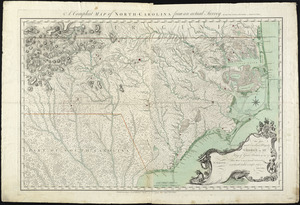
A compleat map of North-Carolina from an actual survey
40.
[Chart of the coast of Georgia]
41.
[Chart of the coast of Georgia]
42.
[The coasts, rivers and inlets of the province of Georgia]
43.
The 100th anniversary map of Abraham Lincoln's visit to Massachusetts, September 11-23, 1848
44.
1630 shoreline
45.
1879. Progress map of the U.S. Geographical Surveys west of the 100th Meridian : prepared under the direction of 1st Lieut....
46.
1903 Map of Salem and surrounding places
47.
19th annual convention of the National Association of Real Estate Boards : at Tulsa, June 7 to June 11 in 1926
48.
2005 significant U.S. hurricane strikes
49.
The 2100 project : an atlas for the Green New Deal
50.
227 Harzgerode
‹ Prev
Next ›
1
2
3
4
5
…
163
164
![Virginiae partis australis et Floridae partis orientalis, interjacentium[que] regionum nova descriptio](https://bpldcassets.blob.core.windows.net/derivatives/images/commonwealth:6t053p120/image_thumbnail_300.jpg)
![Virginiae partis australis, et Floridae partis orientalis, interjacentiumq[ue] regionum nova descriptio](https://bpldcassets.blob.core.windows.net/derivatives/images/commonwealth:st74cw930/image_thumbnail_300.jpg)


![[Map of Florida, Carolina, and the Gulf Coast]](https://bpldcassets.blob.core.windows.net/derivatives/images/commonwealth:z603vr379/image_thumbnail_300.jpg)
![[Chart of the coast of Georgia]](https://bpldcassets.blob.core.windows.net/derivatives/images/commonwealth:z603vv33t/image_thumbnail_300.jpg)
![[Chart of the coast of Georgia]](https://bpldcassets.blob.core.windows.net/derivatives/images/commonwealth:z603vv35c/image_thumbnail_300.jpg)
![[The coasts, rivers and inlets of the province of Georgia]](https://bpldcassets.blob.core.windows.net/derivatives/images/commonwealth:z603vv37x/image_thumbnail_300.jpg)


