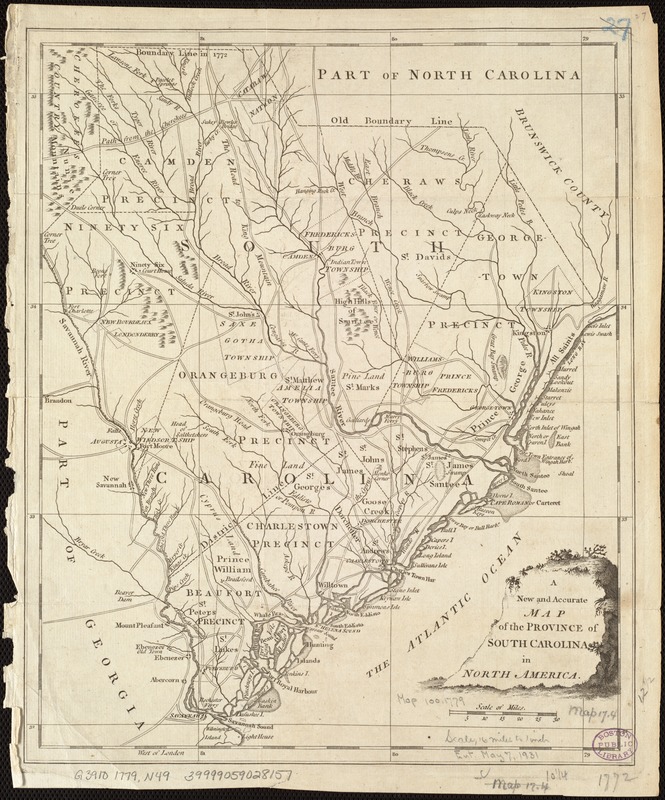
A New and accurate map of the province of South Carolina in North America
This map is also available in American Revolutionary Geographies Online (ARGO), a collections portal especially built for material relating to the American Revolutionary War Era. Visit ARGO to learn more about this item and explore the historical geography of North America in the late eighteenth century.
Item Information
- Title:
- A New and accurate map of the province of South Carolina in North America
- Date:
-
[1779]
- Format:
-
Maps/Atlases
- Location:
-
Boston Public Library
Norman B. Leventhal Map & Education Center - Collection (local):
-
Norman B. Leventhal Map & Education Center Collection
- Subjects:
-
South Carolina--Maps--Early works to 1800
- Places:
-
South Carolina
- Extent:
- 1 map ; 32 x 26 cm.
- Terms of Use:
-
No known copyright restrictions.
No known restrictions on use.
- Publisher:
-
London :
J. Hinton
- Scale:
-
Scale [ca. 1:1,170,000]
- Language:
-
English
- Notes:
-
Relief shown pictorially.
Prime meridian: London
Shows precincts, townships, towns, forts, roads and trails, ferries, courthouses, landmarks, rivers and creeks, harbors, islands and shoals along the coast.
Shows "Old Boundary Line" and "Boundary Line in 1772" with North Carolina.
Appears in Universal Magazine. London : J. Hinton, 1779. Vol. 114.
- Notes (date):
-
This date is inferred.
- Identifier:
-
06_01_006788
- Call #:
-
G3910 1779 .N49
- Barcode:
-
39999059028157


