Toggle navigation
LMEC Home
Exhibitions
Georeferencing
Tools for Teachers
Collections
My Favorites
Sign Up / Log In
Search
Search the map portal
Map Collection
Map Collection
Map Sets
Search
Search
Search for
Search In
All Fields
Creator
Title
Subject
Place
Search All Digital Collections
Advanced Search
13385 Results
Filter your Search
Place
North and Central America
10,111
United States
8,249
Massachusetts
2,691
Suffolk (county)
1,664
Boston
1,621
Europe
1,386
Canada
949
New York
640
more
Place
»
Topic
Boston (Mass.)--Maps
741
City planning--Massachusetts--Boston--Maps
418
United States--History--Revolution, 1775-1783--Maps
329
United States--Maps
315
Urban renewal--Massachusetts--Boston--Maps
254
Real property--Massachusetts--Boston--Maps
252
Massachusetts--Maps
219
Insurance surveys
197
more
Topic
»
Date
Date range begin
–
Date range end
Current results range from
1482
to
2023
View distribution
Creator
United States. Hydrographic Office
595
Boston Redevelopment Authority
403
Des Barres, Joseph F. W. (Joseph Frederick Wallet), 1722-1824
247
Royal United Services Institute for Defence and Security Studies
160
Jefferys, Thomas, -1771
154
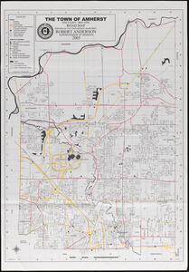
George, III, King of Great Britain, 1738-1820
152
George, IV, King of Great Britain, 1762-1830
151
O.H. Bailey & Co
148
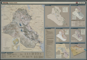
more
Creator
»
Format
Maps/Atlases
13,205
Manuscripts
985
Prints
102
Books
49
Drawings/Illustrations
44
Photographs
15
Objects/Artifacts
13
Documents
7
more
Format
»
Georeferenced
Yes
979
No
12,406
Collection
Norman B. Leventhal Map & Education Center Collection
8,891
American Revolutionary War-Era Maps
3,305
Boston and New England Maps
2,804
Urban Maps
2,397
Maritime Charts and Atlases
1,150
William L. Clements Library Collection
910
Library of Congress Collection
618
Boston Redevelopment Authority Collection
475
more
Collection
»
Available to use
No known restrictions
9,952
Creative Commons license
1,677
Search Constraints
Sort by date (desc)
relevance
title
date (asc)
date (desc)
Number of results to display per page
50 per page
10
per page
20
per page
50
per page
100
per page
View results as:
grid view
map view
Search Results
51.
Flood progression map : 9" SLR
52.
Flood progression map : 21" SLR
53.
Flood progression map : 36" SLR
54.
MBTA flood exposure : 36" SLR 2070s or later
55.
View of SoWa food trucks
56.
Boston over Time
57.
Boston public services
58.
New England regional transportation map = Mapa do transporte regional da Nova Inglaterra = Nueva Inglaterra, mapa regional de...
59.
Boston streets & neighborhoods
60.
Boston's diversity index, 2010 : measures of diversity : age
61.
Boston's diversity index, 2010 : measures of diversity : region of birth
62.
Boston's diversity index, 2010 : measures of diversity : education
63.
Boston's diversity index, 2010 : measures of diversity : language other than English spoken at home
64.
Boston's diversity index, 2010 : measures of diversity : household income
65.
Boston's diversity index, 2010 : measures of diversity : race
66.
Boston's top 6 foreign languages spoken at home, 2010
67.
Boston's top foreign-born populations : Cape Verdeans
68.
Boston's top foreign-born populations : Dominicans
69.
Boston's top foreign-born populations : Chinese
70.
Boston's top foreign-born populations : Haitians
71.
Boston's top foreign-born populations : Salvadorans
72.
Boston's top foreign-born populations : Vietnamese
73.
Map of the countries near to the land of Oz
74.
A South Ender's view of the world
75.
Massachusetts official transportation map
76.
Neighborhoods of Boston
77.
1630 shoreline
78.
Nantucket
79.
Boston Over Time : filling in the land 1630 - present
80.
The people's republic of Cambridge
81.
State of Louisiana, highlighting low-lying areas derived from USGS digital elevation data
82.
Human uses in the coastal zone : comprehensive database assembly July 2006
83.
Peters World map
84.
2005 significant U.S. hurricane strikes
85.
Africa
86.
Amherst map & guide
87.
Massachusetts Turnpike map : the main street of Massachusetts
88.
The population map
89.
South America
90.
The world turned upside down
91.
Asia
92.
Iraq
93.
Commonwealth of Massachusetts U.S. congressional districts
94.
Iraq country profile
95.
Massachusetts official transportation map
96.
The world's most populous countries
97.
Metacomet-Monadnock Trail : an analysis of landuse
98.
What's up? South! : world map
99.
China
100.
China
‹ Prev
Next ›
1
2
3
4
5
6
…
267
268