Metacomet-Monadnock Trail : an analysis of landuse
Item Information
- Title:
- Metacomet-Monadnock Trail : an analysis of landuse
- Cartographer:
- MassGIS (Office : Mass.)
- Cartographer:
- Massachusetts. Executive Office of Environmental Affairs
- Name on Item:
-
map created 8/15/2002 - D. Marrier ; MassGIS; Executive Office of Environmental Affairs
- Date:
-
2002
- Format:
-
Maps/Atlases
- Location:
-
Boston Public Library
Norman B. Leventhal Map & Education Center - Collection (local):
-
David Judkins Weaver Papers
- Subjects:
-
Metacomet-Monadnock Trail--Maps
Massachusetts--Maps
Land use--Metacomet-Monadnock Trail--Maps
Land use--Massachusetts--Maps
- Places:
-
MassachusettsHampden (county)
MassachusettsHampshire (county)
MassachusettsFranklin (county)
- Extent:
- 4 maps on 1 sheet : color ; 41 x 41 cm, on sheet 92 x 114 cm
- Terms of Use:
-
No known copyright restrictions.
No known restrictions on use.
- Publisher:
-
[Boston] :
Executive Office of Environmental Affairs
- Scale:
-
Scale approximately 1:212,500
- Language:
-
English
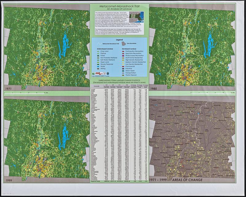
- Table of Contents:
-
1971
1985
1999
1971-1999 areas of change
- Notes:
-
Includes text and surrounding town landuse change statistics.
- Identifier:
-
06_01_018822
- Call #:
-
Weaver folder 9 no. 23


