Massachusetts land use - 1985
Item Information
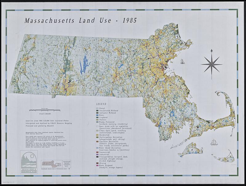
- Title:
- Massachusetts land use - 1985
- Cartographer:
- MassGIS (Office : Mass.)
- Cartographer:
- Massachusetts. Executive Office of Environmental Affairs
- Name on Item:
-
processed and plotted by MassGIS
- Date:
-
1991
- Format:
-
Maps/Atlases
- Location:
-
Boston Public Library
Norman B. Leventhal Map & Education Center - Collection (local):
-
David Judkins Weaver Papers
- Subjects:
-
Massachusetts--Maps
Land use--Massachusetts--Maps
Vegetation mapping--Massachusetts--Maps
Phytogeography--Massachusetts--Maps
- Places:
-
Massachusetts
- Extent:
- 1 map : color ; 83 x 116 cm
- Terms of Use:
-
No known copyright restrictions.
No known restrictions on use.
- Publisher:
-
[Boston, MA] :
Massachusetts Executive Office of Environmental Affairs
- Scale:
-
Scale 1:260,000
- Language:
-
English
- Notes:
-
Version without table of land use statistics or coordinates in border
- Identifier:
-
06_01_018816B
- Call #:
-
Weaver folder 9 no. 13


