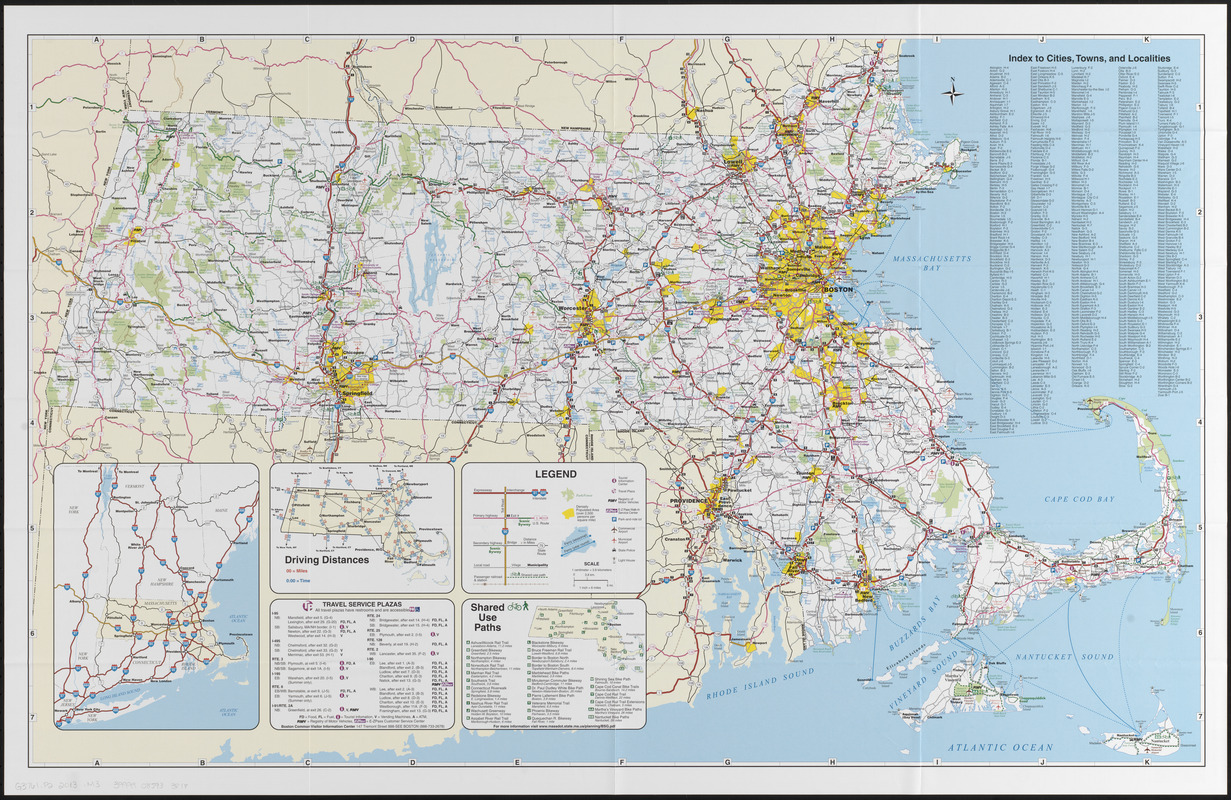
Massachusetts official transportation map

Item Information
- Title:
- Massachusetts official transportation map
- Publisher:
- Massachusetts. Department of Transportation
- Cartographer:
- Metropolitan Planning Organization (Mass.). Central Transportation Planning Staff
- Name on Item:
-
published by the Massachusetts Department of Transportation (MassDOT) ; design and cartography by the Central Transportation Planning Staff
- Date:
-
2013
- Format:
-
Maps/Atlases
- Location:
-
Boston Public Library
Norman B. Leventhal Map & Education Center - Collection (local):
-
Norman B. Leventhal Map & Education Center Collection
- Subjects:
-
Roads--Massachusetts--Maps
Roads--Massachusetts--Boston--Maps
Massachusetts--Maps
Boston (Mass.)--Maps
- Places:
-
Massachusetts
- Extent:
- 1 map : color ; 51 x 83 cm, folded to 22 x 10 cm
- Terms of Use:
-
No known copyright restrictions.
No known restrictions on use.
- Publisher:
-
[Boston, Mass.] :
Massachusetts Department of Transportation (MassDOT)
- Scale:
-
Scale 1:380,160. 1 inch = 6 miles
- Language:
-
English
- Notes:
-
Panel title.
Includes index, inset location map, driving distances, legend, coded list of travel service plazas, and shared use paths.
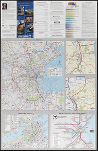
Text and five maps on verso.
Maps on verso: Metropolitan Boston -- Worcester -- Springfield -- Downtown Boston -- MBTA commuter rail/rapid transit.
- Identifier:
-
06_01_015267
06_01_015268
- Call #:
-
G3761.P2 2013 .M3
- Barcode:
-
39999085933818


