State of Louisiana, highlighting low-lying areas derived from USGS digital elevation data
Item Information
- Title:
- State of Louisiana, highlighting low-lying areas derived from USGS digital elevation data
- Description:
-
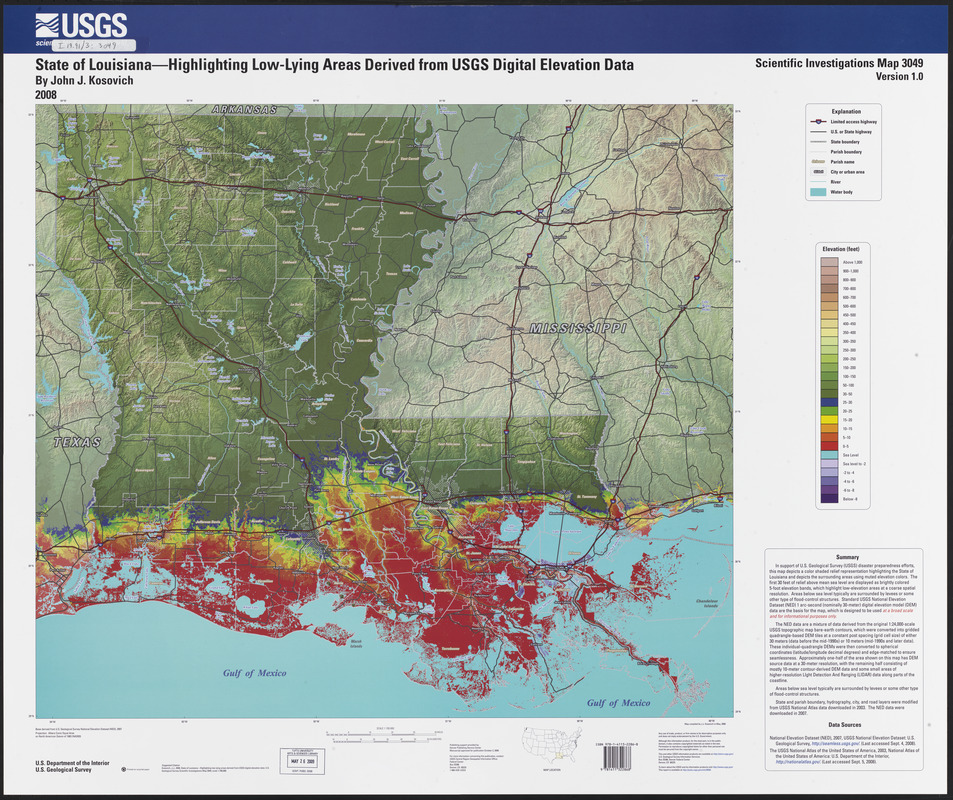
Regions and Seasons: Hurricanes Katrina and Rita not only devastated the natural environment in Louisiana, they had a tremendous impact on the people of the region. 200,000 homes were destroyed and over 1,800 lives were lost in Hurricane Katrina alone. Low-lying coastal areas, such as those depicted in this 2008 map, must employ resiliency efforts to keep humans, structures and ecosystems safe. Resiliency strategies for New Orleans include restoring coastal wetlands, implementing flood risk reduction plans and storm water management systems, and providing monetary incentives to residents and business owners to retrofit their properties to be more resistant to storms.
- Creator:
- Kosovich, John J.
- Publisher:
- Geological Survey (U.S.)
- Name on Item:
-
by John J. Kosovich ; U.S. Department of the Interior, U.S. Geological Survey
- Date:
-
2008
- Format:
-
Maps/Atlases
- Location:
-
Boston Public Library
Norman B. Leventhal Map & Education Center - Collection (local):
-
Norman B. Leventhal Map & Education Center Collection
- Subjects:
-
Louisiana--Relief models--Maps
- Places:
-
Louisiana
- Extent:
- 1 map : color ; 66 x 74 cm, on sheet 82 x 100 cm
- Terms of Use:
-
No known copyright restrictions.
No known restrictions on use.
- Publisher:
-
Denver, Colo. :
U.S. Dept. of the Interior, U.S. Geological Survey
- Scale:
-
Scale 1:700,000
- Projection:
- Albers equal area proj.
- Language:
-
English
- Notes:
-
Relief shown by shading and gradient tints.
Title from HTML index page (viewed on Dec. 9, 2008).
Includes text.
System requirements: Windows XP (version 5.1 or later) or Macintosh Power PC G3, 4, or 5, with Internet hookup and ArcGIS version 9.1 compatibility, and Adobe Acrobat for viewing .pdf files (see also Readme file).
Mode of access: Internet from the USGS web site. Address as of 4/28/09: http://pubs.usgs.gov/sim/3049/ ; current access is available via PURL.
- Notes (exhibitions):
-
Exhibited: "Regions and Seasons: Mapping Climate through History" organized by the Norman B. Leventhal Map Center at the Boston Public Library, 2017.
- Identifier:
-
06_01_015940
- Call #:
-
39999085942017
- Barcode:
-
39999085942017


