Human uses in the coastal zone : comprehensive database assembly July 2006
Item Information
- Title:
- Human uses in the coastal zone : comprehensive database assembly July 2006
- Cartographer:
- Applied Geographics, Inc.
- Publisher:
- Massachusetts Coastal Zone Management Office
- Name on Item:
-
Commonwealth of Massachusetts Office of Coastal Zone Management ; Applied Geographicc [that is, Geographics], Inc.
- Date:
-
2006
- Format:
-
Maps/Atlases
- Location:
-
Boston Public Library
Norman B. Leventhal Map & Education Center - Collection (local):
-
Applied Geographics, Inc. Records
- Subjects:
-
Massachusetts--Maps
Coasts--Massachusetts--Maps
Dredging spoil--Massachusetts--Maps
Whales--Massachusetts--Maps
Boats and boating--Massachusetts--Maps
Coastwise navigation--Massachusetts--Maps
- Places:
-
Massachusetts
- Extent:
- 1 map : color ; 73 x 55 cm, on sheet 79 x 78 cm
- Terms of Use:
-
No known copyright restrictions.
No known restrictions on use.
- Publisher:
-
Boston :
Applied Geographics, Inc.
- Scale:
-
Scale approximately 1:250,000
- Language:
-
English
- Notes:
-
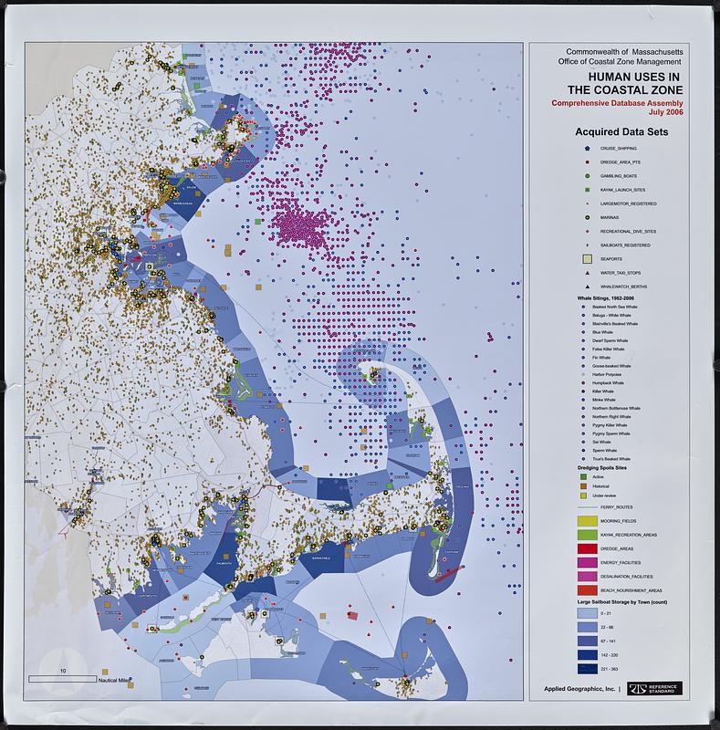
Shows acquired data sets, whale sitings 1962-2006. dredging spoils sites, ferry routes, activity areas and facilities, and large sailboat storage by town.
- Identifier:
-
06_01_018912
- Call #:
-
AppGeo Folder 3 no. 30
- Barcode:
-
30000008056491


