Toggle navigation
LMEC Home
Exhibitions
Georeferencing
Tools for Teachers
Collections
My Favorites
Sign Up / Log In
Search
Search the map portal
Map Collection
Map Collection
Map Sets
Search
Search
Search for
Search In
All Fields
Creator
Title
Subject
Place
Search All Digital Collections
Advanced Search
8167 Results
My Search
Start Over
More Like
commonwealth:wd376654k
Remove constraint More Like: commonwealth:wd376654k
Filter your Search
Place
North and Central America
4,916
United States
3,606
Suffolk (county)
1,026
Boston
999
Europe
963
Canada
427
France
269
Massachusetts
253
more
Place
»
Topic
Boston (Mass.)--Maps
574
United States--Maps
270
Real property--Massachusetts--Boston--Maps
174
Massachusetts--Maps
160
Landowners--Massachusetts--Boston--Maps
132
North America--Maps--Early works to 1800
103
New England--Maps
99
Europe--Maps
78
more
Topic
»
Date
Date range begin
–
Date range end
Current results range from
1482
to
2023
View distribution
Creator
United States. Hydrographic Office
357
O.H. Bailey & Co
148
Des Barres, Joseph F. W. (Joseph Frederick Wallet), 1722-1824
123
United States. Post Office Dept
120
Ptolemy, 2nd cent
100
Walling, Henry Francis, 1825-1888
94
Jefferys, Thomas, -1771
84
Geological Survey (U.S.)
82
more
Creator
»
Format
Maps/Atlases
8,108
Manuscripts
215
Prints
51
Books
36
Objects/Artifacts
10
Drawings/Illustrations
8
Posters
4
Georeferenced
Yes
869
No
7,298
Collection
Norman B. Leventhal Map Center Collection
8,166
Boston and New England Maps
2,187
Urban Maps
1,925
Maritime Charts and Atlases
750
American Revolutionary War-Era Maps
616
Boston Redevelopment Authority Collection
86
David Judkins Weaver Papers
2
Applied Geographics, Inc. Records
1
more
Collection
»
Available to use
No known restrictions
8,025
Creative Commons license
46
Search Constraints
Sort by relevance
relevance
title
date (asc)
date (desc)
Number of results to display per page
50 per page
10
per page
20
per page
50
per page
100
per page
View results as:
grid view
map view
Search Results
1.
Atlas of Barnstable County, Massachusetts : towns of Bourne, Mashpee, Falmouth, Sandwich, Barnstable, Yarmouth, Dennis,...
2.
Chart of Cape Cod Harbor and the adjacent coast of Provincetown and Truro
3.
Comparative map of Cape Cod Harbor showing physical changes between the survey of Maj. J.D. Graham in 1835, and the U.S. Coast...
4.
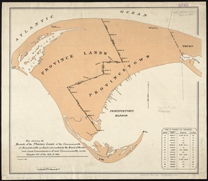
Map showing the bounds of the Province lands of the Commonwealth of Massachusetts, as fixed and marked by the Board of Harbor...
5.
Provincetown Harbor
6.
Historic Massachusetts : a travel map to help you feel at home in the Bay State
7.
A map of Cape Cod
8.
A map of Cape Cod
9.
A map of Cape Cod
10.
Map of Cape Cod and vicinity
11.
Map of Cape Cod and vicinity
12.
Map of Cape Cod and vicinity
13.
A map of Cape Cod wherin is shown ye discovery and settlement of the same; with the tracks of ye pilgrims carefully prepared...
14.
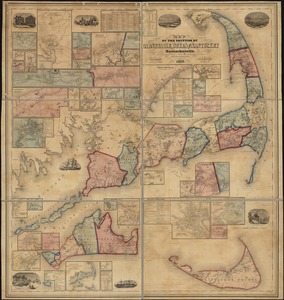
Map of the counties of Barnstable, Dukes and Nantucket, Massachusetts : based upon the trigonometrical survey of the state
15.
The Scrimshaw historical map of Cape Cod
16.
Atlas of Barnstable County, Massachusetts : towns of Bourne, Mashpee, Falmouth, Sandwich, Barnstable, Yarmouth, Dennis,...
17.
Cape Cod
18.
Cape Cod, Barnstable County, Mass.
19.
Cape Cod open space : SCORP-GIS integration project
20.
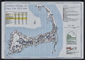
Landuse change on Cape Cod 1971-1984
21.
The 100th anniversary map of Abraham Lincoln's visit to Massachusetts, September 11-23, 1848
22.
1630 shoreline
23.
1879. Progress map of the U.S. Geographical Surveys west of the 100th Meridian : prepared under the direction of 1st Lieut....
24.
1903 Map of Salem and surrounding places
25.
19th annual convention of the National Association of Real Estate Boards : at Tulsa, June 7 to June 11 in 1926
26.
2005 significant U.S. hurricane strikes
27.
The 2100 project : an atlas for the Green New Deal
28.
227 Harzgerode
29.
305 Glatz
30.
38,000,000 escaped -- 10,000,000 died
31.
4 Kinten
32.
660 Wakulah St., Roxbury
33.
[A chart of Boston Bay and vicinity]
34.
[A chart of New York Island & North River : East River, passage through Hell Gate, Flushing Bay, Hampstead Bay, Oyster,...
35.
The A.A.A. key road map of continental Europe
36.
Aaron Bohrod's America, its history
37.
ABC pathfinder railway guide map : eastern division
38.
Abolition of Slavery, 1863
39.
Aboriginal map of North America, denoting the boundaries and the locations of various Indian tribes
40.
Acapulco, México
41.
Accurata delineatio Castrorum Suecicorum, ut et Haffniae, Regni Daniae Metropolis
42.
Accurata delineatio oppugnatae a faederatis, Caesareis, Polonicis, Danicis, et Brandeburgicis copijs sub-ductu Seren: Electoris...
43.
Accurata delineatio regionis circa Nieburgum Fioniæ cum prælio ibi commisso inter Danorum et fæderatorum exercitum ab una et...
44.
Accurata Scaniae, Blekingiae et Hallandiae descriptio
45.
An accurate map of Cuba, and the adjacent islands
46.
An accurate map of Dorset Shire divided into hundreds
47.
An accurate map of Dorset Shire, divided into its hundreds
48.
An accurate map of England and Wales with the principal roads from the best authorities
49.
An accurate map of England and Wales with the principal roads from the best authorities
50.
An accurate map of Europe from the best authorities
‹ Prev
Next ›
1
2
3
4
5
…
163
164


![[A chart of Boston Bay and vicinity]](https://bpldcassets.blob.core.windows.net/derivatives/images/commonwealth:cj82m2976/image_thumbnail_300.jpg)


