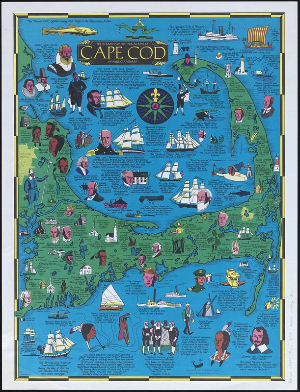
The Scrimshaw historical map of Cape Cod
Item Information
- Title:
- The Scrimshaw historical map of Cape Cod
- Cartographer:
- Giambarba, Paul
- Publisher:
- Scrimshaw Publishing
- Name on Item:
-
drawn by Paul Giambarba
- Date:
-
1966
- Format:
-
Maps/Atlases
- Genre:
-
Pictorial maps
- Location:
-
Boston Public Library
Norman B. Leventhal Map & Education Center - Collection (local):
-
Norman B. Leventhal Map & Education Center Collection
- Subjects:
-
Cape Cod (Mass.)--Maps
Cape Cod (Mass.)--History
- Places:
-
MassachusettsBarnstable (county)Cape Cod (area)
- Extent:
- 1 map : color ; 59 x 43 cm
- Terms of Use:
-
No known copyright restrictions.
No known restrictions on use.
- Publisher:
-
Centerville, Cape Cod, Mass. :
Scrimshaw Publishing
- Scale:
-
Scale approximately 1:150,000
- Language:
-
English
- Notes:
-
Pictorial map.
Includes illustrations and notes.
- Identifier:
-
06_01_017892_A
- Call #:
-
G3762.C35A5 1966 .G53
- Barcode:
-
39999085963161


