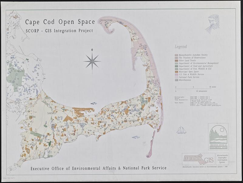
Cape Cod open space : SCORP-GIS integration project
Item Information
- Title:
- Cape Cod open space : SCORP-GIS integration project
- Cartographer:
- Massachusetts. Executive Office of Environmental Affairs
- Contributor:
- MassGIS (Office : Mass.)
- Contributor:
- United States. National Park Service
- Name on Item:
-
Executive Office of Environmental Affairs & National Park Service
- Date:
-
1991
- Format:
-
Maps/Atlases
- Location:
-
Boston Public Library
Norman B. Leventhal Map & Education Center - Collection (local):
-
David Judkins Weaver Papers
- Subjects:
-
Cape Cod (Mass.)--Maps
Open spaces--Massachusetts--Cape Cod--Maps
Protected areas--Massachusetts--Cape Cod--Maps
- Places:
-
MassachusettsBarnstable (county)Cape Cod (area)
- Extent:
- 1 map : color ; 84 x 117 cm
- Terms of Use:
-
No known copyright restrictions.
No known restrictions on use.
- Publisher:
-
[Boston] :
Massachusetts Executive Office of Environmental Affairs
- Scale:
-
Scale 1:90,000
- Language:
-
English
- Notes:
-
Indicates organizations responsible for open spaces.
Includes illustrations of fish and ships.
- Identifier:
-
06_01_018815
- Call #:
-
Weaver folder 9 no. 12