Toggle navigation
LMEC Home
Exhibitions
Georeferencing
Tools for Teachers
Collections
My Favorites
Sign Up / Log In
Search
Search the map portal
Map Collection
Map Collection
Map Sets
Search
Search
Search for
Search In
All Fields
Creator
Title
Subject
Place
Search All Digital Collections
Advanced Search
381 Results
My Search
Start Over
More Like
commonwealth:hx11z345d
Remove constraint More Like: commonwealth:hx11z345d
Filter your Search
Place
North and Central America
339
United States
219
Canada
104
Essex (county)
25
Louisbourg
21
Saint Lawrence River
19
Suffolk (county)
16
Warren (county)
16
more
Place
»
Topic
United States--History--French and Indian War, 1754-1763--Maps, Manuscript--Early works to 1800
58
Louisbourg (N.S.)--Maps, Manuscript--Early works to 1800
18
Fort Edward (N.Y.)--Maps, Manuscript--Early works to 1800
15
Saint Lawrence River--Maps, Manuscript--Early works to 1800
15
Fort Ticonderoga (N.Y.)--Maps, Manuscript--Early works to 1800
14
Louisbourg (N.S.)--History--Siege, 1745--Maps, Manuscript--Early works to 1800
14
Fortification--New York (State)--Fort Edward--Maps, Manuscript--Early works to 1800
13
Fortification--New York (State)--Maps, Manuscript--Early works to 1800
12
more
Topic
»
Date
Date range begin
–
Date range end
Current results range from
1664
to
1816
View distribution
Creator
Royal United Services Institute for Defence and Security Studies
160
George, III, King of Great Britain, 1738-1820
151
George, IV, King of Great Britain, 1762-1830
150
Amherst, Jeffery Amherst, Baron, 1717-1797
128
Skinner, Monier
28
Skinner, William, 1700-1780
28
Brasier, William
17
Bastide, John Henry, approximately 1700-1770
15
more
Creator
»
Format
Maps/Atlases
364
Manuscripts
154
Drawings/Illustrations
15
Georeferenced
Yes
7
No
374
Collection
British Library Collection
376
American Revolutionary War-Era Maps
357
Boston and New England Maps
21
Library of Congress Collection
5
Urban Maps
5
Maritime Charts and Atlases
2
Available to use
Creative Commons license
381
Search Constraints
Sort by relevance
relevance
title
date (asc)
date (desc)
Number of results to display per page
50 per page
10
per page
20
per page
50
per page
100
per page
View results as:
grid view
map view
Search Results
1.
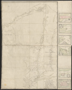
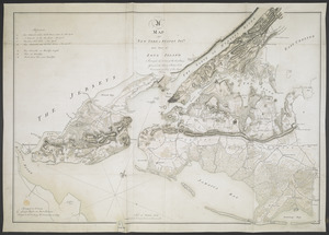
A MAP OF THE PROVINCE OF NEW-YORK, PART OF NEW JERSEY with a Part of NEW FRANCE Composed from Actual Surveys
2.
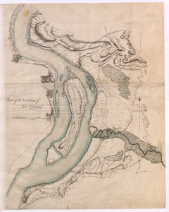
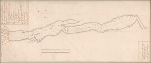
[A map of the southern part of the Lake Champlain, from "Tienderoga fort" to Crown Point]
3.
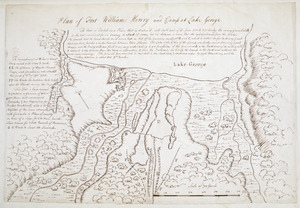
[A map of Lake George from Fort William Henry to Ticonderoga]
4.
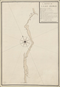
A SKETCH OF LAKE GEORGE
5.
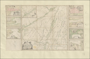
TO HIS EXCELLENCY MAJOR GENERAL ABERCROMBIE COLONEL OF THE 44TH REG:T OF FOOT CO: IN CHIEF OF THE ROYAL AMERICAN REG: &...
6.
Carte Du Lac ontario nouvellement Rellevé avec ces port a grand pois a bitté Lescadre Engloisse & francoisse Leur gremant...
7.
The Course of the Wood Creek from the Mowhock River at the Onoida or Great Carrying Place to The Onoida Lake. Representing the...
8.
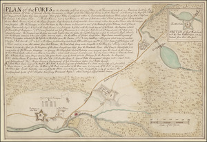
PLAN of the FORTS at the Onoida or Great Carrying Place in the Province of New York in America built by Major Charles Craven by...
9.
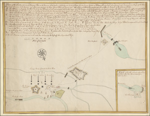
Plan of the Forts at the Onoida or Great Carrying Place in the Province of New York in North America built by Major Charles...
10.
A PLAN of the FORTS MONTGOMERY & CLINTON as taken by his Majesty's Forces under the Command of Gen:l Sir Henry clinton the 6.th...
11.
PLAN of the Great Falls on Hudsons River
12.
SKETCH of FORTS CLINTON & MONTGOMERY Stormed 6.th October 1777 by the Troops under the Command of Sir Henry Clinton K.B. L.t...
13.
A Draught of Lake George with all the Islands & Soundings
14.
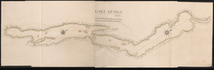
LAKE GEORGE
15.
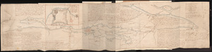
[A map of Lake Champlain and Lake George, showing the route from Fort Edward to Montreal]
16.
French Draught of Lake Champlain & Lake George
17.
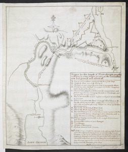
Project for the Attack of Ticonderoga, proposed to be put in executino as near as the circumstances and ground will admit of
18.
[A map of Fort Carillon and environs]
19.
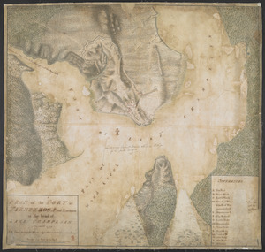
[A map of Fort Carillon and environs]
20.
[A map showing the northern part of Lake George and Fort Ticonderoga]
21.
[Plan Du fort Georges appelé par les Anglois William-Henri prie par les francois en 1757 le 9 Aout]
22.
Plan of Fort William Henry and Camp at Lake George
23.
A Draught of the Fortress building at Crown Point 22.d Oct.t 1759
24.
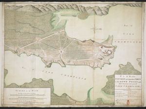
PLAN of the FORTRESS and dependant FORTS at CROWN POINT with their Environs and part of LAKE CHAMPLAIN. 1759
25.
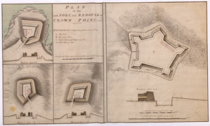
PLAN of the new FORT, and REDOUTS at CROWN POINT, called as below
26.
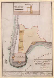
PROJECT for taking POST at CROWN POINT
27.
Carte du Lac Champlain depuis le Fort de Chambly Jusques au desus du Fort S.t Frederic, dans la Nouvelle France
28.
A Correct Plan of the Province of New Hampshire together with part of Hudsons River from Albany to Lake George and from thence...
29.
Sketch of the Isthmus to the NE of Crown Point
30.
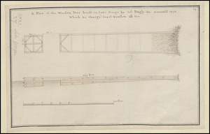
A Plan of the Wooden Peer built in Lake George by Col. Bagly in novemb:r 1756 Which he charged Genr:l Winslow 60:L for
31.
[A colored map of the route between Albany and Oswego; drawn about 1756, on a scale of 2 miles to an inch]
32.
[A map of Lake Erie with the route southward from Fort Presqu'Isle to Fort Cumberland, with inset plans of Fort Pitt, Fort...
33.
A MAP of NEW YORK, & STATEN ISLDS; And part of LONG ISLAND : Surveyed by Order of His Excellency General Sir Henry Clinton K.B....
34.
[Map showing Fort William Henry, Fort Carillon, Fort St Frederic, and the upper reaches of the Connecticut River]
35.
[Map of Fort Carillon]
36.
[PLAN de Carillon]
37.
PLAN of the FORT in TIENDEROGA and Environs at the head of LAKE CHAMPLAIN November 1759
38.
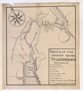
SKETCH OF THE COUNTRY ROUND TYCONDEROGA
39.
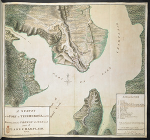
A SURVEY of the FORT at TIENDEROGA and its Environs, with the FRENCH LINES and part of LAKE CHAMPLAIN 1759
40.
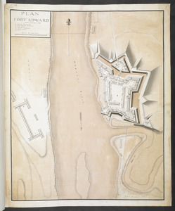
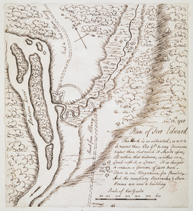
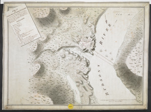
Fort Edward
41.
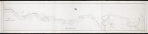
PART OF HUDSON'S RIVER
42.
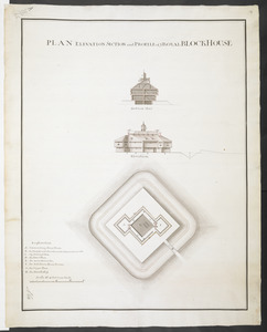
PLAN ELEVATION SECTION and PROFILE of ye ROYAL BLOCKHOUSE
43.
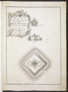
PLAN ELEVATION SECTION and PROFILE of ye ROYAL BLOCKHOUSE OPPOSITE FORT EDWARD
44.
PLAN FORT EDWARD
45.
PLAN of FORT EDWARD
46.
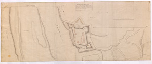
PLAN of Fort Edward
47.
PLAN of Fort EDWARD
48.
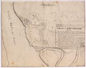
A PLAN of FORT EDWARD
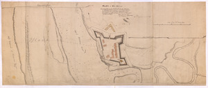
49.
Plan of Fort Edward
50.
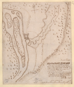
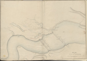
Plan of the Environs of Fort Edward
‹ Prev
Next ›
1
2
3
4
5
…
7
8
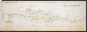
![[A map of the southern part of the Lake Champlain, from "Tienderoga fort" to Crown Point]](https://bpldcassets.blob.core.windows.net/derivatives/images/commonwealth:6108vv78r/image_thumbnail_300.jpg)
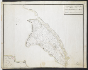
![[A map of Lake George from Fort William Henry to Ticonderoga]](https://bpldcassets.blob.core.windows.net/derivatives/images/commonwealth:hx11z3380/image_thumbnail_300.jpg)


![[A map of Lake Champlain and Lake George, showing the route from Fort Edward to Montreal]](https://bpldcassets.blob.core.windows.net/derivatives/images/commonwealth:hx11z3312/image_thumbnail_300.jpg)
![[A map of Fort Carillon and environs]](https://bpldcassets.blob.core.windows.net/derivatives/images/commonwealth:hx11z538d/image_thumbnail_300.jpg)
![[A map of Fort Carillon and environs]](https://bpldcassets.blob.core.windows.net/derivatives/images/commonwealth:hx11z342k/image_thumbnail_300.jpg)
![[A map showing the northern part of Lake George and Fort Ticonderoga]](https://bpldcassets.blob.core.windows.net/derivatives/images/commonwealth:hx11z3444/image_thumbnail_300.jpg)
![[Plan Du fort Georges appelé par les Anglois William-Henri prie par les francois en 1757 le 9 Aout]](https://bpldcassets.blob.core.windows.net/derivatives/images/commonwealth:hx11z1913/image_thumbnail_300.jpg)


![[A colored map of the route between Albany and Oswego; drawn about 1756, on a scale of 2 miles to an inch]](https://bpldcassets.blob.core.windows.net/derivatives/images/commonwealth:hx11z3223/image_thumbnail_300.jpg)
![[A map of Lake Erie with the route southward from Fort Presqu'Isle to Fort Cumberland, with inset plans of Fort Pitt, Fort Venango, Fort Le Boeuf and Fort Presque Isle]](https://bpldcassets.blob.core.windows.net/derivatives/images/commonwealth:6108vw18h/image_thumbnail_300.jpg)
![[Map showing Fort William Henry, Fort Carillon, Fort St Frederic, and the upper reaches of the Connecticut River]](https://bpldcassets.blob.core.windows.net/derivatives/images/commonwealth:hx11z1735/image_thumbnail_300.jpg)
![[Map of Fort Carillon]](https://bpldcassets.blob.core.windows.net/derivatives/images/commonwealth:hx11z179t/image_thumbnail_300.jpg)
![[PLAN de Carillon]](https://bpldcassets.blob.core.windows.net/derivatives/images/commonwealth:hx11z1778/image_thumbnail_300.jpg)