Toggle navigation
LMEC Home
Exhibitions
Georeferencing
Tools for Teachers
Collections
My Favorites
Sign Up / Log In
Search
Search the map portal
Map Collection
Map Collection
Map Sets
Search
Search
Search for
Search In
All Fields
Creator
Title
Subject
Place
Search All Digital Collections
Advanced Search
8217 Results
My Search
Start Over
More Like
commonwealth:7h149w855
Remove constraint More Like: commonwealth:7h149w855
Filter your Search
Place
North and Central America
4,954
United States
3,645
Suffolk (county)
1,026
Boston
999
Europe
963
Canada
450
France
269
Massachusetts
249
more
Place
»
Topic
Boston (Mass.)--Maps
574
United States--Maps
314
Real property--Massachusetts--Boston--Maps
174
Massachusetts--Maps
160
Landowners--Massachusetts--Boston--Maps
132
New England--Maps
104
North America--Maps--Early works to 1800
103
Europe--Maps
78
more
Topic
»
Date
Date range begin
–
Date range end
Current results range from
1482
to
2023
View distribution
Creator
United States. Hydrographic Office
357
O.H. Bailey & Co
148
Des Barres, Joseph F. W. (Joseph Frederick Wallet), 1722-1824
123
United States. Post Office Dept
120
Ptolemy, 2nd cent
100
Walling, Henry Francis, 1825-1888
94
Jefferys, Thomas, -1771
84
Geological Survey (U.S.)
83
more
Creator
»
Format
Maps/Atlases
8,158
Manuscripts
215
Prints
52
Books
36
Objects/Artifacts
10
Drawings/Illustrations
8
Posters
4
Georeferenced
Yes
871
No
7,346
Collection
Norman B. Leventhal Map Center Collection
8,170
Boston and New England Maps
2,184
Urban Maps
1,925
Maritime Charts and Atlases
750
American Revolutionary War-Era Maps
661
Boston Redevelopment Authority Collection
86
American Antiquarian Society Collection
23
William L. Clements Library Collection
20
more
Collection
»
Available to use
No known restrictions
8,027
Creative Commons license
49
Search Constraints
Sort by relevance
relevance
title
date (asc)
date (desc)
Number of results to display per page
50 per page
10
per page
20
per page
50
per page
100
per page
View results as:
grid view
map view
Search Results
1.
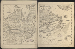
Aboriginal map of North America, denoting the boundaries and the locations of various Indian tribes
2.
Dinsmore's complete map of the railroads & canals in the United States & Canada
3.
Dinsmore's new railroad map of the United States and the Canadas, showing all the railroads completed and in progress,...
4.
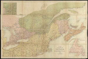
General railway map engraved expressly for the Official guide of the railways and steam navigation lines of the United States,...
5.
A Map exhibiting the frontiers of Canada and the United States : intended to illustrate the operations of the British &...
6.
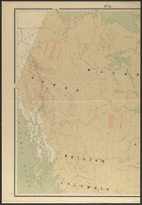
Map of North America : showing all routes to Alaska and Klondike country
7.
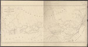
Relief map of Canada and the United States
8.
Schonberg's imperial map of the United States and Canada : constructed, drawn and compiled from the latest and best authorities...
9.
Trans-continental map : showing the main lines and proposed extensions of the various trans-continental railroad systems of the...
10.
America Septentrionalis : a Domino d'Anville in Galliis edita nune in Anglia Coloniss in Interiorem Virginiam deductis nec non...
11.
The British governments in Nth. America : laid down agreeable to the proclamation of Octr. 7, 1763
12.
Carte des pays connus sous le nom de Canada, : dans laquelle sont distinguées les possessions françoises, et angl?
13.
A General map of North America; : from the latest observations
14.
Karte von den seen in Canada
15.
A Map of the British dominions in North America as settled by the late treaty of Peace 1763
16.
A map of the British empire, in North America
17.
A Map of the present seat of war in North America
18.
A New & accurate map of North America, : including the British acquisitions gain'd by the late war, 1763
19.
A new map of the British empire in Nth. America
20.
Partie occidentale du Canada, : contenant les cinq Grands Lacs, avec les pays circonvoisins
21.
The United States of North America with the British & Spanish territories according to the treaty
22.
British America, comprehending Canada, Labrador, New-Foundland, Nova Scotia &c
23.
British possessions in North America
24.
The British possessions in North America from the best authorities
25.
The British possessions in North America from the best authorities
26.
Canada and Nova Scotia
27.
Canada and Nova Scotia
28.
Carte de la Nouvelle-France, augmentée depuis la derniere, servant a la navigation faicte en son vray Meridien par le Sr. de...
29.
Coal areas of Canada
30.
Dawson's map of the Dominion of Canada
31.
Dominion of Canada
32.
E.P. Dutton & Co.'s railroad, steam boat & stage route map of New England, New-York and Canada
33.
Government map of part of the Huron and Ottawa Territory, Ontario
34.
A map of Canada
35.
Map of the Dominion of Canada
36.
A map of the province of Upper Canada, describing all the new settlements, townships, & cc. with the countries adjacent, from...
37.
Map of the provinces of upper & lower Canada with the adjacent parts of the United States of America, &c
38.
Map shewing the railways of Canada, to accompany annual report on railway statistics 1884
39.
Map showing mounted police stations in north-western Canada
40.
Map to accompany the report on the exploratory survey of the Canadian Pacific Railway
41.
Minerals
42.
New map of the Dominion of Canada
43.
Relief map of the Dominion of Canada
44.
Williams' telegraph and rail road map of the New England states, eastern protion of New York state and Canada : compiled from...
45.
19th annual convention of the National Association of Real Estate Boards : at Tulsa, June 7 to June 11 in 1926
46.
2005 significant U.S. hurricane strikes
47.
The 2100 project : an atlas for the Green New Deal
48.
38,000,000 escaped -- 10,000,000 died
49.
Abolition of Slavery, 1863
50.
The adventures of Mark Twain
‹ Prev
Next ›
1
2
3
4
5
…
164
165