Toggle navigation
LMEC Home
Exhibitions
Georeferencing
Tools for Teachers
Collections
My Favorites
Sign Up / Log In
Search
Search the map portal
Map Collection
Map Collection
Map Sets
Search
Search
Search for
Search In
All Fields
Creator
Title
Subject
Place
Search All Digital Collections
Advanced Search
376 Results
My Search
Start Over
More Like
commonwealth:6108vw16z
Remove constraint More Like: commonwealth:6108vw16z
Filter your Search
Place
North and Central America
335
United States
216
Canada
103
Essex (county)
24
Louisbourg
21
Saint Lawrence River
19
Fort Edward
16
Suffolk (county)
16
more
Place
»
Topic
United States--History--French and Indian War, 1754-1763--Maps, Manuscript--Early works to 1800
58
Louisbourg (N.S.)--Maps, Manuscript--Early works to 1800
18
Fort Edward (N.Y.)--Maps, Manuscript--Early works to 1800
16
Fort Ticonderoga (N.Y.)--Maps, Manuscript--Early works to 1800
15
Saint Lawrence River--Maps, Manuscript--Early works to 1800
15
Louisbourg (N.S.)--History--Siege, 1745--Maps, Manuscript--Early works to 1800
14
Fortification--New York (State)--Fort Edward--Maps, Manuscript--Early works to 1800
13
Fortification--New York (State)--Maps, Manuscript--Early works to 1800
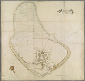
13
more
Topic
»
Date
Date range begin
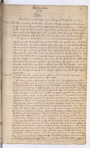
–
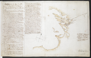
Date range end
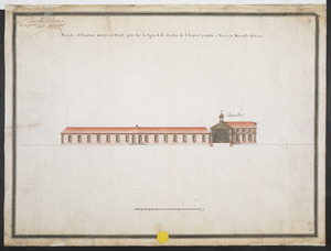
Current results range from
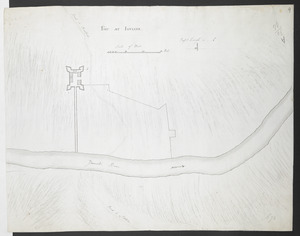
1664
to
1816
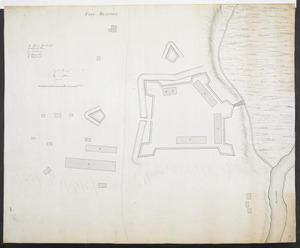
View distribution
Creator
Royal United Services Institute for Defence and Security Studies
160
George, III, King of Great Britain, 1738-1820
152
George, IV, King of Great Britain, 1762-1830
151
Amherst, Jeffery Amherst, Baron, 1717-1797
128
Skinner, Monier
28
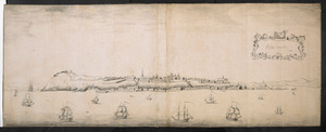
Skinner, William, 1700-1780
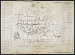
28
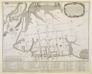
Brasier, William
16
Bastide, John Henry, approximately 1700-1770
15
more
Creator
»
Format
Maps/Atlases
359
Manuscripts
150
Drawings/Illustrations
15
Georeferenced
Yes
7
No
369
Collection
British Library Collection
376
American Revolutionary War-Era Maps
352
Boston and New England Maps
21
Urban Maps
5
Maritime Charts and Atlases
2
Available to use
Creative Commons license
376
Search Constraints
Sort by relevance
relevance
title
date (asc)
date (desc)
Number of results to display per page
50 per page
10
per page
20
per page
50
per page
100
per page
View results as:
grid view
map view
Search Results
51.
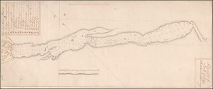
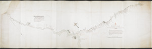
[Chart of the Saint Lawrence River]
52.
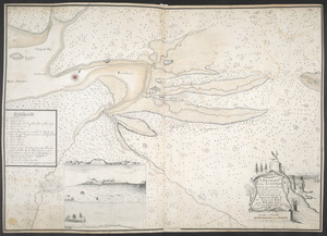
[Chart of the Saint Lawrence River from Anticosti to Quebec]
53.
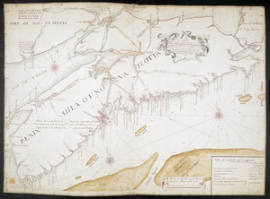
A CHART OF THE SEA COASTS OF THE PENINSULA OF NOVA SCOTIA
54.
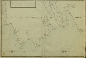
A CHART of the South East Part of l'Isle Royal, or Cape Bretton taken from the best Surveys, and the Observations of the most...
55.
[Coast of South Carolina, Georgia and Florida from Charleston to St. Augustine]
56.
[Coast of South Carolina, Georgia and Florida from Charleston to St. Augustine]
57.
A Copy of the Plan returned by his Maj:tys Com:rs for setling the Boundarys between the Provinces of New Hampshire and the...
58.
A Correct Plan of the Province of New Hampshire together with part of Hudsons River from Albany to Lake George and from thence...
59.
COURS of ye ONONDAGA RIVER from ye three RIVERS to OSWEGO
60.
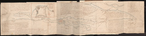
The Course of the Wood Creek from the Mowhock River at the Onoida or Great Carrying Place to The Onoida Lake. Representing the...
61.
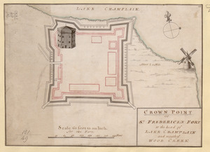
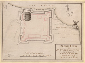
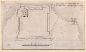
CROWN POINT or ST. FREDERICK'S FORT at the head of LAKE CHAMPLAIN and the Mouth of WOOD CREEK
62.
CROWN POINT or ST. FREDERICK'S FORT at the head of LAKE CHAMPLAIN and the Mouth of WOOD CREEK
63.
Crown Point or S.t Frederick's Fort at the Head of Lake Champlain and the Mouth of Wood Creek
64.
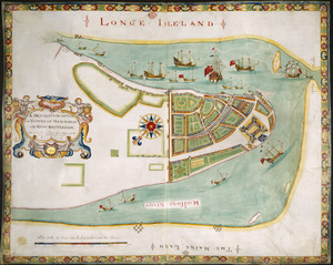
A DESCRIPTION OF THE TOWNE OF MANNADOS OR NEW AMSTERDAM as it was in September 1661 lying in Latitude 40 de: and 40,: Anno...
65.
Draught of a Scout over the Mountains West-ward of Lake Champlain
66.
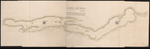
A Draught of Lake George with all the Islands & Soundings
67.
A Draught of the Fortress building at Crown Point 22.d Oct.t 1759
68.
A DRAUGHT of the ISTHMUS which joyns Nova Scotia to the Continent with the Situation of the ENGLISH and FRENCH FORTS & the...
69.
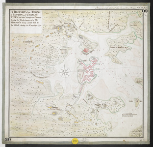
A DRAUGHT of the TOWNS of BOSTON and CHARLES TOWN and the Circumjacent Country shewing the Works thrown up by His MAJESTY'S...
70.
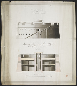
ELEVATION and SECTION of the TOWER at POINT PLEASANT
71.
[Entrance to the Harbour of S.t Johns Newfoundland]
72.
An Exact Draught of Bostone harbour, with a Survey of most of the Islands about it
73.
Explanation of the Plans
74.
Explication d'un Esquis des Côtes depuis Oswego jusques a la Baye de Frontenac, et les environs des Isle qui Sont en...
75.
Façade, Elevation, Coupe et Profil, pris sur la ligne a.b. du plan de l'hopital projetté a Faire a la Nouvelle Orleans
76.
Fort at Carlisle
77.
FORT AT IUNIATA
78.
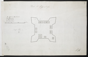
Fort at Shippensburgh
79.
Fort Augusta
80.
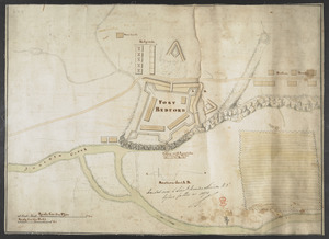
FORT BEDFORD
81.
FORT BEDFORD
82.
[Fort Bedford, on the Juniata Creek]
83.
Fort Edward
84.
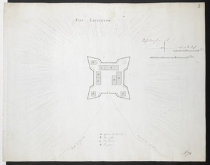
FORT LITTLETON
85.
[Fort Pitt]
86.
Fort William & Mary on Piscataqua River in the Province of New Hampshire on the Continent of America
87.
[Fort William and Mary on Piscataqua River]
88.
French Draught of Lake Champlain & Lake George
89.
[French Plan of York Town Virginia]
90.
GRAND PORTAGE from the RIVER S.T LAURENCE to the LAKE TEMESCOUATA, 35 Miles : This Portage was made about fourteen years ago,...
91.
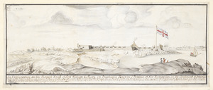
Halifax Nova Scotia 1760
92.
ICHNOGRAPHY OF CHARLESTON, South Carolina
93.
The ICHNOGRAPHY of CHARLES-TOWN, at High Water
94.
The Icqnographical draft of Castle Island where upon is built Her Maj.ties Castle and by Her Maj.ties Special Command named...
95.
[Island of Coudre]
96.
LAKE GEORGE
97.
[Lake Ontario]
98.
Lake Ontario & River S.t Laurence from the Lake to Fort William Augustus in Three Rivers, this was taken from a French Draft...
99.
Lake Ontario & River S.t Laurence from the Lake to Fort William Augustus in Three Rivers, this was taken from a French Draft...
100.
Lake Ontario & River S.t Laurence from the Lake to Fort William Augustus in Three Rivers, this was taken from a French Draft...
‹ Prev
Next ›
1
2
3
4
5
6
7
8
![[Chart of the Saint Lawrence River]](https://bpldcassets.blob.core.windows.net/derivatives/images/commonwealth:hx11z0594/image_thumbnail_300.jpg)
![[Chart of the Saint Lawrence River from Anticosti to Quebec]](https://bpldcassets.blob.core.windows.net/derivatives/images/commonwealth:hx11z079m/image_thumbnail_300.jpg)
![[Coast of South Carolina, Georgia and Florida from Charleston to St. Augustine]](https://bpldcassets.blob.core.windows.net/derivatives/images/commonwealth:hx11z448f/image_thumbnail_300.jpg)
![[Coast of South Carolina, Georgia and Florida from Charleston to St. Augustine]](https://bpldcassets.blob.core.windows.net/derivatives/images/commonwealth:hx11z450g/image_thumbnail_300.jpg)


![[Entrance to the Harbour of S.t Johns Newfoundland]](https://bpldcassets.blob.core.windows.net/derivatives/images/commonwealth:6108vv35z/image_thumbnail_300.jpg)

![[Fort Bedford, on the Juniata Creek]](https://bpldcassets.blob.core.windows.net/derivatives/images/commonwealth:hx11z402t/image_thumbnail_300.jpg)

![[Fort Pitt]](https://bpldcassets.blob.core.windows.net/derivatives/images/commonwealth:hx11xz65w/image_thumbnail_300.jpg)
![[Fort William and Mary on Piscataqua River]](https://bpldcassets.blob.core.windows.net/derivatives/images/commonwealth:6108vv71t/image_thumbnail_300.jpg)
![[French Plan of York Town Virginia]](https://bpldcassets.blob.core.windows.net/derivatives/images/commonwealth:hx11z256q/image_thumbnail_300.jpg)
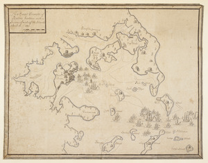
![[Island of Coudre]](https://bpldcassets.blob.core.windows.net/derivatives/images/commonwealth:hx11z0658/image_thumbnail_300.jpg)
![[Lake Ontario]](https://bpldcassets.blob.core.windows.net/derivatives/images/commonwealth:hx11xz576/image_thumbnail_300.jpg)
![Lake Ontario & River S.t Laurence from the Lake to Fort William Augustus in Three Rivers, this was taken from a French Draft that was on Board the Prise Williamson belonging to Monsr La Broquerie [east sheet]](https://bpldcassets.blob.core.windows.net/derivatives/images/commonwealth:hx11z135r/image_thumbnail_300.jpg)
![Lake Ontario & River S.t Laurence from the Lake to Fort William Augustus in Three Rivers, this was taken from a French Draft that was on Board the Prise Williamson belonging to Monsr La Broquerie [middle sheet]](https://bpldcassets.blob.core.windows.net/derivatives/images/commonwealth:hx11z1379/image_thumbnail_300.jpg)
![Lake Ontario & River S.t Laurence from the Lake to Fort William Augustus in Three Rivers, this was taken from a French Draft that was on Board the Prise Williamson belonging to Monsr La Broquerie [west sheet]](https://bpldcassets.blob.core.windows.net/derivatives/images/commonwealth:hx11z139v/image_thumbnail_300.jpg)