Toggle navigation
LMEC Home
Exhibitions
Georeferencing
Tools for Teachers
Collections
My Favorites
Sign Up / Log In
Search
Search the map portal
Map Collection
Map Collection
Map Sets
Search
Search
Search for
Search In
All Fields
Creator
Title
Subject
Place
Search All Digital Collections
Advanced Search
376 Results
My Search
Start Over
More Like
commonwealth:6108vv723
Remove constraint More Like: commonwealth:6108vv723
Filter your Search
Place
North and Central America
336
United States
210
Canada
103
Essex (county)
24
Louisbourg
21
Saint Lawrence River
19
Fort Edward
16
Suffolk (county)
16
more
Place
»
Topic
United States--History--French and Indian War, 1754-1763--Maps, Manuscript--Early works to 1800
58
Louisbourg (N.S.)--Maps, Manuscript--Early works to 1800
18
Fort Edward (N.Y.)--Maps, Manuscript--Early works to 1800
16
Fort Ticonderoga (N.Y.)--Maps, Manuscript--Early works to 1800
15
Saint Lawrence River--Maps, Manuscript--Early works to 1800
15
Louisbourg (N.S.)--History--Siege, 1745--Maps, Manuscript--Early works to 1800
14
Fortification--New York (State)--Fort Edward--Maps, Manuscript--Early works to 1800
13
Fortification--New York (State)--Maps, Manuscript--Early works to 1800
13
more
Topic
»
Date
Date range begin
–
Date range end
Current results range from
1664
to
1816
View distribution
Creator
Royal United Services Institute for Defence and Security Studies
160
George, III, King of Great Britain, 1738-1820
151
George, IV, King of Great Britain, 1762-1830
150
Amherst, Jeffery Amherst, Baron, 1717-1797
128
Skinner, Monier
28
Skinner, William, 1700-1780
28
Brasier, William
16
Bastide, John Henry, approximately 1700-1770
15
more
Creator
»
Format
Maps/Atlases
360
Manuscripts
149
Drawings/Illustrations
14
Georeferenced
Yes
7
No
369
Collection
British Library Collection
376
American Revolutionary War-Era Maps
352
Boston and New England Maps
21
Urban Maps
5
Maritime Charts and Atlases
2
Available to use
Creative Commons license
376
Search Constraints
Sort by date (desc)
relevance
title
date (asc)
date (desc)
Number of results to display per page
50 per page
10
per page
20
per page
50
per page
100
per page
View results as:
grid view
map view
Search Results
301.
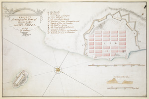
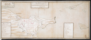
PROJECT for Fortifying the Town of HALLIFAX ; in NOVA SCOTIA
302.
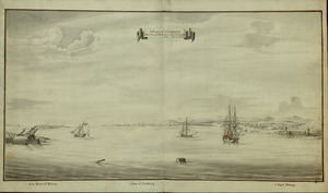
A Prospect of LOUISBOURG taken from ye NE Harbour
303.
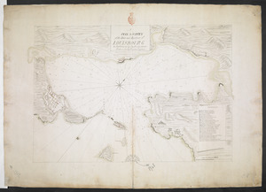
A PLAN & SURVEY of the Town and Harbour of LOUISBOURG : the harbour by Cap Darell & the Town & Batteries by Cap Bastide Engineer
304.
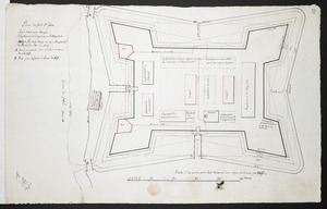
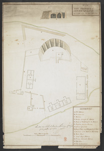
Plan du fort S.t Jean
305.
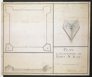
PLAN E L'ELEVATION DU FORT S.T JEAN
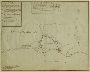
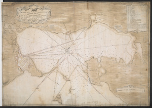
306.
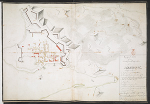
[An outline plan of the harbour and fortifications of Louisbourg]
307.
[Map showing Saint John's Harbour and a proposed fort]
308.
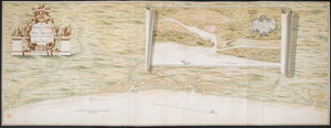
PLAN of FORT FREDERICK at NEWFOUND-LAND as it is now with the new Additions
309.
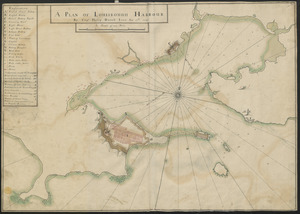
A PLAN OF LOUISBOUGH HARBOUR
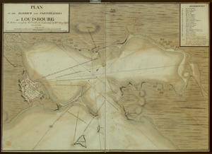
310.
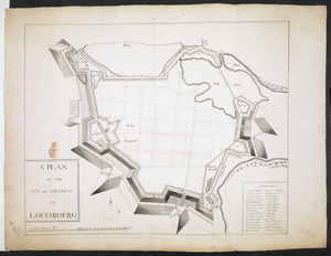
A PLAN OF THE CITY and FORTRESS OF LOUISBOURG
311.
Plan of the City and Fortress of LOUISBOURG Surrendered to his Britanick Majesty by Capitulation the 17 June 1745. to Lieut....
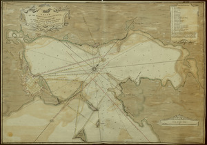
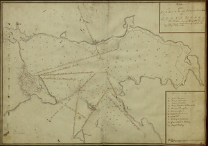
312.
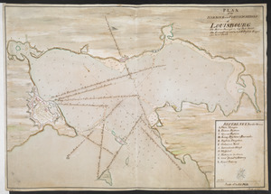
A PLAN OF THE HARBOUR AND FORTIFICATIONS OF LOUISBOURG
313.
A PLAN OF THE HARBOUR AND FORTIFICATIONS OF LOUISBOURG
314.
Plan of the HARBOUR and FORTIFICATIONS OF LOUISBOURG
315.
A PLAN OF THE HARBOUR AND FORTIFICATIONS OF LOUISBOURG : The Harbour Survey'd by Cap.t Phi; Durrell The Fortifications by Cap.t...
316.
PLAN of the HARBOUR and FORTIFICATIONS of LOUISBOURG : The Harbour Survey'd by Capt Phill Durell the Town & Fortifications by...
317.
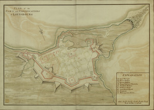
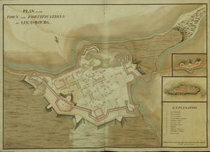
PLAN of the TOWN and FORTIFICATIONS of LOUISBOURG
318.
PLAN of the TOWN and FORTIFICATIONS of LOUISBOURG
319.
PLAN of the TOWN and FORTRESS of LOUISBOURG on the ISLAND CAPE BRETON : Surrender'd ye 16th June 1745 after a Seige of 12 days...
320.
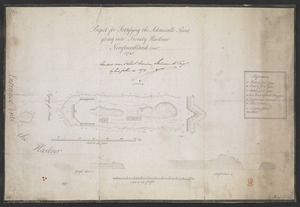
Project for Fortifying the Admiralls Point going into Trinity Harbour Newfoundland Octob.r 1745
321.
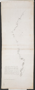
Plan of Part of Black River & Part of Otter Creek with the Distances by Computation
322.
[Map of the coast of Florida from Fort William to Musketae River] [north sheet]
323.
[Map of the coast of Florida from Fort William to Musketae River] [south sheet]
324.
A new plan of ye great town of Boston in New England in America with the many additionall buildings & new streets to the year 1743
325.
A Survey of the Coast from FORT WILLIAM near S.t Iuans River to Mosquito River
326.
Superficial Sketch of an advantagious Fortification for LOUISBOURG
327.
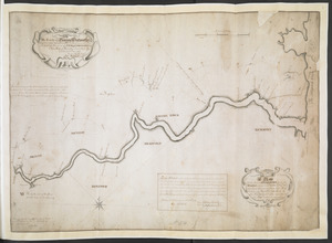
A Map Of the River MERRIMACK from the Atlantick Ocean to Pantuckett Falls describing bounds between His Maj:tys Province of New...
328.
[A manuscript map of Isle Royalle]
329.
[Acadie, Isle Saint Jean and part of Isle Royale with the Baye Francoise]
330.
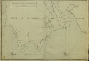
A CHART of the South East Part of l'Isle Royal, or Cape Bretton taken from the best Surveys, and the Observations of the most...
331.
[Entrance to the Harbour of S.t Johns Newfoundland]
332.
A Map of the Sea Coasts of NEW ENGLAND According to the actual Survey made thereof BY CAP.T CYPRIAN SOUTHACK As also the...
333.
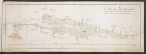
Carte du Lac Champlain depuis le Fort de Chambly Jusques au desus du Fort S.t Frederic, dans la Nouvelle France
334.
The ICHNOGRAPHY of CHARLES-TOWN, at High Water
335.
[Map of Saint Simons and Jekyll Islands]
336.
A New Plan of ye Great Town of BOSTON in New England in AMERICA with the many Additionall Buildings & New Streets to the Year,...
337.
A PLAN of the Rivers and Boundary Lines referr'd to in ye Proceedings & Judgment of ye Commissioners for adjusting the Bounds...
338.
1.r Plan du fort proposé dans l'Ille de S.t Simon pour la deffence de l'Entree du Havre de Jenkins Sownd
339.
1.r Plan du fort proposé dans l'Ille de S.t Simon pour la deffence de l'Entree du Havre de Jenkins Sownd
340.
2.e Plan d'une Batterie & d'une Redoute avec un Corps de Garde construit en forme de Redoute a Machecoulis pour y Servir de...
341.
[A sketch map of the proposed battery (?) on Jekyll Island (?)]
342.
[Map and profiles of proposed (?) fortifications on Jekyll Island (?)]
343.
[Map of Saint Simons and Jekyll Islands with fortifications]
344.
[Map of the proposed fort and adjacent redoubt on Saint Simons Island]
345.
Plan dun Fort convenable en quelque endroit ce que soit dune Cote maritime Auquel on a changé la figure reguliere du 1.r...
346.
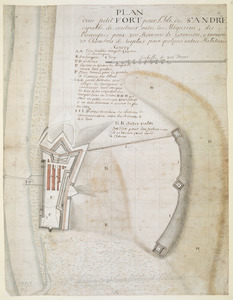
PLAN dun petit FORT pour l'Isle de S.t ANDRE capable de contenir outre les Magazins, des Barraques pour 200 Hommes de Garrison,...
347.
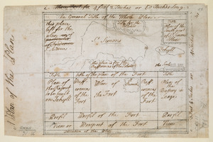
A Plan of the Plan
348.
A SMALL MAP of the SEA COAST of NEW ENGLAND Together with the out Lines of Several of the Provinces Lying theron. 1738
349.
A Copy of the Plan returned by his Maj:tys Com:rs for setling the Boundarys between the Provinces of New Hampshire and the...
350.
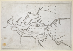
Proposed Maryland / Pennsylvania Boundary
‹ Prev
Next ›
1
2
3
4
5
6
7
8
![[An outline plan of the harbour and fortifications of Louisbourg]](https://bpldcassets.blob.core.windows.net/derivatives/images/commonwealth:hx11z5128/image_thumbnail_300.jpg)
![[Map showing Saint John's Harbour and a proposed fort]](https://bpldcassets.blob.core.windows.net/derivatives/images/commonwealth:6108vw12v/image_thumbnail_300.jpg)
![[Map of the coast of Florida from Fort William to Musketae River] [north sheet]](https://bpldcassets.blob.core.windows.net/derivatives/images/commonwealth:hx11z4742/image_thumbnail_300.jpg)
![[Map of the coast of Florida from Fort William to Musketae River] [south sheet]](https://bpldcassets.blob.core.windows.net/derivatives/images/commonwealth:hx11z476m/image_thumbnail_300.jpg)

![[A manuscript map of Isle Royalle]](https://bpldcassets.blob.core.windows.net/derivatives/images/commonwealth:hx11z507d/image_thumbnail_300.jpg)
![[Acadie, Isle Saint Jean and part of Isle Royale with the Baye Francoise]](https://bpldcassets.blob.core.windows.net/derivatives/images/commonwealth:hx11z490f/image_thumbnail_300.jpg)
![[Entrance to the Harbour of S.t Johns Newfoundland]](https://bpldcassets.blob.core.windows.net/derivatives/images/commonwealth:6108vv35z/image_thumbnail_300.jpg)

![[Map of Saint Simons and Jekyll Islands]](https://bpldcassets.blob.core.windows.net/derivatives/images/commonwealth:hx11z454k/image_thumbnail_300.jpg)


![[A sketch map of the proposed battery (?) on Jekyll Island (?)]](https://bpldcassets.blob.core.windows.net/derivatives/images/commonwealth:hx11z460q/image_thumbnail_300.jpg)
![[Map and profiles of proposed (?) fortifications on Jekyll Island (?)]](https://bpldcassets.blob.core.windows.net/derivatives/images/commonwealth:hx11z458p/image_thumbnail_300.jpg)
![[Map of Saint Simons and Jekyll Islands with fortifications]](https://bpldcassets.blob.core.windows.net/derivatives/images/commonwealth:hx11z4564/image_thumbnail_300.jpg)
![[Map of the proposed fort and adjacent redoubt on Saint Simons Island]](https://bpldcassets.blob.core.windows.net/derivatives/images/commonwealth:hx11z468x/image_thumbnail_300.jpg)