Toggle navigation
LMEC Home
Exhibitions
Georeferencing
Tools for Teachers
Collections
My Favorites
Sign Up / Log In
Search
Search the map portal
Map Collection
Map Collection
Map Sets
Search
Search
Search for
Search In
All Fields
Creator
Title
Subject
Place
Search All Digital Collections
Advanced Search
13694 Results
Filter your Search
Place
North and Central America
10,357
United States
8,484
Massachusetts
2,796
Suffolk (county)
1,678
Boston
1,634
Europe
1,419
Canada
950
New York
650
more
Place
»
Topic
Boston (Mass.)--Maps
748
City planning--Massachusetts--Boston--Maps
418
United States--History--Revolution, 1775-1783--Maps
329
United States--Maps
322
Real property--Massachusetts--Boston--Maps
254
Urban renewal--Massachusetts--Boston--Maps
254
Massachusetts--Maps
233
Insurance surveys
197
more
Topic
»
Date
Date range begin
–
Date range end
Current results range from
1482
to
2023
View distribution
Creator
United States. Hydrographic Office
597
Boston Redevelopment Authority
404
Des Barres, Joseph F. W. (Joseph Frederick Wallet), 1722-1824
247
Royal United Services Institute for Defence and Security Studies
160
Jefferys, Thomas, -1771
154
George, III, King of Great Britain, 1738-1820
152
George, IV, King of Great Britain, 1762-1830
151
O.H. Bailey & Co
148
more
Creator
»
Format
Maps/Atlases
13,513
Manuscripts
985
Prints
102
Books
49
Drawings/Illustrations
44
Photographs
15
Objects/Artifacts
13
Documents
7
more
Format
»
Georeferenced
Yes
979
No
12,715
Collection
Norman B. Leventhal Map & Education Center Collection
9,108
American Revolutionary War-Era Maps
3,305
Boston and New England Maps
2,921
Urban Maps
2,480
Maritime Charts and Atlases
1,169
William L. Clements Library Collection
910
Library of Congress Collection
618
Boston Redevelopment Authority Collection
475
more
Collection
»
Available to use
No known restrictions
10,260
Creative Commons license
1,678
Search Constraints
Sort by date (desc)
relevance
title
date (asc)
date (desc)
Number of results to display per page
50 per page
10
per page
20
per page
50
per page
100
per page
View results as:
grid view
map view
Search Results
351.
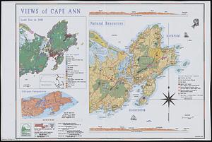
Views of Cape Ann
352.
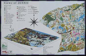
Views of Dennis
353.
Washington Street boulevard study : generalized land use - proposed
354.
Washington Street boulevard study : proposed fabric
355.
Washington Street boulevard study : corridor wide urban design strategy
356.
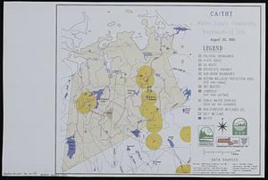
Water supply resources, Weymouth-13 site : CA/THT
357.
Wellhead protection areas in southeastern Massachusetts
358.
Wellhead protection areas in southeastern Massachusetts
359.
Sears Park conceptual site plan with historic waterway
360.
FPIR/FEIR Olmsted Plaza : a redevelopment of the Sears property, 309 Park Drive/201 Brookline Avenue in the Fenway
361.
Ruggles Center : existing condition plan
362.
Ruggles Center : site area diagram
363.
660 Wakulah St., Roxbury
364.
Hancock Woods : as of right plan
365.
Airport obstruction chart OC 110, Daytona Beach Regional Airport, Daytona Beach, Florida
366.
Airport obstruction chart OC 114, Stapleton International Airport, Denver, Colorado
367.
Airport obstruction chart OC 119, Detroit Metropolitan Wayne County, Detroit, Michigan
368.
Airport obstruction chart OC 140, Mahlon Sweet Field, Eugene, Oregon
369.
Airport obstruction chart OC 152, Sherman AAF, Fort Leavenworth, Kansas
370.
Airport obstruction chart OC 166, Chicago-O'Hare International Airport, Chicago, Illinois
371.
Airport obstruction chart OC 175, Great Bend Municipal Airport, Great Bend, Kansas
372.
Airport obstruction chart OC 39, Bangor International Airport, Bangor, Maine
373.
Airport obstruction chart OC 41, W.K. Kellogg Regional Airport, Battle Creek, Michigan
374.
Airport obstruction chart OC 48, Billings Logan International Airport, Billings, Montana
375.
Airport obstruction chart OC 51, Bismarck Municipal Airport, Bismarck, North Dakota
376.
Airport obstruction chart OC 72, Natrona County International Airport, Casper, Wyoming
377.
Airport obstruction chart OC 78, Charlotte/Douglas International Airport, Charlotte, North Carolina
378.
Airport obstruction chart OC 79, Lovell Field, Chattanooga, Tennessee
379.
Airport obstruction chart OC 80, Cheyenne Airport, Cheyenne, Wyoming
380.
Airport obstruction chart OC 81, Chicago Midway Airport, Chicago, Illinois
381.
Airport obstruction chart OC 84, Cleveland--Hopkins International Airport, Cleveland, Ohio
382.
Architectural styles, Chinatown historic core, historic edge
383.
General plan of the MWRA/MDC water system
384.
James Hayes Park
385.
John Hancock office and parking garage complex, Boston, Massachusetts
386.
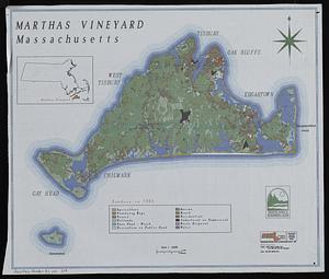
Marthas Vineyard, Massachusetts : landuse in 1985
387.
Mass pike air rights study
388.
Massachusetts shoreline change summary map
389.
We must have order
390.
Zoning districts, city of Boston
391.
New Congress Street improvements
392.
Cultural facilities conceptual plan
393.
Midtown area plan for the public realm
394.
South End urban renewal area project Mass. r-56 site preparation contract no. 50 Worcester Square Park reconstruction
395.
Airport obstruction chart OC 142, Snohomish County (Paine Field) Airport, Everett, Washington
396.
Airport obstruction chart OC 178, Greensboro-Highpoint-Winston Salem Regional Airport, Greensboro, North Carolina
397.
Airport obstruction chart OC 184, Toledo Express Airport, Toledo, Ohio
398.
Airport obstruction chart OC 34, Jack McNamara Field, Crescent City, California
399.
Buffers around tributaries to the Wachusett Reservoir compared to 1985 urban landuse and currently protected open space in...
400.
The Charles River basin : hydrography, wetlands & protected open space in the basin
‹ Prev
Next ›
1
2
…
4
5
6
7
8
9
10
11
12
…
273
274