Toggle navigation
LMEC Home
Exhibitions
Georeferencing
Tools for Teachers
Collections
My Favorites
Sign Up / Log In
Search
Search the map portal
Map Collection
Map Collection
Map Sets
Search
Search
Search for
Search In
All Fields
Creator
Title
Subject
Place
Search All Digital Collections
Advanced Search
8555 Results
My Search
Start Over
More Like
commonwealth:9g54z626j
Remove constraint More Like: commonwealth:9g54z626j
Filter your Search
Place
North and Central America
5,850
United States
4,774
Massachusetts
2,052
Europe
1,359
Suffolk (county)
1,039
Boston
1,012
Canada
448
Asia
422
more
Place
»
Topic
Boston (Mass.)--Maps
577
United States--Maps
273
Real property--Massachusetts--Boston--Maps
174
Massachusetts--Maps
160
Landowners--Massachusetts--Boston--Maps
132
North America--Maps--Early works to 1800
103
New England--Maps
99
Europe--Maps
78
more
Topic
»
Date
Date range begin
–
Date range end
Current results range from
1482
to
2023
View distribution
Creator
United States. Hydrographic Office
594
O.H. Bailey & Co
148
Des Barres, Joseph F. W. (Joseph Frederick Wallet), 1722-1824
123
United States. Post Office Dept
120
Ptolemy, 2nd cent
100
Walling, Henry Francis, 1825-1888
94
Geological Survey (U.S.)
86
Jefferys, Thomas, -1771
85
more
Creator
»
Format
Maps/Atlases
8,496
Manuscripts
215
Prints
56
Books
36
Objects/Artifacts
10
Drawings/Illustrations
8
Posters
4
Georeferenced
Yes
869
No
7,686
Collection
Norman B. Leventhal Map & Education Center Collection
8,550
Boston and New England Maps
2,209
Urban Maps
1,941
Maritime Charts and Atlases
1,081
American Revolutionary War-Era Maps
616
Boston Redevelopment Authority Collection
92
Available to use
No known restrictions
8,414
Creative Commons license
46
Search Constraints
Sort by relevance
relevance
title
date (asc)
date (desc)
Number of results to display per page
50 per page
10
per page
20
per page
50
per page
100
per page
View results as:
grid view
map view
Search Results
1.
Map of Boston Common and Public Garden
2.
Plan of Public Garden : showing proposed arrangement of lots thereon
3.
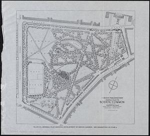
General plan for Boston Common
4.
Plan for the construction of improvements at the Boston Common
5.
Proposed park system from the Common to the West Roxbury Park including the Back Bay and Muddy river improvements, Jamaica Pond...
6.
Boston Elevated Railway lines 1921
7.
Boston Elevated Railway lines operated 1925
8.
Boston Elevated Railway system
9.
Boston Elevated Railway track lengths of surface lines and subway
10.
Boston Elevated Railway track lengths of surface lines and subway
11.
Boston Subway, East Boston Tunnel, Washington St. Tunnel, tunnel for Cambridge connection & proposed Riverbank Subway
12.
Central part of Boston Elevated Railway system showing connections
13.
Central part of Boston Elevated Railway system showing connections
14.
Central part of Boston Elevated Railway system showing connections 1903
15.
Central part of Boston Elevated Railway system showing connections 1904
16.
Map of Boston
17.
Map of Boston and vicinity, showing tracks operated by the Boston Elevated Railway Co. January, 1910
18.
Map of Boston proper
19.
[Map of Boston, showing surface lines, proposed elevated lines, connecting surface lines and route of subway
20.
Map of the Boston Elevated Ry. 1915
21.
Map of the Boston Elevated Ry. 1927
22.
Massachusetts Bay Transportation Authority system map
23.
MBTA map : 1977-1978
24.
Mean travel time to work
25.
Metropolitan Boston transportation map : subway, bus, rail
26.
Metropolitan Boston transportation map : subway, bus, rail
27.
Metropolitan Boston transportation map : subway, bus, rail
28.
Metropolitan Boston transportation map : subway, bus, rail
29.
Metropolitan Boston transportation map : subway, bus, rail
30.
Metropolitan Boston transportation map : subway, bus, rail
31.
Plan showing proposed route of Subway, February 1895
32.
Street railways of Boston and vicinity Jan. 1914
33.
T 1980 system map
34.
T system map : 1978-1979
35.
T system map
36.
Tracks operated by the Boston Elevated Railway Company January 1916
37.
Back Bay project no. Mass. R-47 : police signal system, fire alarm system and M.T.A. facilities
38.
Government Center project no. Mass. r-35 : proposed land use map
39.
Government Center project no. Mass. r-35 : subway adjustments plan
40.
Parker Hill-Fenway project no. Mass. R-48 : police signal system, fire alarm system and M.T.A. facilities
41.
Tremont St. subway Boston, Mass. Haymarket Sq. Station
42.
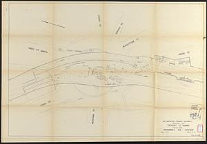
The 100th anniversary map of Abraham Lincoln's visit to Massachusetts, September 11-23, 1848
43.
1630 shoreline
44.
1879. Progress map of the U.S. Geographical Surveys west of the 100th Meridian : prepared under the direction of 1st Lieut....
45.
1903 Map of Salem and surrounding places
46.
19th annual convention of the National Association of Real Estate Boards : at Tulsa, June 7 to June 11 in 1926
47.
2005 significant U.S. hurricane strikes
48.
The 2100 project : an atlas for the Green New Deal
49.
227 Harzgerode
50.
305 Glatz
‹ Prev
Next ›
1
2
3
4
5
…
171
172