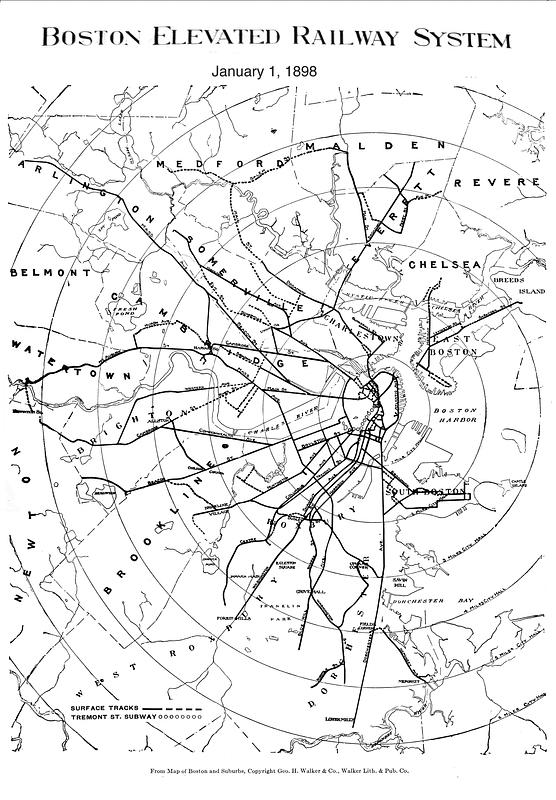
Boston Elevated Railway system
Item Information
- Title:
- Boston Elevated Railway system
- Publisher:
- Boston Elevated Railway Company
- Date:
-
1898
- Format:
-
Maps/Atlases
- Location:
-
Boston Public Library
Norman B. Leventhal Map & Education Center - Collection (local):
-
Norman B. Leventhal Map & Education Center Collection
- Subjects:
-
Local transit--Massachusetts--Boston--Maps
Railroads, elevated--Massachusetts--Boston--Maps
Subways--Massachusetts--Boston--Maps
Boston (Mass.)--Maps
Boston Elevated Railway Company
- Places:
-
MassachusettsSuffolk (county)Boston
- Extent:
- 1 map
- Terms of Use:
-
No known copyright restrictions.
No known restrictions on use.
- Publisher:
-
[Boston] :
[Boston Elevated Railway Company]
- Language:
-
English
- Notes:
-
Shows surface tracks and Tremont St. subway.
"From map of Boston and suburbs, copyright Geo. H. Walker & Co., Walker Lith. & Pub. Co."
Annotated on image: "January 1, 1898."
- Identifier:
-
1898-System
- Call #:
-
G3764.B6P33 svar .B67
- Barcode:
-
39999065669267


