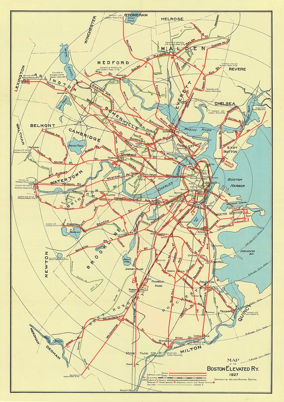
Map of the Boston Elevated Ry. 1927
Item Information
- Title:
- Map of the Boston Elevated Ry. 1927
- Cartographer:
- Mather, Walter I.
- Date:
-
1927
- Format:
-
Maps/Atlases
- Location:
-
Boston Public Library
Norman B. Leventhal Map & Education Center - Collection (local):
-
Norman B. Leventhal Map & Education Center Collection
- Subjects:
-
Local transit--Massachusetts--Boston--Maps
Railroads, elevated--Massachusetts--Boston--Maps
Subways--Massachusetts--Boston--Maps
Bus rapid transit--Massachusetts--Boston--Maps
Boston (Mass.)--Maps
Boston Elevated Railway Company
- Places:
-
MassachusettsSuffolk (county)Boston
- Extent:
- 1 map : color
- Terms of Use:
-
No known copyright restrictions.
No known restrictions on use.
- Publisher:
-
Boston :
[publisher not identified]
- Language:
-
English
- Notes:
-
Shows surface lines, elevated, subways and tunnels, car houses, power stations, steam R.R., sub power stations, bus lines and garages.
Includes notes about connections.
- Identifier:
-
1927-System
- Call #:
-
G3764.B6P33 svar .B67
- Barcode:
-
39999065669267


