Map of Boston proper
Item Information
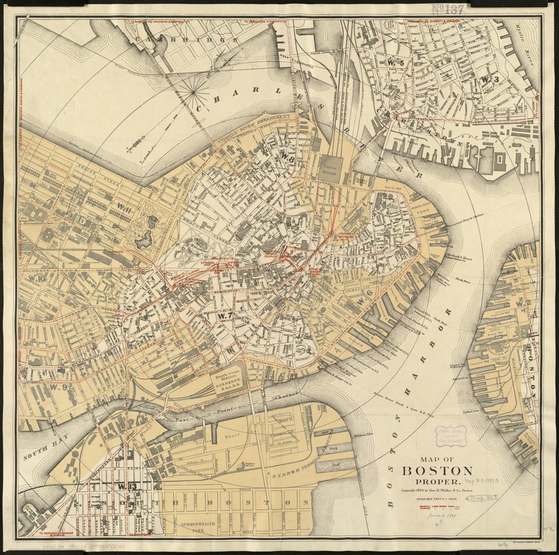
- Title:
- Map of Boston proper
- Cover title :
- Subway map of Boston proper
- Creator:
- Geo. H. Walker & Co
- Date:
-
[ca. 1894]
- Format:
-
Maps/Atlases
- Location:
-
Boston Public Library
Norman B. Leventhal Map & Education Center - Collection (local):
-
Norman B. Leventhal Map & Education Center Collection
- Subjects:
-
Subways--Massachusetts--Boston--Maps
Street-railroads--Massachusetts--Boston--Maps
Boston (Mass.)--Maps
- Places:
-
MassachusettsSuffolk (county)Boston
- Extent:
- 1 map : col. ; 65 x 65 cm.
- Terms of Use:
-
No known copyright restrictions.
No known restrictions on use.
- Publisher:
-
Boston :
Geo. H. Walker & Co.
- Scale:
-
Scale [1:6,000].
- Language:
-
English
- Notes:
-
Shows also names of selected buildings and subway and surface lines and stations in red ink.
Relief shown by hachures.
Oriented with north toward the upper right.
Indicates original shoreline and radial distances from City Hall.
- Identifier:
-
06_01_004731
- Call #:
-
G3764.B6 1894 .G4
- Barcode:
-
39999059007151


