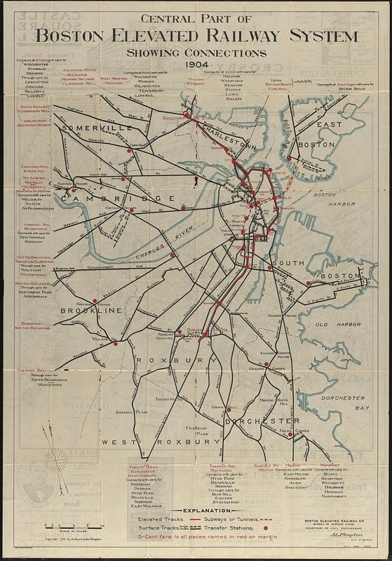
Central part of Boston Elevated Railway system showing connections

Item Information
- Title:
- Central part of Boston Elevated Railway system showing connections
- Title (alt.):
-
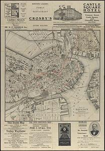
Map of Boston proper
- Cartographer:
- Plimpton, Arthur Leslie
- Publisher:
- Lane, John J.
- Publisher:
- Geo. H. Walker & Co.
- Publisher:
- Boston Elevated Railway Company
- Name on Item:
-
A.L. Plimpton, civil engineer
- Date:
-
1904
(created)
(c) 1903 (copyright)
- Format:
-
Maps/Atlases
- Location:
-
Boston Public Library
Norman B. Leventhal Map & Education Center - Collection (local):
-
Norman B. Leventhal Map & Education Center Collection
- Subjects:
-
Boston (Mass.)--Maps
Railroads, Elevated--Massachusetts--Boston--Maps
Subways--Massachusetts--Boston--Maps
Street-railroads--Massachusetts--Boston--Maps
Boston Elevated Railway Company
- Places:
-
MassachusettsSuffolk (county)Boston
- Extent:
- 1 map : color ; 103 x 70 cm, folded in cover 20 x 10 cm
- Terms of Use:
-
No known copyright restrictions.
No known restrictions on use.
- Publisher:
-
Boston :
Published by John J. Lane ; Geo. H. Walker & Co.
- Scale:
-
Scale approximately 1:15,000
- Language:
-
English
- Notes:
-
Publisher from cover.
Lists connections at ends of lines.
"Copyright 1903 by Arthur Leslie Plimpton."
Map of Boston proper, advertisements, and illustrations on verso.
- Identifier:
-
06_01_017160A
06_01_017160B
- Call #:
-
G3764.B6P33 1904 .P55
- Barcode:
-
39999085955316


