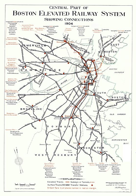
Central part of Boston Elevated Railway system showing connections 1904

Item Information
- Title:
- Central part of Boston Elevated Railway system showing connections 1904
- Publisher:
- Boston Elevated Railway Company
- Cartographer:
- Plimpton, Arthur Leslie
- Contributor:
- Geo. H. Walker & Co.
- Name on Item:
-
Boston Elevated Railway Co. Bureau of Surface Lines, Department of Civil Engineering, A.L. Plimpton, civil engineer
- Date:
-
1904
- Format:
-
Maps/Atlases
- Location:
-
Boston Public Library
Norman B. Leventhal Map & Education Center - Collection (local):
-
Norman B. Leventhal Map & Education Center Collection
- Subjects:
-
Local transit--Massachusetts--Boston--Maps
Railroads, elevated--Massachusetts--Boston--Maps
Subways--Massachusetts--Boston--Maps
Boston (Mass.)--Maps
Boston Elevated Railway Company
- Places:
-
MassachusettsSuffolk (county)Boston
- Extent:
- 1 map : color
- Terms of Use:
-
No known copyright restrictions.
No known restrictions on use.
- Publisher:
-
[Boston] :
Boston Elevated Railway Co.
- Language:
-
English
- Notes:
-
Shows elevated tracks, subways or tunnels, surface tracks and transfer stations.
Oriented with north to the upper left.
Notes about connections in margins.
"W.I.M. HB.A. J.W.O."--lower right.
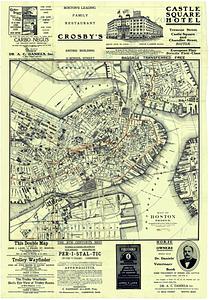
Advertisements and map of Boston proper showing local transit on verso.
- Identifier:
-
1904-System-Central
1904-System-Back
- Call #:
-
G3764.B6P33 svar .B67
- Barcode:
-
39999065669267


