Toggle navigation
LMEC Home
Exhibitions
Georeferencing
Tools for Teachers
Collections
My Favorites
Sign Up / Log In
Search
Search the map portal
Map Collection
Map Collection
Map Sets
Search
Search
Search for
Search In
All Fields
Creator
Title
Subject
Place
Search All Digital Collections
Advanced Search
8162 Results
My Search
Start Over
More Like
commonwealth:4m90fp04s
Remove constraint More Like: commonwealth:4m90fp04s
Filter your Search
Place
North and Central America
4,912
United States
3,602
Suffolk (county)
1,026
Boston
999
Europe
962
Canada
427
France
269
Massachusetts
249
more
Place
»
Topic
Boston (Mass.)--Maps
574
United States--Maps
270
Real property--Massachusetts--Boston--Maps
174
Massachusetts--Maps
160
Landowners--Massachusetts--Boston--Maps
132
North America--Maps--Early works to 1800
103
New England--Maps
99
Europe--Maps
78
more
Topic
»
Date
Date range begin
–
Date range end
Current results range from
1482
to
2023
View distribution
Creator
United States. Hydrographic Office
357
O.H. Bailey & Co
148
Des Barres, Joseph F. W. (Joseph Frederick Wallet), 1722-1824
123
United States. Post Office Dept
120
Ptolemy, 2nd cent
100
Walling, Henry Francis, 1825-1888
94
Jefferys, Thomas, -1771
84
Geological Survey (U.S.)
82
more
Creator
»
Format
Maps/Atlases
8,103
Manuscripts
215
Prints
51
Books
36
Objects/Artifacts
10
Drawings/Illustrations
8
Posters
4
Georeferenced
Yes
869
No
7,293
Collection
Norman B. Leventhal Map Center Collection
8,162
Boston and New England Maps
2,184
Urban Maps
1,925
Maritime Charts and Atlases
750
American Revolutionary War-Era Maps
616
Boston Redevelopment Authority Collection
86
Available to use
No known restrictions
8,021
Creative Commons license
46
Search Constraints
Sort by relevance
relevance
title
date (asc)
date (desc)
Number of results to display per page
50 per page
10
per page
20
per page
50
per page
100
per page
View results as:
grid view
map view
Search Results
1.
Balkan peninsula
2.
Die Balkan-Halbinsel in 4 blättern : Türkei, Rumänien, Griechenland, Serbien, Montenegro, Bulgarien
3.
The Balkans
4.
The Balkans
5.
Block diagram showing terrain of the Balkan Peninsula
6.
Caucasus, Central Asia and Turkey
7.
The cross and the crescent--Harper's pictorial map of the seat of the war in the east
8.
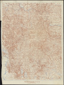
The Daily Telegraph war map no. 10
9.
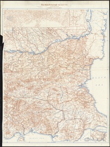
The Daily telegraph war map no. 18
10.
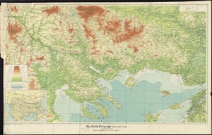
The Daily Telegraph war map no. 19
11.
The Daily Telegraph war map no. 20
12.
Eastern Mediterranean
13.
The Egyptian gazette war map no. 3
14.
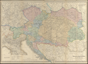
G. Freytags völker- und sprachenkarte von Österreich-Ungarn
15.
General-strassen & ortskarte des Österreichisch-Ungarischen Reiches nebst ganz süd-west-Deutschland einem grossen theile von...
16.
The Graphic map of Bulgaria, eastern Roumelia, the Turkish Empire in Europe, etc., according to the Treaty of Berlin
17.
Guerre d'orient, Balkans, Asie Mineure, Perse
18.
Karte der Türkei in Europa und Asien
19.
Karte des russisch-türkischen kriegsschauplatzes in Europa und Asien
20.
Kriegsschauplatz uebersichtskarte der Europäischen Türkei mit den vasallenstaaten Montenegro, Serbien, Rumænien u. Griechenland
21.
A map of those countries in which the apostles travelled : in propagating Christianity
22.
Mer noire
23.
The National Geographic magazine map of the new Balkan states and Central Europe
24.
Orbis Romani pars orientalis
25.
Political map of the Balkan States
26.
Rand, McNally & Co.'s indexed atlas of the world map of Turkey in Europe, Roumania, Servia, Bulgaria, and Montenegro
27.
Schedler's map of Turkey and Greece
28.
The seat of war
29.
Seat of war in the east : map of Turkey and parts adjacent
30.
Seat of war in the east
31.
Seat of war in the east : map of Turkey and parts adjacent
32.
Special-karte der Europäischen Türkey
33.
Die staten der Balkan-Halbinsel : nach den Grenzbestimmungen des Friedens von Haġios Stephanos (S. Stefano) 3. März 1878
34.
Türkei und Griechenland
35.
Turkey, in Europe and Hungary : from the best authorities
36.
Turkey in Europe, from the latest authorities
37.
The 100th anniversary map of Abraham Lincoln's visit to Massachusetts, September 11-23, 1848
38.
1630 shoreline
39.
1879. Progress map of the U.S. Geographical Surveys west of the 100th Meridian : prepared under the direction of 1st Lieut....
40.
1903 Map of Salem and surrounding places
41.
19th annual convention of the National Association of Real Estate Boards : at Tulsa, June 7 to June 11 in 1926
42.
2005 significant U.S. hurricane strikes
43.
The 2100 project : an atlas for the Green New Deal
44.
227 Harzgerode
45.
305 Glatz
46.
38,000,000 escaped -- 10,000,000 died
47.
4 Kinten
48.
660 Wakulah St., Roxbury
49.
[A chart of Boston Bay and vicinity]
50.
[A chart of New York Island & North River : East River, passage through Hell Gate, Flushing Bay, Hampstead Bay, Oyster,...
‹ Prev
Next ›
1
2
3
4
5
…
163
164


![[A chart of Boston Bay and vicinity]](https://bpldcassets.blob.core.windows.net/derivatives/images/commonwealth:cj82m2976/image_thumbnail_300.jpg)
