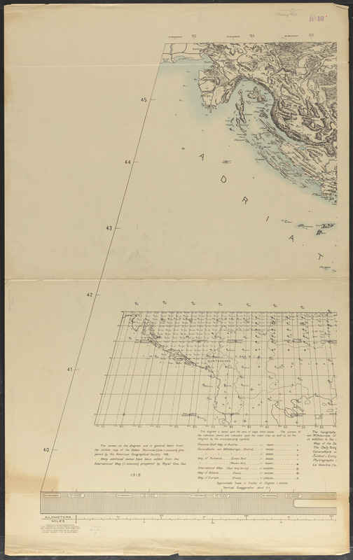
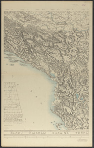
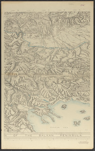
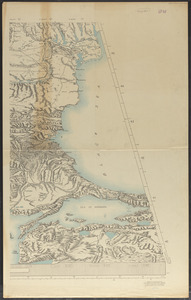
Block diagram showing terrain of the Balkan Peninsula

Item Information
- Title:
- Block diagram showing terrain of the Balkan Peninsula
- Creator:
- American Geographical Society of New York
- Date:
-
1918
- Format:
-
Maps/Atlases
- Location:
-
Boston Public Library
Norman B. Leventhal Map & Education Center - Collection (local):
-
Norman B. Leventhal Map & Education Center Collection
- Subjects:
-
Block diagrams--Balkan Peninsula
Balkan Peninsula--Maps
Block diagrams
- Places:
-
Balkan Peninsula (area)
- Extent:
- 1 map on 4 sheets : color ; 100 x 273 cm, on sheets 123 x 77 cm
- Terms of Use:
-
No known copyright restrictions.
No known restrictions on use.
- Publisher:
-
New York :
The American Geographical Society
- Scale:
-
Scale 1:600,000 in center of diagram
- Language:
-
English
- Notes:
-
Relief shown by spot heights and landform drawings.
Prime meridians: Greenwich, Ferro and Paris.
Includes diagram showing sets of maps this map is based on.
- Identifier:
-
06_01_012521A
06_01_012521B
06_01_012521C
06_01_012521D
- Call #:
-
G6801.C2 1918 .A43
- Barcode:
-
39999065697540


