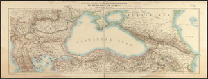
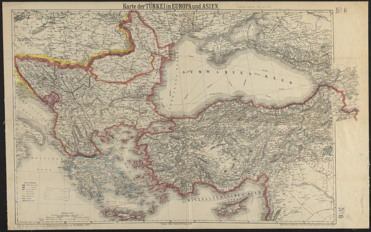
Karte der Türkei in Europa und Asien
Item Information
- Title:
- Karte der Türkei in Europa und Asien
- Title (alt.):
-
General-uebersichts-karte des gesammten Russisch-Türkischen kriegsschauplatzes in Europa und Wien, nebst Rumänien, Serbien, Montenegro, Griechenland, Oesterreich und Russland
- Cartographer:
- Schäfer, M.
- Publisher:
- Abelsdorff, Albert
- Printer:
- Grack & Aron
- Name on Item:
-
nach den neuesten und besten hülfsmitteln bearbeitet von M. Schäfer
- Date:
-
1877
- Format:
-
Maps/Atlases
- Location:
-
Boston Public Library
Norman B. Leventhal Map & Education Center - Collection (local):
-
Norman B. Leventhal Map & Education Center Collection
- Subjects:
-
Balkan Peninsula--Maps
Turkey--Maps
- Places:
-
Balkan Peninsula (area)
- Extent:
- 1 map : hand colored ; 48 x 79 cm, folded to 22 x 14 cm
- Terms of Use:
-
No known copyright restrictions.
No known restrictions on use.
- Publisher:
-
Berlin :
Verlag v. Albert Abelsdorff
- Scale:
-
Scale 1:3,000,000
- Language:
-
German
- Notes:
-
Relief shown by hachures.
Prime meridian: Ferro.
Hand-colored to show boundaries.
- Identifier:
-
06_01_015200
- Call #:
-
G7430 1877 .S33
- Barcode:
-
39999085932752