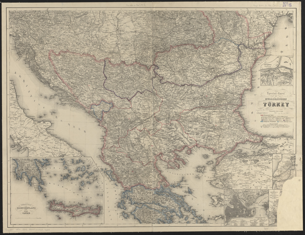
Special-karte der Europäischen Türkey
Item Information
- Title:
- Special-karte der Europäischen Türkey
- Description:
-
Map of European side of Turkey and Crete, as well as Greece and Macedonia, Albania, Bulgaria, Bosnia and Herzegovina, and Serbia.
- Cartographer:
- Schleifmann, H.
- Publisher:
- Bibliographisches Institut Leipzig
- Name on Item:
-
H. Schleifmann sc.
- Date:
-
[ca. 1876]
- Format:
-
Maps/Atlases
- Location:
-
Boston Public Library
Norman B. Leventhal Map & Education Center - Collection (local):
-
Norman B. Leventhal Map & Education Center Collection
- Subjects:
-
Albania--Maps
Balkan Peninsula--Maps
Bosnia and Herzegovina--Maps
Bulgaria--Maps
Crete (Greece)--Maps
Greece--Maps
Macedonia (Greece)--Maps
Serbia--Maps
Turkey--Maps
- Places:
-
Albania
Bosnia and Herzegovina
GreeceCrete (region)
Turkey
Bulgaria
Serbia
Balkan Peninsula (area)
- Extent:
- 1 map : hand color, mounted on linen ; 63 x 83 cm
- Terms of Use:
-
No known copyright restrictions.
No known restrictions on use.
- Publisher:
-
Leipzig :
Bibliographisches Institut in Leipzig
- Scale:
-
Scale 1:1,750,000
- Language:
-
German
- Notes:
-
Relief shown by hachures.
Prime meridian: Ferro.
Insets: Südlicher Theil von Griechenland und die insel Candia -- Silistria und Umgegend -- Der befestigte südliche Theil der Dardanellen Strasse -- Der Bosporus oder die Meerenge von Constantinopel -- Constantinopel.
- Identifier:
-
06_01_012520
- Call #:
-
G6800 1876 .S35
- Barcode:
-
39999065697649